By Rae Alexandra
If you’ve ever taken an outbound N Judah or K Ingleside train from Embarcadero Station, then you’ve unwittingly passed through the hull of a gigantic underground ship named Rome.
Rome has been lying beneath downtown San Francisco since 1852, when it was abandoned by a crew too interested in the gold rush to return to her, and subsequently deliberately sunk. Rome was rediscovered in 1994 when Muni’s Metro Turnback tunnel was under construction, but she was too big and too delicate to extract. Remarkably, there are dozens of other vessels just like Rome buried beneath the city’s streets.
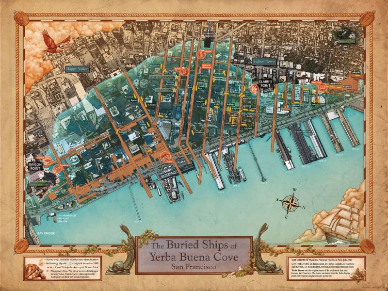
The estimated 30–60 ships ended up becoming part of the city when the shoreline was extended to facilitate the task of getting cargo from ships to land. Sinking ships and building on top of them was simply the easiest way to claim and fill in the land at the time.
In 2017, KQED’s own Bay Curious did a wonderful exploration of the “ghost fleet beneath your feet.” Now a presentation at the Mechanics’ Institute promises to delve deeper into this fascinating topic, using a revised historical map of Yerba Buena Cove (today’s financial district and Embarcadero). The map is the final result of painstaking research by archaeologists working alongside staff at the San Francisco Maritime Museum.


