All this rain got you down? Sick to death of grey skies and finding out just how many boots you own that look kind of waterproof but, in reality, are not at all? Same.
Surprise! The Bay Area Has Been Getting Hammered With Floods Since 1862
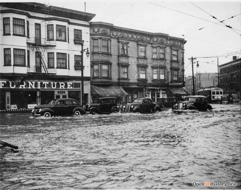
If it makes you feel any better, this bleak, all-encompassing torrential rain we’ve been getting hammered by isn’t actually as unprecedented or freaky as some commentators would have you believe. Outside of the on-off drought we’ve long dealt with, stormy deluges of varying degrees have been flooding the Bay Area for about as far back as records go.
Before you fall into the abyss that is wondering why the region hasn’t gotten any better at dealing with heavy rainfall, let’s just take a look back at some storms of the past. May they remind us that one day — some day! —there will be an end to all of this depressing weather.
1862
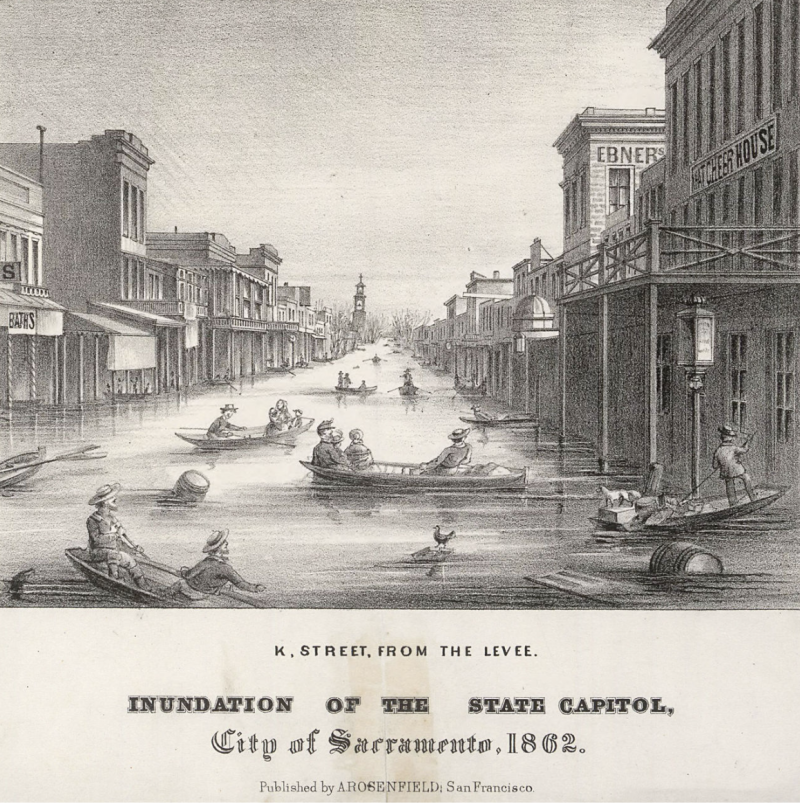
During a 15-day period between December 1861 and January 1862, nearly 20 inches of rain fell on San Francisco. The city wound up on the receiving end of 24 inches total over the course of a month. (By comparison, SF and Oakland have so far received 13 and a half inches of rain from these recent atmospheric rivers.) Sacramento had it far worse, though.
In January, 1862, the Sacramento Bee reported that the “condition of the state” was “watery” — “a vast seas such as was never before witnessed here, and this entire district has become a series of desolation.” Between the Sacramento and San Joaquin Valleys, “what movable property such as houses and fences that the water might have left, was broken up and scattered by the joint action of wind and waves.” Livestock losses devastated the entire region. To offer assistance to their neighbors in the north, San Francisco quickly sent $5,000 in cash and “cooked provisions” to Sacramento. That was despite the fact that weather-related issues abounded in San Francisco even two months after the widespread floods.
On March 22, 1862, the Weekly Butte Democrat reported a new disaster. “On Friday morning last, a lake, which has been forming in the vicinity of the Mission, among the hills, burst its banks and rushed forth in vast volume of water, tearing away gardens, banks, fences in its course. The pond, or lake, was nearly half a mile long and a quarter of a mile wide and over twenty feet deep. About 100 feet of the Market Street Railroad was carried away.”
Despite what you might have heard, the Bay Area has not seen floods this bad ever since.
1904
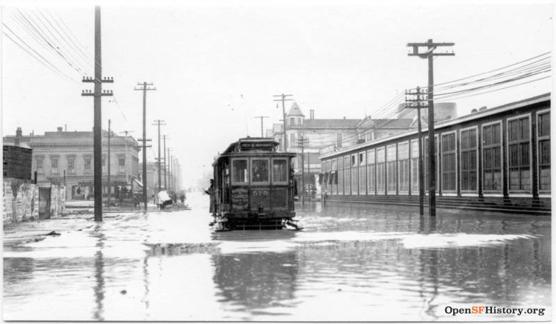
In September 1904, 3.25 inches of rain fell in San Francisco in 24 hours, breaking a city record. And things were bad across the entire region. The Bakersfield Morning Echo reported that, “At Napa, San Jose, Stockton and many others, the rainfall has been unprecedented for September.”
Later that month, the Salt Lake City Tribune noted: “The unprecedented rainstorms continue, the precipitation being … 4.42 inches, more than four times the amount ever before recorded [in San Francisco] in the month of September. At the Cliff House, several windows were broken by the spray driven in from the ocean.”
1937
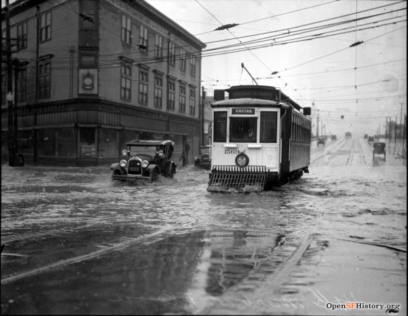
At the end of 1937, the Pasadena Post reported extensively on storms that were ravaging California. On Dec. 12, it described the situation in San Francisco thusly: “Planes grounded. Four ships battered. Shipping at a standstill. Slight damage from gales. Five persons killed, indirect result of storms.”
The following day, the paper reported: “Flood waters smashed through … the Sacramento and San Joaquin valleys today in the aftermath of one of the most severe rainstorms on record … The rest of the state was digging itself out of the mud and the debris left by receding waters.”
1941
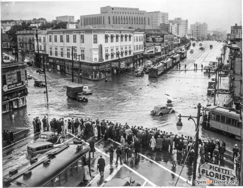
On April 4, 1941, the Contra Costa Gazette wrote: “San Francisco, Oakland, Berkeley, El Cerrito, Mill Valley, San Rafael, Santa Rosa and peninsula cities reported one of the heaviest sustained rainfalls of their experience.
“In San Francisco, more than half an inch fell in 30 minutes. In Mill Valley, 1.87 inches of rain fell between midnight and 8 a.m. Marin County creeks filled quickly and overflowed over streets and highways. There were some landslides. Water also poured into the San Pablo underpass connecting with the San Francisco Oakland Bay bridge, trapping automobiles. There also was water in the South San Francisco underpass on Bayshore Highway.”
1952
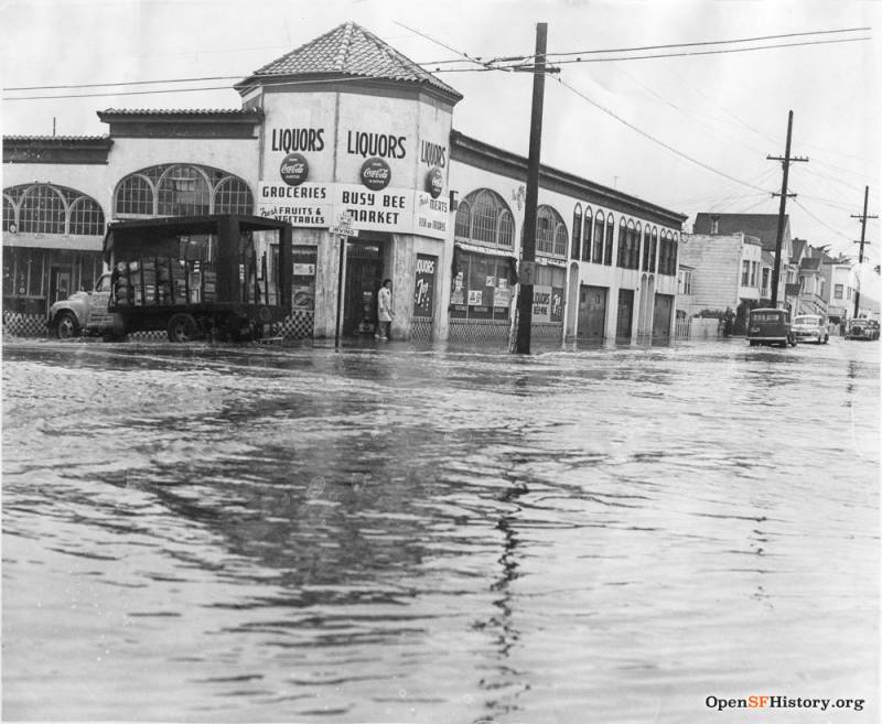
This storm was so terrible, it was front page news all the way in South Carolina. On Jan. 15, 1952, the Times and Democrat reported: “A raging storm roared across Northern California … It gave California its worst winter in half a century … Countless trees came down in hundreds of towns, breaking power and telephone lines. Many communities were without electricity or gas. San Francisco’s rainfall for the season reached 17.91 inches, the most on any comparable date since 1890.”
1960
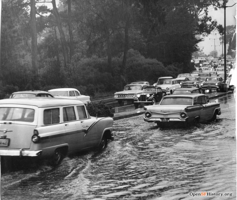
The massive storm of Nov. 1960 caused the most havoc in Oregon and Washington, but the aftermath in the Bay was newsworthy, as evidenced by the photo above. San Francisco got an inch and a quarter of rainfall in one day.
1982
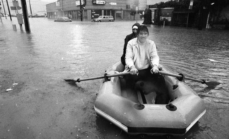
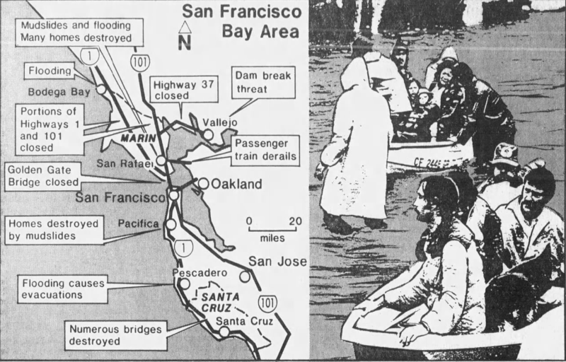
The 1982 storms that pummeled the Bay were particularly horrendous. The Selma Enterprise reported on Jan. 14, 1982 that, “More than three dozen people died in Bay Area rain, flooding and mudslides and seven north state counties have been declared disaster areas.”
The deluge blanketed the entire Bay Area, as seen in this graphic by the Modesto Bee:
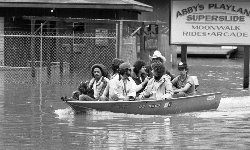
Here’s what the flooding looked like in Guerneville. Yikes.
1996
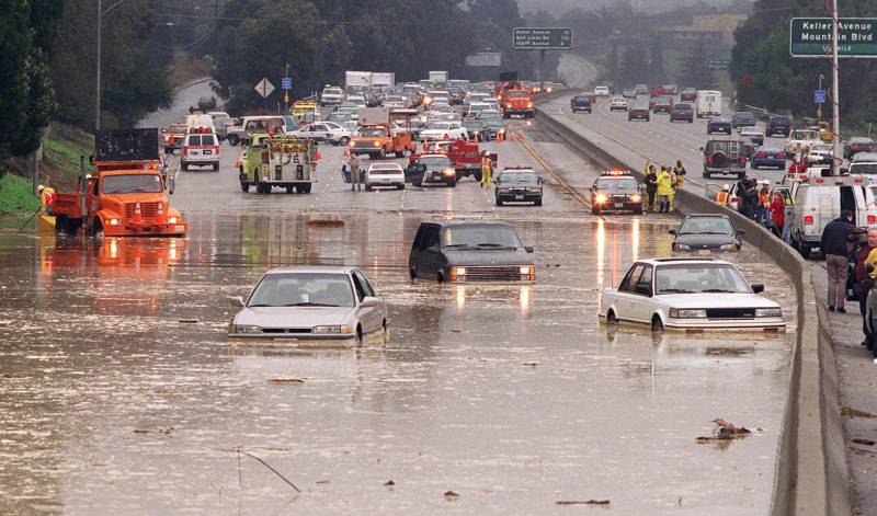
In December 1996, nearly 68,000 homes between Eureka and San Luis Obispo — many of them in the East Bay — dealt with storm-related blackouts. San Rafael got hit hardest with 3.10 inches of rain in one day. The entire Bay Area was under a high wind advisory, SFO got hit with a rash of delays, and traffic chaos was everywhere. Parts of 101 got coned off, I-580 in Oakland was closed because of a broken water main, mudslides blocked Highway 17 between Los Gatos and Santa Cruz, and flooding shut down Highway 121 in Sonoma County.
2005
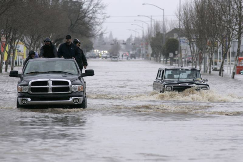
2005 started with flooding in Sacramento, saw parts of Yosemite closed because of flooding in May, then ended with a series of storms.
Before 2006 got ready to roll in, the Modesto Bee relayed that: “Areas north of the San Francisco Bay Area, already saturated from earlier onslaughts of rain and wind, bore the brunt of nature’s fury with rainfall totals averaging about four inches [in 24 hours]. Some mountainous areas near the Humboldt County coast got as much as six inches.” SFO had delays on “most flights” and parts of I-5 and 101 closed. Not a party.
If current forecasts are to be believed, the Bay is scheduled for a break in the rain next week … before more storms at the end of the month. Good luck out there.

