upper waypoint

Smoke From Big Sur Fire Prompts New Spare the Air Alerts

Save ArticleSave Article
Failed to save article

Please try again

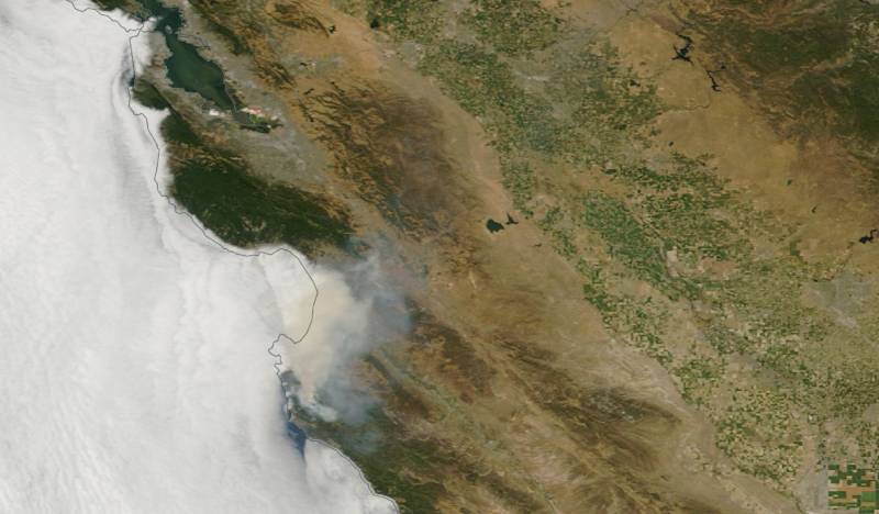
A Monday afternoon satellite image of smoke produced by the Soberanes Fire in Monterey County. (NASA Worldview)

Updated 2:15 p.m. Wednesday: With a blanket of smoke continuing to drift north from the Soberanes Fire in Monterey County, the Bay Area Air Quality Management District has extended its Spare the Air alert for the region through Thursday .

As before, the Wednesday and Thursday alerts were triggered by high ozone levels, especially in the Santa Clara Valley and eastern Contra Costa and Alameda counties. The air agency and weather forecasters say no significant relief is expected from the smoky conditions until a trough of low pressure dislodges a dome of high pressure that has built over California and the Southwest. That's not expected to happen until this weekend at the earliest.

On the fire lines, Cal Fire reported that an on-call bulldozer operator, part of the 3,000-person force called in to contain the blaze just inland from the northern reaches of the Big Sur coast, was killed during night-time operations early Wednesday. The exact circumstances of the incident haven't been reported. A second dozer operator survived an accident in which his machine rolled over.

As of midday Wednesday, the Soberanes blaze, which started last Friday, had burned through about 24,000 acres of drought-desiccated chaparral and forest in the mountains between Carmel Highlands and Point Sur. The fire is just 10 percent contained and fire managers estimate that full containment won't be achieved until Aug. 31.

The fire is believed to have started in Garrapata State Park, a 3,000-acre property that features a precipitous coastal ridge. The fire has burned through virtually all of Garrapata and has prompted the closure of several other popular destinations in the area, including Andrew Molera and Julia Pfeiffer Big Sur state parks, Point Lobos Marine Reserve and the historic Point Sur lighthouse.
Sponsored

In addition to challenging terrain, firefighters are facing challenges from hot, dry weather and a temperature inversion that has trapped smoke near ground level in some locations and limited the use of aircraft.

Original post (Tuesday, July 26): That unusual coppery cast to the sunlight Tuesday morning? It's caused by smoke that continues to spread from the Soberanes Fire, burning in the Monterey County mountains along the northern end of the Big Sur coast.

Smoke from the blaze, which Cal Fire said Tuesday morning has burned 19,311 acres and is 10 percent contained, spread haze across much of the region and prompted the Bay Area Air Quality Management District to declare a second straight Spare the Air day.

A district statement says that strong high pressure over the region, along with smoke drifting north and east, will lead to high ozone levels in both the Santa Clara Valley and the hot eastern sector of Alameda and Contra Costa counties.

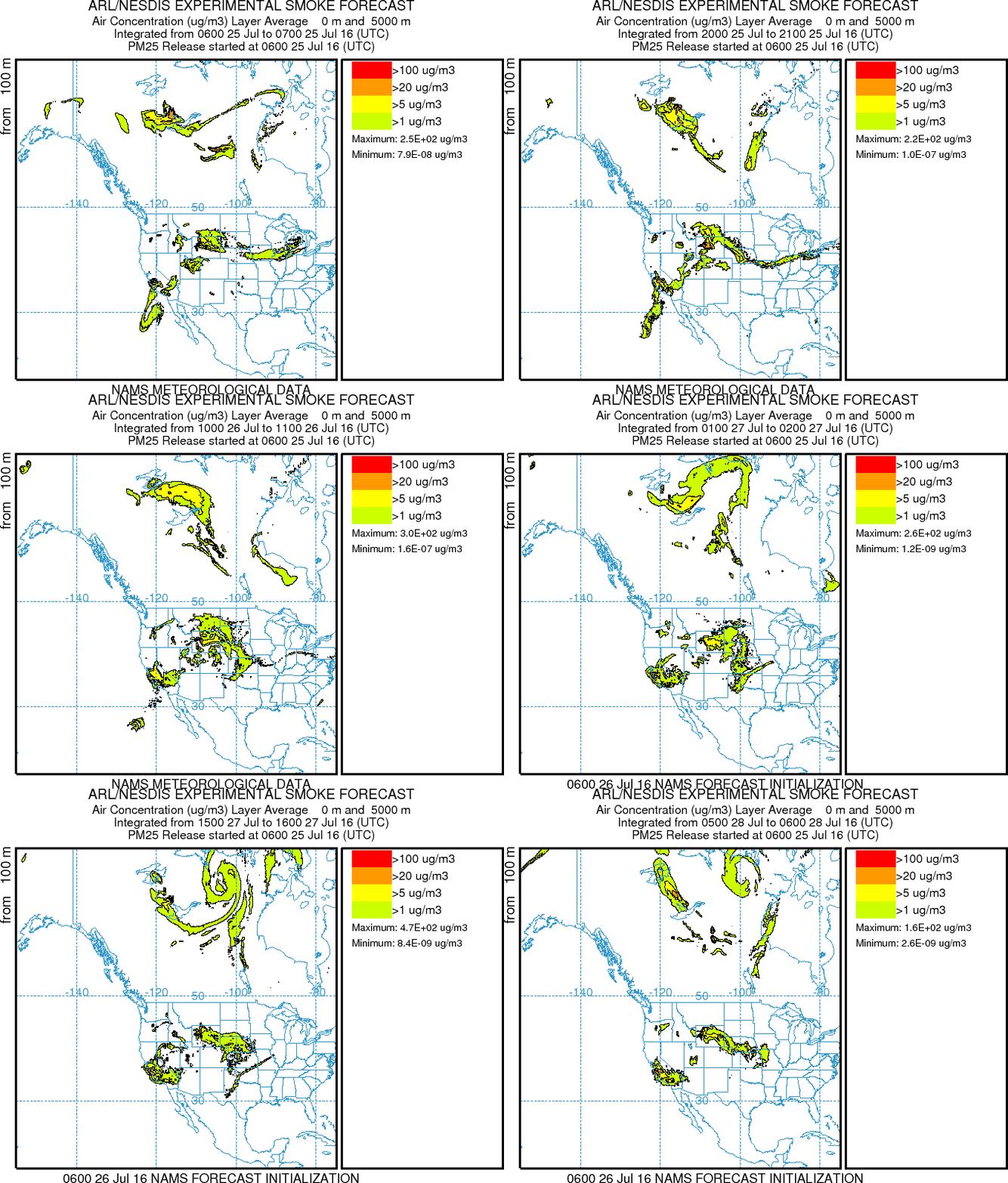
Smoke forecast from NOAA's Air Resource Laboratory.
Smoke forecast from NOAA's Air Resource Laboratory. (NOAA)

“A week of poor air quality is expected in our region due to high temperatures, stagnant air and smoke from the
Soberanes Fire,” said Jack Broadbent, the air agency's executive officer.

The point of the Spare the Air alert, in case you've forgotten, is to get us to limit our use of cars and other machines that use internal combustion engines. Their exhaust is a principal contributor to high ozone levels.

Tuesday's forecast highs east of the Oakland and Berkeley hills include 103 in San Ramon; 102 in Lafayette, Livermore and Pleasanton; 100 in Concord; and 98 in Antioch.

The National Weather Service forecasts lower temperatures and clearing skies later in the week.

The effects of the Soberanes Fire are not just a Bay Area concern, by the way. Reno, a good 300 miles from Big Sur, has experienced elevated air pollution levels from the smoke -- a situation expected to continue most of this week.

A couple additional smoke forecast and observation resources:

lower waypoint
next waypoint