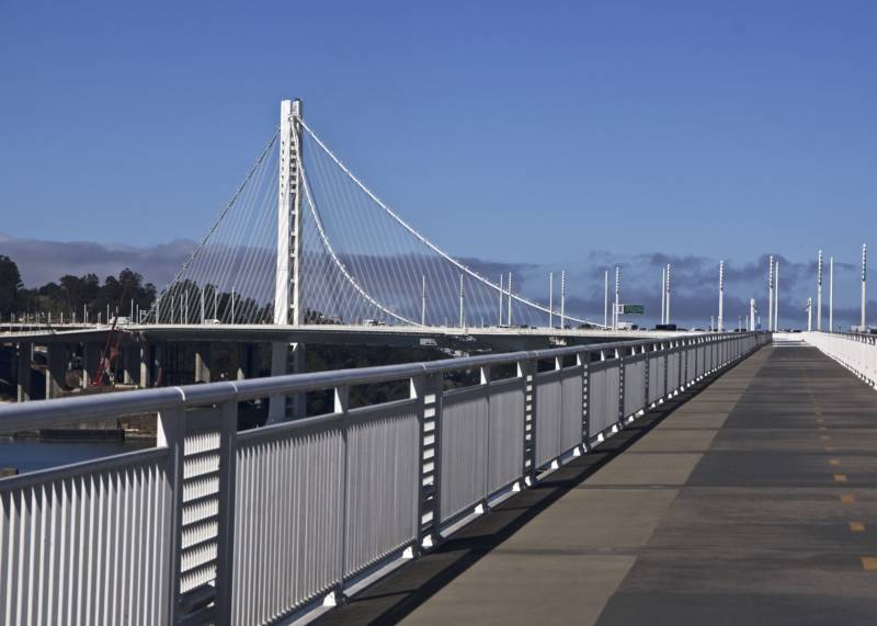
Randy Rentschler, spokesman for the Metropolitan Transportation Commission, said Tuesday that the agencies involved in the project -- which include Caltrans, the Bay Area Toll Authority, the San Francisco County Transportation Authority and the city's Treasure Island Development Authority -- want to make sure the island end of the path is safe before it opens.
Rentschler said it will be important "for people to understand the environment they're in" when they reach Yerba Buena Island.
"What's happening there is not only is there a lot of construction trucks all the time, but roads are closed, too," Rentschler said. "So the idea is to provide access to people that's safe and provide people an experience that is memorable in a positive way."
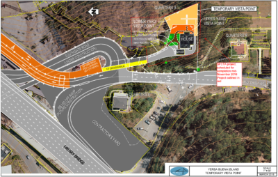
To improve the odds that path users will have that positive experience, the S.F. County Transportation Authority has built a temporary vista point, complete with bike racks, restrooms and water fountains, adjacent to an old Navy residence just to the southwest of the trail's western end.
SFCTA spokesman Eric Young said Tuesday that work on preparing the short route from the path to the vista point, which includes a 12-foot-wide crosswalk across Southgate Road and new directional and advisory signage, is nearly complete. Young said the vista facility, which will look east and southeast over the Oakland waterfront, is expected to open by mid-November.
Rivera, Rentschler and Young all say they expect the bike path to be open to Yerba Buena Island by then -- sometime in the next two to three weeks. Among the issues still to be ironed out is what to do for cyclists who want to travel down from the heights of Yerba Buena Island to the adjacent sea-level expanse of Treasure Island.
Rentschler notes it will be possible for cyclists to ride to and from Treasure Island but emphasized it's not an undertaking for the faint of heart.
The route "is tight, is congested with people seeking to get onto the freeway, in some cases it has trucks on it," Rentschler said. "Experienced cyclists would have no problem with this. But I would urge people not to bring inexperienced bicyclists or families on this road -- it is simply not a safe place for them to be."
For the short term, transportation officials are planning to use shuttle vans or buses to get both those less experienced riders and pedestrians from the new vista point to Treasure Island.
After the current bridge-related ramp construction ends, Rentschler says, transportation agencies will build "much safer" alternate routes from the end of the eastern span trail to Treasure Island. That project, which he says is already mapped out, will involve repaving roads, fencing and guardrails along some parts of the route, and restriping intersections.
"But look, that's going to take a while," Rentschler said. "I guess I'm asking folks to be happy with what they can get -- all the way across -- knowing that when you get there, except for the most experienced riders, you've found the end of your trip as opposed to the beginning of it."
Of course, that's when cyclists will really start asking when they'll be able to ride all the way to San Francisco. That's another project that's going to take a while.


