upper waypoint

Red Flag Warnings In Effect for Bay Area as Fire Risk Heightens Over Weekend

Save ArticleSave Article
Failed to save article

Please try again

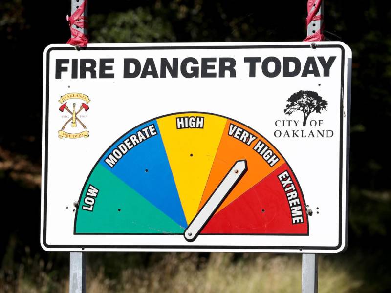
A fire danger chart by a roadside.
A high fire danger sign is seen along Skyline Boulevard in the hills of Oakland, on Sept. 24, 2019. (Jane Tyska/MediaNews Group/The Mercury News via Getty Images)

Red flag warnings from the National Weather Service are in effect for most of the Bay Area this weekend, including the North Bay and East Bay, the Santa Cruz Mountains, the Santa Clara hills, the San Mateo coast, and the Santa Lucia Mountains. The NWS issued the warnings Friday, forecasting gusty offshore winds and low relative humidity that are expected to affect large parts of the region, heightening the risk of wildfires, especially from 5 p.m. Saturday through Sunday evening.

Red flag warnings were also expected to go into effect late Saturday for the North Bay and East Bay interior valleys as well as for Sonoma County and the San Francisco peninsula, according to Chelsea Burkett, public information officer of the CalFire Santa Clara unit.

“I’m out and about right now and I’m definitely seeing a change in the winds,” said Burkett on Saturday afternoon. “It’s a lot gustier, it’s more consistent, and it’s cold outside, so that can be deceiving for people. But that doesn’t mean that there’s less likelihood of there being a fire.”
According to the International Fire Chiefs Association (PDF), a red flag warning is a weather warning issued only by the National Weather Service for a select area, and it forecasts conditions (warm temperatures, low humidity in dried fuel moistures, and strong winds expected within 24 hours) that create increased risk for a wildland fire or rapid-fire growth if an incident were to occur.

The red flag warning has been in effect from early Saturday morning to Sunday evening, particularly for high elevation areas of the North Bay, East Bay and Santa Cruz Mountains, where wind gusts will range from 45 mph to upwards of 50 mph, the weather service said Friday.

Burkett from CalFire said it’s important that people be aware of their surroundings, pay attention to changes of weather, and refrain from using power tools, especially lawnmowers.

“I know it’s cold outside and that can be deceiving. But the fuel, the vegetation that we’re seeing, is still very susceptible to fire and the likelihood of a fire starting or spreading because someone is misusing those kinds of power tools, especially when it comes to backyard maintenance, it’s very high,” said Burkett.

Due to the high winds, forecasters put up a Wind Advisory this weekend for the North Bay interior mountains, Marin Coastal Range, East Bay hills, Santa Clara hills and Santa Cruz Mountains.

Meanwhile, minimum relative humidity is expected to dip from 25 percent to as low as 10%, with overnight recoveries of 25% to 45% for the North Bay, East Bay and the Santa Cruz Mountains on Saturday and Sunday, adding to the elevated fire risk in these areas, forecasters said.

Moderate to major fire risk levels across much of the region will ease significantly beginning on Monday, forecasters said.

This story includes reporting by Bay City News and KQED’s Attila Pelit.

Sponsored

lower waypoint
next waypoint