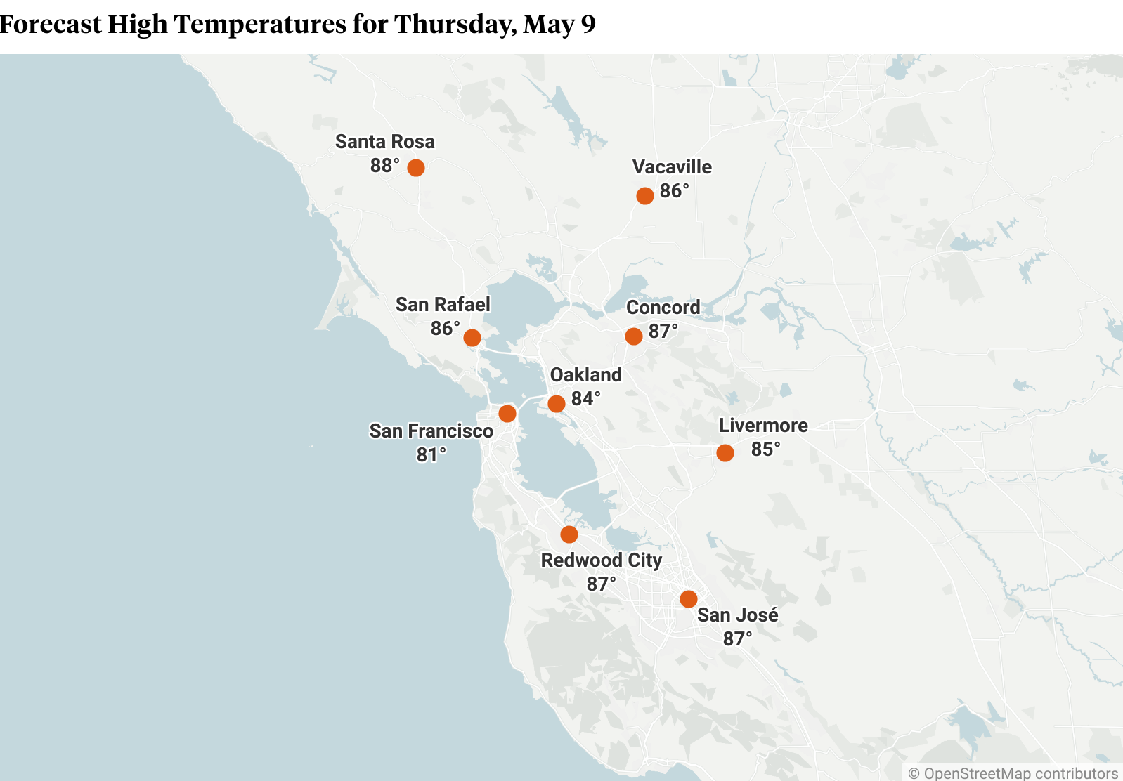
The significant warming trend is being driven by high pressure and offshore flow, which is a weather feature normally seen in the fall, with warm, dry wind coming from the north and northeast, said Mehle, the NWS meteorologist.
That offshore flow led to some wind advisories early Thursday, with morning gusts of 45 to 55 mph expected in the Mayacamas Mountains, north of Santa Rosa. Although no advisory was issued for the East Bay Hills, Mount Diablo was also expected to see gusts of 40 to 50 mph on Thursday morning.
The heat and wind are not expected to significantly increase fire danger, though, thanks in large part to recent precipitation, including last weekend’s rainstorm, Mehle said.
“We’re actually in pretty good shape from that standpoint. We are seeing wetter than normal fuels around the Bay Area due to our wet spring,” he said. “These late-season rain events that we’re getting are helping to mitigate fire concerns.”
The NWS did not issue a red-flag warning, and state and local fire officials said they were not on high alert.
Conditions in the Bay Area will continue to heat up on Friday, which is expected to be the warmest day of the week, particularly in inland areas. Some parts of the North Bay and East Bay could approach 90 degrees.
Temperatures will start to dip on Saturday with increased onshore flow, according to the NWS forecast. However, another ridge of high pressure approaching the West Coast should keep the mercury above seasonal averages, with interior areas remaining 5 to 15 degrees above average into early next week.
That ridge will drive higher temperatures by next Tuesday or Wednesday, Mehle said, but “not as warm as what we’re seeing today or tomorrow.”