Here are the morning’s top stories on Wednesday, January 1, 2025…
- Scientists project the Bay Area sea level could rise more than a foot over the next few decades. Solutions implemented now can help communities prepare for a wetter future. This is especially true for the most vulnerable places, like San Francisco’s iconic waterfront.
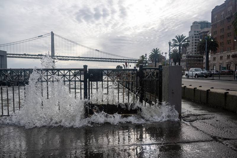
King Tides Foreshadow A Far Wetter Future For San Francisco Shoreline
Every time waves from king tides crash against San Francisco’s hard city edge, officials brace for flooding along the Embarcadero southeast of the Ferry Building. It’s a reminder that as baseline sea levels continue to rise, future floodwaters could inundate a vital part of the city’s transportation infrastructure: commuter rail lines.
The city is working on two solutions to cure its bayside flooding woes. The first is a shorter-term plan to raise the shoreline and use deployable temporary infrastructure (PDF) to block water from getting into the train system. The second would take decades: rebuilding a vulnerable stretch of San Francisco’s seawall and raising structures like the Ferry Building.
Elaine Forbes, executive director of the Port of San Francisco, said king tides have worsened over the past decade. That makes the flood-resiliency work especially urgent. “We are seeing the impacts of climate change now,” Forbes said. “We have an immediate flood problem that we have to take care of now. We’ve been lucky, but we cannot wait much longer. Time is not on our side.”

