By now, everyone in the Bay Area knows about the Did You Feel It? system, set up by the U.S. Geological Survey in the 1990s to record earthquake reports. This week the Survey has launched a similar effort, called Did You See It? or DYSI, to enlist citizens in recording landslides. Bay Area residents should take to this tool enthusiastically because we live in landslide country as well as earthquake country. In fact, earthquakes so often cause landslides that conscientious folks can now make twice the contribution after a seismic event.
The earthquake tool has succeeded so well because, among other things, the facts it needs to know are easy to check off—where you were, what things you noticed, what was damaged. The new landslide tool works a little differently because landslides aren't the same kind of event. Reporting a landslide on the DYSI tool takes a bit of observation.
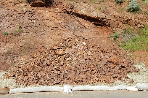
Landslides are classified along a spectrum between falls and flows. They involve three kinds of material: earth (soil), debris (rocks and soil) and rocks. Rockfalls, like this example from the Marin Headlands, should be familiar. They're basically a rattle of rocks.
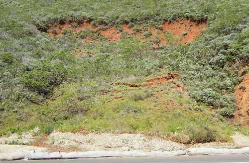
Flows include earthflows and debris flows. They have a fluid motion and shape, like this example, a debris flow from the Marin Headlands.


