upper waypoint

Fleet Of Cars to Collect Block-by-Block Air Quality Data in Bay Area

01:04
Save ArticleSave Article
Failed to save article

Please try again

A fleet of Toyota Priuses equipped with sensors to detect greenhouse gases, particulate matter and other pollutants is monitoring air quality across the Bay Area.

The Bay Area Air Quality Management District announced this month that the hybrids will collect block-by-block data from all nine Bay Area counties, spanning more than 5,000 square miles of public roads. The district will use data collected through this year and early 2021 to create hyper-local air quality maps. Those will be available to the public on the BAAQMD’s website starting later this year.
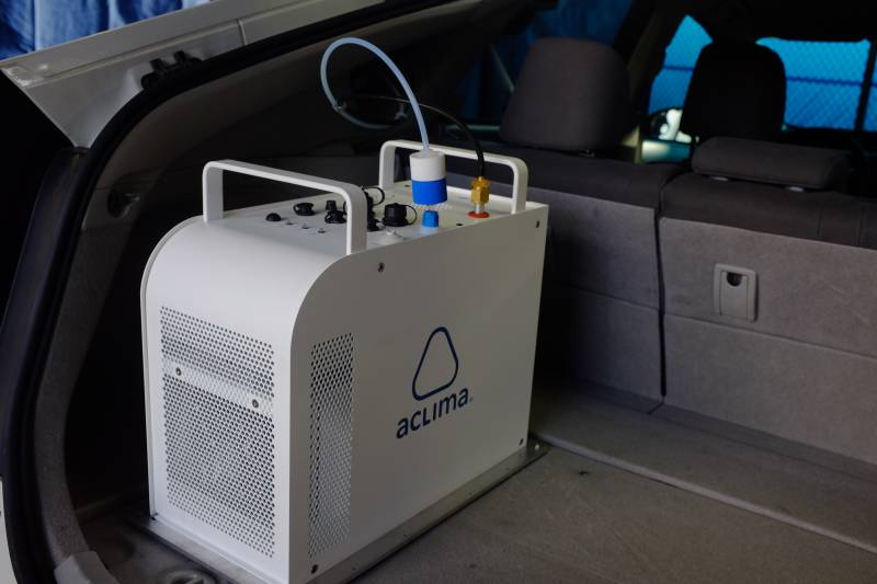
The Bay Area Air Quality Management District’s fleet of low-emissions cars will measure air quality with a unit of sensors stored in the back. (Peter Arcuni/KQED)

The air district is partnering with technology company Aclima to outfit the mobile fleet with sensors that measure pollution in the form of carbon monoxide, carbon dioxide, nitrogen monoxide, nitrogen dioxide, ozone and fine particulate matter, all detrimental to human health. Aclima will help analyze the data.

Air quality district executive officer Jack Broadbent says recent wildfires, climate change and federal rollbacks of emission standards have created a need for more precise local air quality tracking.

“What we need now, more than ever, are facts,” Broadbent said, adding that his agency is going to use “new technologies and approaches to build upon our air quality data to better inform our actions and protect Bay Area residents.”
Sponsored

The district has 30 stationary air monitoring stations spread across the region. Data from these stations feeds into the continually updating federal AirNow map. But this data doesn’t reflect the differences in air quality across all Bay Area cities or neighborhoods.

A study published in Environmental Science & Technology in 2017 showed that pollution in West Oakland could vary significantly from block to block. The researchers mounted air sensors onto Google Street View cars. Air quality maps that use data from consumer air sensors, like Purple Air, have painted a similar picture in the Bay Area.

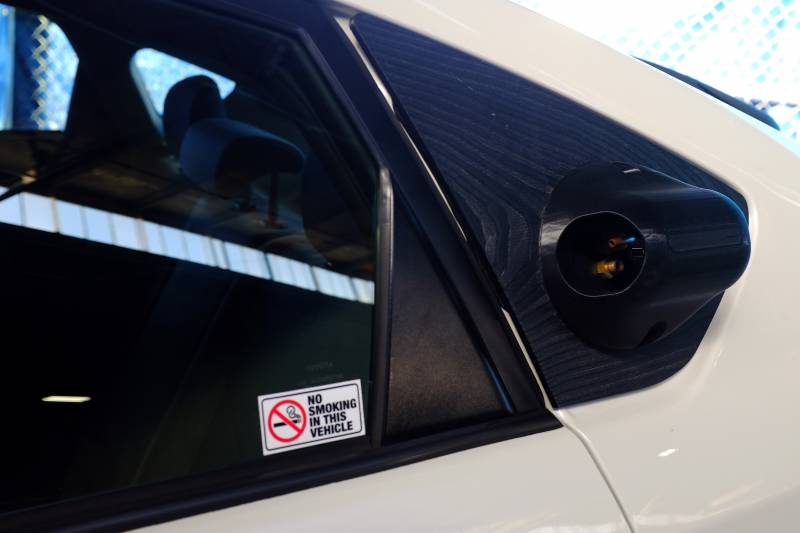
The air intake valve on one of the Air District’s new pollution monitoring cars. (Peter Arcuni/KQED)

While the BAAQMD won’t post the new data  in real time, it will be compiled over months and used to create a public map of air pollution and greenhouse levels on every block in the Bay Area. The map will be similar to the one created for West Oakland, according to Aclima.

“This new data will help us identify pollution hotspots in order to strengthen and target our actions to reduce emissions … partnering with local governments and communities to protect public health,” said Ranyee Chiang, the BAAQMD’s director of meterology and measurement.

Broadbent says the project will give policymakers accurate data to “help drive the air quality and climate efforts well into the future.”

In August the district dispatched the first vehicles to the Richmond-San Pablo area. The fleet has since expanded to San Francisco, Alameda, Contra Costa, San Mateo and Santa Clara counties. The rollout will be completed in the coming months.

Representatives from BAAQMD and Aclima say the Bay Area fleet will eventually number “dozens” of cars that measure air quality  24 hours a day, seven days a week.

lower waypoint
next waypoint