“We have so many habitats that could potentially drown over the next 10 to 20 years, and then everyone’s lifestyle is going to be impacted by flooding, whether or not they live near the shoreline,” said Dana Brechwald, assistant planning director for climate adaptation with BCDC.
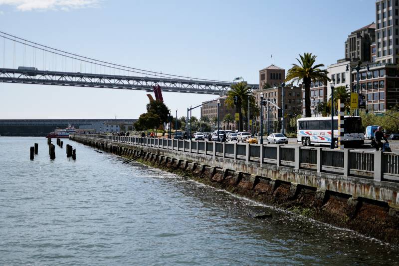
Since the 1880s, the Pacific Ocean has risen by about 8 inches along the West Coast, but state scientists predict more than a foot of bay rise by 2050 and more than six feet by the end of the century in the worst-case scenario.
The plan attempts to do three main things: create a unified vision for the future of shoreline adaptation, outline eight regional priorities, and create guidelines for local governments to generate their plans. One of the regional priorities is reducing contaminated sites, which could steep like teabags in rising seawater.
Public comment is open until Oct. 18, BCDC will hold a public hearing on Oct. 17, and the agency will finalize the plan by the end of the year.
Janelle Kellman is a city council member for the City of Sausalito who runs the nonprofit Center for Sea Level Rise Solutions. Kellman said she “fully endorses this idea of regional collaboration. This is absolutely the way we need to go.”
However, Kellman said she hopes BCDC will make the plan even more “actionable” with a detailed scope of the work or example budgets “with actions that local governments can implement immediately.”
Last Thursday, BCDC officials presented the plan to a group of elected officials, and San Rafael Mayor Kate Colin expressed concern.
“I have red flags,” she said. “I think this plan is too rigid. I think it’s too onerous. I really want cities to be met where they are.”
Colin told BCDC staff that she doesn’t think five weeks of public comment is enough time to get input on the sweeping plan that relies on localities to do much of the work. For example, Colin said it took over a year to get public input for her city’s general plan. Plus, the cost of mitigating a disaster is expensive. She said her city doesn’t have the “extra million bucks” to implement the plan locally.
“I will be the biggest fan when this goes forward in a way that I believe represents really good government, using the existing resources that I have here in San Rafael,” she said. “And this, to me right now, is not that.”
Assuming BCDC marches ahead with its timeline, the draft plan will be finalized and adopted in 2025.
Afterward, the agency will metaphorically hang an “open for business sign” outside of its door to help cities and counties come up with local sea-level rise plans.
The state is offering at least one grant program led by the Ocean Protection Council to help localities create these plans, Brechwald said.
“We hope that people start chatting with us early on so that we can all figure out how to proceed forward together,” Brechwald said.