By Dan Brekke
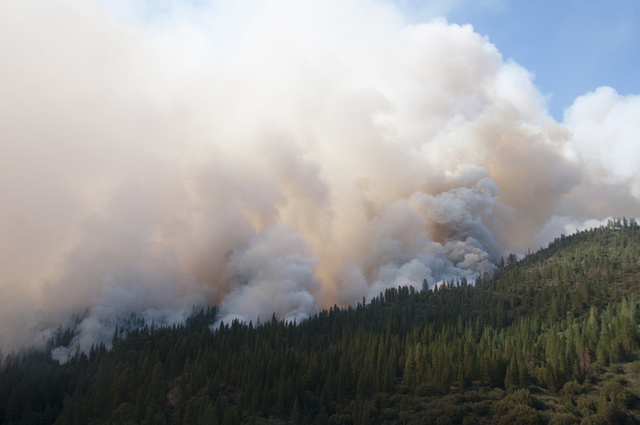
The latest (8 a.m. Thursday): Fire officials say crews are making steady progress against the Rim Fire on the western boundary of Yosemite National Park. They say a California Air National Guard drone is playing a key role in helping firefighters respond to new outbreaks around the edge of the giant blaze, which has now consumed 192,737 acres, or 301 square miles. The fire is now the sixth largest on Cal Fire’s list of the 20 largest wildfires in the state since 1932.
Key details:
- Containment grows: The joint federal-state fire command says 4,840 firefighters are on the lines now. They report the fire is 30 percent contained and will probably take another three weeks to fully surround. The cost of fighting the fire so far? $39 million.
- Still threatened: The blaze continues to threaten about 4,500 homes. Eleven residences have burned so far, along with about 100 other structures, mostly tent cabins at Berkeley’s Tuolumne Family Camp.
- Bad air: A large swath of the Sierra Nevada and foothills continue to languish under a blanket of heavy smoke from the fire. Unhealthy air is forecast for most of the Lake Tahoe-Carson City-Reno area.
- Hetch Hetchy water and power: San Francisco utility officials continue to say they’ve seen no change in water quality in supplies shipped from Hetch Hetchy Reservoir. The fire reached the southern edge of the reservoir earlier this week and ash has been falling on the surface. As the San Francisco Chronicle reported Wednesday, ecologists say the real danger to Hetch Hetchy may be months or years ahead. Damage in the reservoir’s 450-square-mile watershed could lead to soil- and debris-laden runoff winding up in the lake. That in turn would force city officials to devise a way to filter the water it ships to 2.5 million residents in San Francisco, the Peninsula and parts of Alameda County.
Now, about that National Guard drone. Here’s what the Associated Press reports this morning:
The California National Guard drone deployed Wednesday was being remotely piloted hundreds of miles away, allowing ground commanders to keep an eye out for new fires they otherwise wouldn’t have immediately seen.
“The drone is providing data directly back to the incident commander, allowing him to make quick decisions about which resources to deploy and where,” Berlant said.
Previously, officials relied on helicopters that needed to refuel every two hours.
While unmanned aircraft have mapped past fires, use of the Predator will be the longest sustained mission by a drone in California to broadcast information to firefighters in real time.
The plane, the size of a small Cessna, will remain over the burn zone for up to 22 hours at a time, allowing fire commanders to monitor fire activity, determine the fire’s direction of movement, the extent of containment and confirm new fires ignited by lightning or flying embers.
The drone is being flown by the 163rd Wing of the California National Guard at March Air Reserve Base in Riverside and is operating from Victorville Airport, both in Southern California. It generally flew over unpopulated areas on its 300-mile flight to the Rim Fire. Outside the fire area, it will be escorted by a manned aircraft.
Officials were careful to point out the images are being used only to aid in the effort to contain the fire.
In 2009 a NASA Predator equipped with an infrared imaging sensor helped the U.S. Forest Service assess damage from a fire in Angeles National Forest. In 2008, a drone capable of detecting hot spots helped firefighters assess movement of a series of wildfires stretching from Southern California’s Lake Arrowhead to San Diego.