Pacific Gas and Electric Company has sparked some of the state’s deadliest wildfires. The utility pleaded guilty to 84 counts of involuntary manslaughter after the 2018 Camp Fire. It faces felony charges in connection with the 2019 Kincade Fire in Sonoma County. And it is also under criminal investigation for last September’s Zogg Fire in Shasta County, a blaze ignited by a power line that killed four people.
That record led a federal judge earlier this year to declare that “PG&E has been a terror — T-E-R-R-O-R — to the people of California.”
Epic fires throughout California in recent years have highlighted the urgency of preparation, and exposed vast vulnerabilities. Heading into wildfire season, which given the already hot, dry conditions this spring, is expected to potentially be among the most dangerous on record, we wanted to get a better understanding of how dangerous PG&E’s power lines really are.
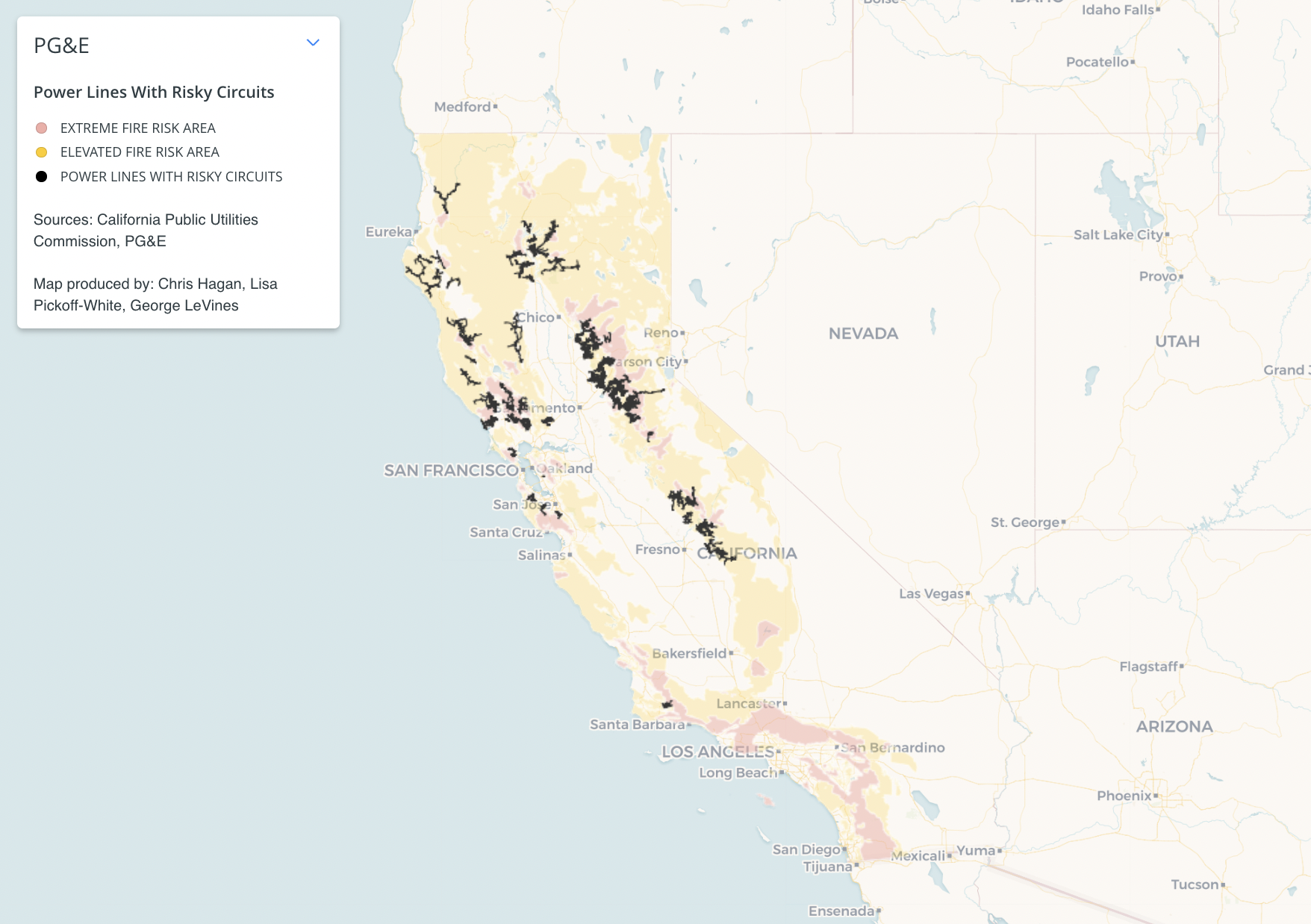
So we created a map that shows the riskiest power lines in PG&E’s grid — based on data from a recent audit by the California Public Utilities Commission Wildfire Safety Division — and layered it on top of areas that the CPUC has identified for “extreme” and “elevated” wildfire danger for this year. Our map also includes the electric circuits where PG&E believes there is high risk of a tree igniting by catching sparks from a power line or hitting a utility pole.
At-Risk Power Lines in Vulnerable Fire Zones

Now we want your help assessing wildfire risk. If you are concerned about the safety of power lines in your area, please email us pictures of the lines and the street address or cross street of where it is located, along with your contact information, to fires@kqed.org. We promise not to publish or reveal any personal information without securing your approval first. We will assess your photographs for compliance with state law and may share them, along with the geographic information you provide, with PG&E, Cal Fire and the CPUC.
What PG&E Is Required to Do
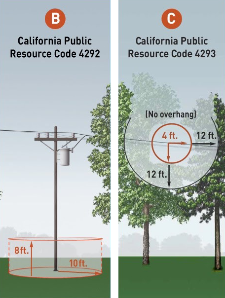
Here’s what PG&E is required to do, and what you should look for:
In its audit, the CPUC said PG&E “appears to not be sufficiently prioritizing or reducing the risk of wildfire ignition.”
The commission, in January, said PG&E had failed to do any vegetation mitigation work on many of its highest-risk circuits, including some areas of wine country north of San Francisco, the Sierra Foothills and the Santa Cruz Mountains.
In an emailed statement in response to the CPUC audit, PG&E spokesperson Lynsey Paulo said, “We have more to do, and we are committed to doing it the right way.”
On May 6, the utility issued a 196-page “corrective action plan” acknowledging that its vegetation management strategy “had gaps and shortcomings.”
The company said it had “undertaken efforts and initiatives” to improve the safety of its grid.
State law requires PG&E to follow two basic rules during the state-designated fire season:

1. Keep tree limbs away from electric wires
All foliage must be cleared within 4 feet of power lines that carry between 2,400 and 72,000 volts (most regular electric lines). That rule extends to 10 feet for higher-voltage lines and requires the removal of “dead, diseased, defective and dying trees” that could fall onto the lines.
2. Maintain distance between trees and utility poles
PG&E is required to maintain a firebreak of at least 10 feet from utility poles, and tree limbs within that radius that are up to 8 feet above the ground must be removed.
In other words, even if a tree trunk is more than 10 feet away from a utility pole, its low-lying branches (less than 8 feet off the ground) should not be within that firebreak radius, so as to prevent the pole itself from catching fire.
Both of these rules include some exceptions, and only apply in locations that are part of the “State Responsibility Area,” which includes most parts of California at heightened risk of wildfire that are not on federal land.
Inspecting the Lines, Getting Results
Before asking you to photograph the lines, we tried it out ourselves. In late April, we sent a reporter — Marc Albert of Northern California Public Media — out to drive a high-risk section of the grid in western Sonoma County, an area of “extreme” wildfire risk, according to Cal Fire. He went armed with a camera and copies of government regulations for how those lines are to be kept safe.
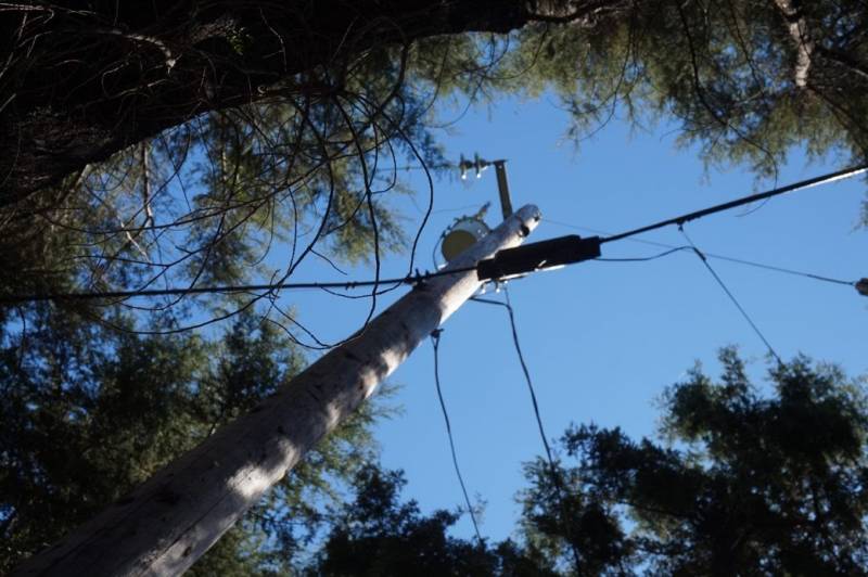
Albert found a number of power lines that appeared to violate these regulations. On Harrison Grade and Green Valley roads northwest of Sebastopol, he found oaks and redwoods with branches that appeared precariously close to electric current.
Some of the oak trees were also very close to the utility poles, despite the 10-foot radius requirement. And some low-lying tree branches also extended into that safety zone.

