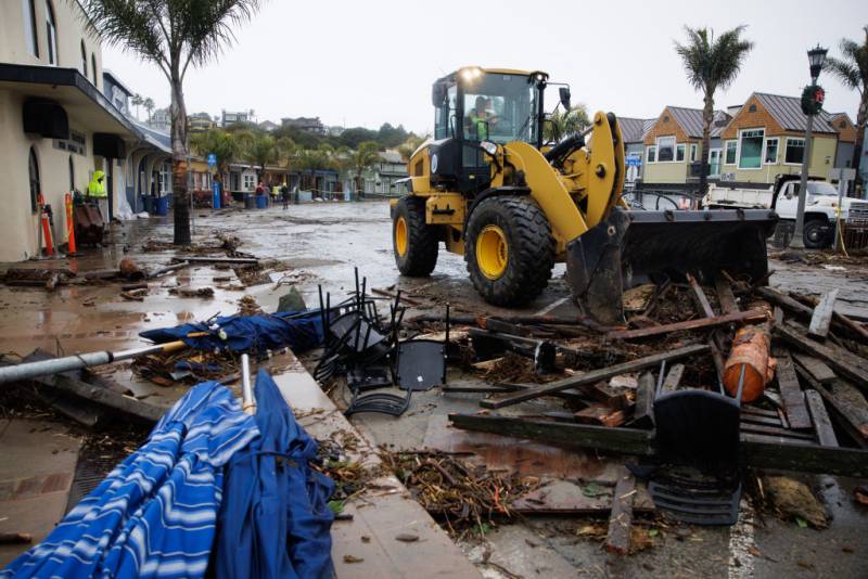
A series of atmospheric rivers has caused storm damage to infrastructure throughout Santa Cruz County. On Thursday, the wharf in Capitola was broken in half by a powerful storm surge. Currently over 5,000 people remain without power, and initial damage estimates from the storm are over $20 million. This all comes as another powerful storm is set to make landfall on Monday.
KQED's Natalia Navarro spoke with Dave Reid, director of the Santa Cruz County Office of Response, Recovery and Resilience, about the county’s efforts both to prepare for the next storms and clean up after the last one.
This story has been edited for clarity and brevity.
Natalia Navarro: So Dave, we’re hearing that the damage in Santa Cruz County is really countywide. Can you give us an idea of the kinds of damage we are seeing and who it’s affecting?
Dave Reid: It’s a profound impact across our county. In our mountainous regions we’re seeing landslides and slope failures impacting our county-maintained road network as well as damaging homes and other critical infrastructure. Along our rivers and creeks and drainages, we’ve experienced flooding in our Soquel businesses and residences in mid-county and south county. And a lot of people saw on social media the power and impact of our ocean along our coastline. So it’s really a widespread impact from these storms over the last week.
Is the county spending more resources right now cleaning up from the last storm, or preparing for the next?
There’s a balance there. What we’re trying to do in the cleanup and preparation side is to make sure to the best of our ability that our natural drainage systems and our engineered stormwater systems are clear and ready to try and take this next storm. So we’re trying to remove woody debris that may cause more harm or damage to the flooding potential. We’re trying to clear our drainage infrastructure so that our storm drains and culverts are clear. And we are trying to get out when we can to assess current damages to our community members ahead of this next storm.

One area of concern is the Pajaro River, on the border with Monterey County. Could you talk about what you’ll be watching for, and what steps you will take if the river reaches a flood stage?
We’re going to be watching the storm in all our creeks and streams obviously, but the Pajaro and the potential impact there could be very significant. So we’re going to be watching as the water levels rise and interact with the very old levee system that we gratefully got funding to have repaired, but that has not been repaired yet. So as those water levels rise Monday evening into early Tuesday, we’ll be watching that closely, and well ahead of any of those concerns we may be issuing evacuation orders. But what we really want to make sure is that we’re watching the weather forecasting and that we have the best available data to make the most informed decisions to keep our community safe.
Are there specific areas in the county that you are anticipating may have evacuation orders in the coming few days?
If the weather forecast holds, we will be issuing evacuation orders in most of our low-lying drainages — Soquel Creek, Aptos Creek, the Salsipuedes-Corralitos-Pajaro River and the San Lorenzo River. But this storm may also cause additional damages in our mountainous regions with additional landslides and slope failures, because the soils are so saturated already.

