upper waypoint

Bay Area Scrambles to Clean Up as Yet Another Storm System Hits the Region

Save ArticleSave Article
Failed to save article

Please try again

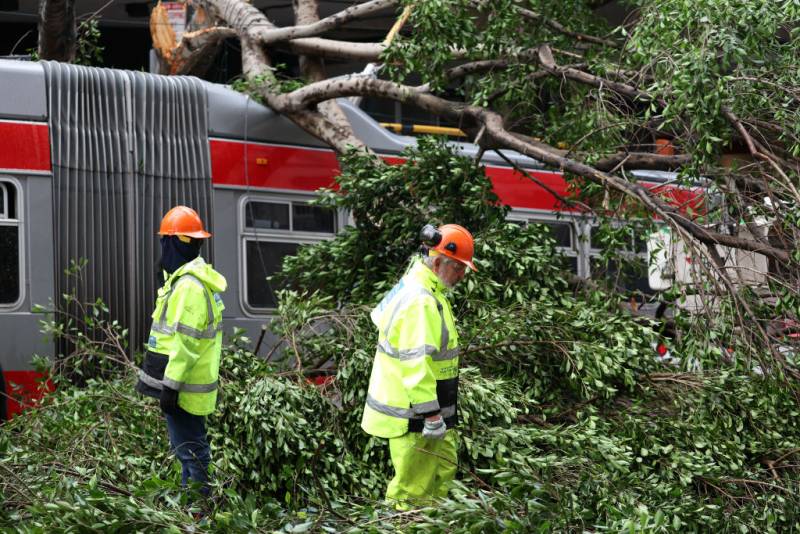
Two municipal workers in fluorescent suits and orange helmets work as a tree lays on top of a bus.
San Francisco Department of Public Works workers cut up a tree that fell on an SF Muni bus after a storm passed through the area on Jan. 10, 2023, in San Francisco. The San Francisco Bay Area and much of California continues to get drenched by powerful atmospheric river events that have brought high winds and flooding rains. The storms have toppled trees, flooded roads and cut power to tens of thousands. Storms are lined up over the Pacific Ocean and are expected to bring more rain and wind through the end of the week and into the weekend. (Justin Sullivan/Getty Images)

This story will no longer be updated. 

Update, 6:15 p.m. Wednesday: The body of a 43-year-old Ukiah woman was recovered from a submerged vehicle in Forestville today, according to the Sonoma County Sheriff’s Office. 

Dispatch reported receiving a 911 call from a driver that her car was stuck in floodwaters in the 6000 block of Trenton-Healdsburg Road, Forestville. The caller reported there was water in the car before the line was disconnected. Dispatch immediately tried to call back several times with no response.

Deputies from the Sheriff’s Office, fire personnel from Sonoma County Fire District and the California Highway Patrol arrived Tuesday but couldn’t locate the vehicle, calling off the search at sunset when it became too dangerous to continue. The search resumed Wednesday when they found the vehicle submerged in 810 feet of flood water approximately 100 yards off the road.

The woman was identified as Daphne Fontino by the Sonoma County Coroner’s Office, according to a news release from the Sonoma County Sheriff’s Office. This brings the total number of confirmed deaths as a result of storm events since Dec. 30 to 19, the Los Angeles Times is reporting.

In Hollister last night, a swift water rescue team made up of personnel from the Oakland Fire Department and members of seven other local agencies rescued two men after their truck was overwhelmed by fast-moving floodwaters in the vicinity of 595 Hospital Road, according to the City of Oakland.

The vehicle became stuck and was subsequently submerged in high water as the two passengers found themselves trapped on top of the vehicle. The rescue team used multiple ladders and other technical rescue tools to reach them and help them to safety. The men declined medical treatment but did not appear to be suffering from any injuries.

“The technical skill and communication involved in the rescue was phenomenal, and I hope this incident is a reminder for everyone about the dangers of attempting to drive through powerful and unpredictable storm water,” said Oakland Fire Chief Reginald Freeman. 

Meanwhile, Pacific Gas and Electric said power outages continued to affect more than 15,956 customers in the Bay Area as of 4 p.m. Wednesday, 13,059 of whom are in the South Bay, with 1,304 PG&E customers without power in the North Bay, 1,457 on the Peninsula, 131 in the East Bay, and five without power in San Francisco.

Update, 4:45 p.m. Wednesday: The PBF refinery in Martinez has released more than 11 million gallons of refinery-processed wastewater and storm water into the Carquinez Strait during the successive storms that have slammed the region over the last two weeks, according to the latest estimates from Bay Area water regulators.

That’s close to double the estimate from last Friday — the same day local residents complained of an odor coming from the facility, which has had a number of significant spills in recent years.

Eileen White, executive officer of the San Francisco Bay Regional Water Quality Control Board, said the discharge volume is now up to 11.2 million gallons for the Martinez refinery, but emphasized that “everything is still estimated.”

White also confirmed that Chevron’s Richmond refinery is releasing wastewater into the bay as well, but it’s still unclear how much.

“It sounds like it’s ongoing, so we won’t have a spill volume until later,” she said. “Everyone’s still in the response mode, with three more atmospheric rivers forecasted for the next week.”

The spills are among a number of local instances in which the recent torrential rains have overwhelmed infrastructure like storm drains, sewer lines and treatment plants, forcing significant amounts of wastewater into local waterways.

Update, 1:40 p.m. Wednesday: Another day, another storm. Wednesday delivered more heavy rain to much of the Bay Area, a day after the region was hit with an extremely rare cocktail of hail, thunder and lightning.

Yesterday’s storm system, part of the recent unrelenting series of atmospheric river events blasting California, has now moved well inland and is currently bringing mountain snows across the Intermountain West and into much of the central Rockies.

But now, “an enormous cyclone rotating well off the West Coast” is responsible for this latest round of heavy precipitation and gusty winds in Northern California, according to the National Weather Service. The North Bay is forecast to get the worst of today’s storm, with the potential for 2–3 inches of rain through the day, along with up to another 2 inches on Thursday.

About 2–3 inches of rain are expected to fall in the East Bay Wednesday, along with 1–2 inches in Santa Cruz County and up to 1.5 inches in the South Bay, in San Francisco and down the Peninsula.

Aside from the North Bay, Thursday should bring a brief respite (relatively speaking) to the rest of the Bay Area, with just 0.1–0.5 inches expected, before another storm front moves through the region Friday through Sunday. That storm is expected to drop 1–2 inches in San Francisco and on the Peninsula, 1.5–3 inches in Santa Cruz County, and 1–2 inches in the South Bay.

Meanwhile, in the North Bay, up to 4 inches are expected over the weekend, spurring new concerns of the Russian River flooding. The National Oceanic and Atmospheric Association/NWS California Nevada River Forecast Center had predicted the Russian River would experience a double-crested flood, but that prediction has been revised and the Russian River is not expected to reach flood levels again in the coming days. As of Wednesday, the Sonoma Sheriff’s Office lifted the evacuation warning for all residents living near the Russian River floodway and its tributaries just south of Healdsburg to Jenner.

Full school closures in four school districts of Sonoma County remain in place Wednesday “due to storm related impacts,” according to the Sonoma County Office of Education. The affected school districts are Fort Ross Elementary, Horicon, Kashia and Montgomery Elementary, with no virtual or in-person classes. The school districts have been closed since last week, with Horicon since Jan. 4 and the others since Jan. 5. The announcement included the caveat that officials at school districts make decisions independent of the county office.

Update, 5:30 p.m. Tuesday: A rare display of hail, thunder and lightning hit parts of the Bay Area on Tuesday, the latest wrinkle in a series of dramatic winter storms that have slammed the region with heavy rain and high winds.

Pea-sized hail fell in numerous cities in the area, including in Berkeley, but no damage was reported as a result.
A flood watch was in effect for much of the Bay Area through Tuesday afternoon as swollen rivers, creeks and streams threatened to overflow their banks, according to the National Weather Service.

Several areas of Monterey and Santa Cruz counties remained under evacuation orders or warnings as of Tuesday afternoon. Monterey County residents are encouraged to check whether they are in an area under evacuation order by typing in their address here. Santa Cruz County residents can do the same via the Zonehaven platform.

Meanwhile, communities along the Russian River breathed a collective sigh of relief when evacuation warnings were lifted late Tuesday morning after officials determined that the river had crested at 31.7 feet earlier in the morning, just shy of the 32-foot flood stage.

Update, 4 p.m. Tuesday: Gov. Gavin Newsom on Tuesday afternoon surveyed flood-damaged small businesses in Capitola Village, a community near Santa Cruz that has been particularly hard-hit by relentless storm surges.

“We’re soaked. This place is soaked,” he said, warning that additional storms in the coming days, even if less severe, will pack a mighty punch. “And now just more modest precipitation could have equal or greater impact in terms of the conditions on the ground.”

Newsom said an emergency declaration by President Biden now includes 31 California counties and means that “direct assistance will be forthcoming when conditions are right and we’ve assessed the damage.”

“We’re not walking away,” he said, pledging to help small businesses recover. “Obviously, they’re going to have to assess their own insurance liabilities and it all will be determinative in terms of where we land. But we’ll do our best.”

Newsom said he wanted to be careful to not “overpromise” and leave people “wanting and angry.” But, he added, “obviously the state, its intention, as is the federal government, is to help in the short run and the long run to be there for these businesses.”

Update, 2:45 p.m. Tuesday: BART is reporting major delays at the Richmond station in the Berryessa, Richmond and Millbrae directions. There is a major power outage.

Update, 2:30 p.m. Tuesday: As thunderstorms rolled across the Bay Area, lightning struck some of San Francisco’s landmarks, including Sutro Tower and the Transamerica Pyramid.

Update, 2:15 p.m. Tuesday: Around 40 people in some 29 RVs sought refuge at the Forestville Youth Park in Sonoma County’s Forestville, after being forced to evacuate nearby RV parks.

Darby, a Maribel resident who declined to give his last name, has been stationed at the park since Friday.

He, along with around 28 other RVs, totaling some 40 people, moved their RVs to the park after flooding at the Mirabel RV Park and Guerneville’s River Bend RV Park sent people searching for higher ground.

“It’s been actually pretty crazy,” Darby said. “We’re not home. We don’t have electricity. We don’t have sewer.”

Although evacuation orders lifted Tuesday, a power outage at the Mirabel RV Park means residents aren’t expected to return until Friday, said Tim Miller, executive director at West County Community Services, which has been helping provide some prepared meals, portable toilets and handwashing stations for the storm refugees.

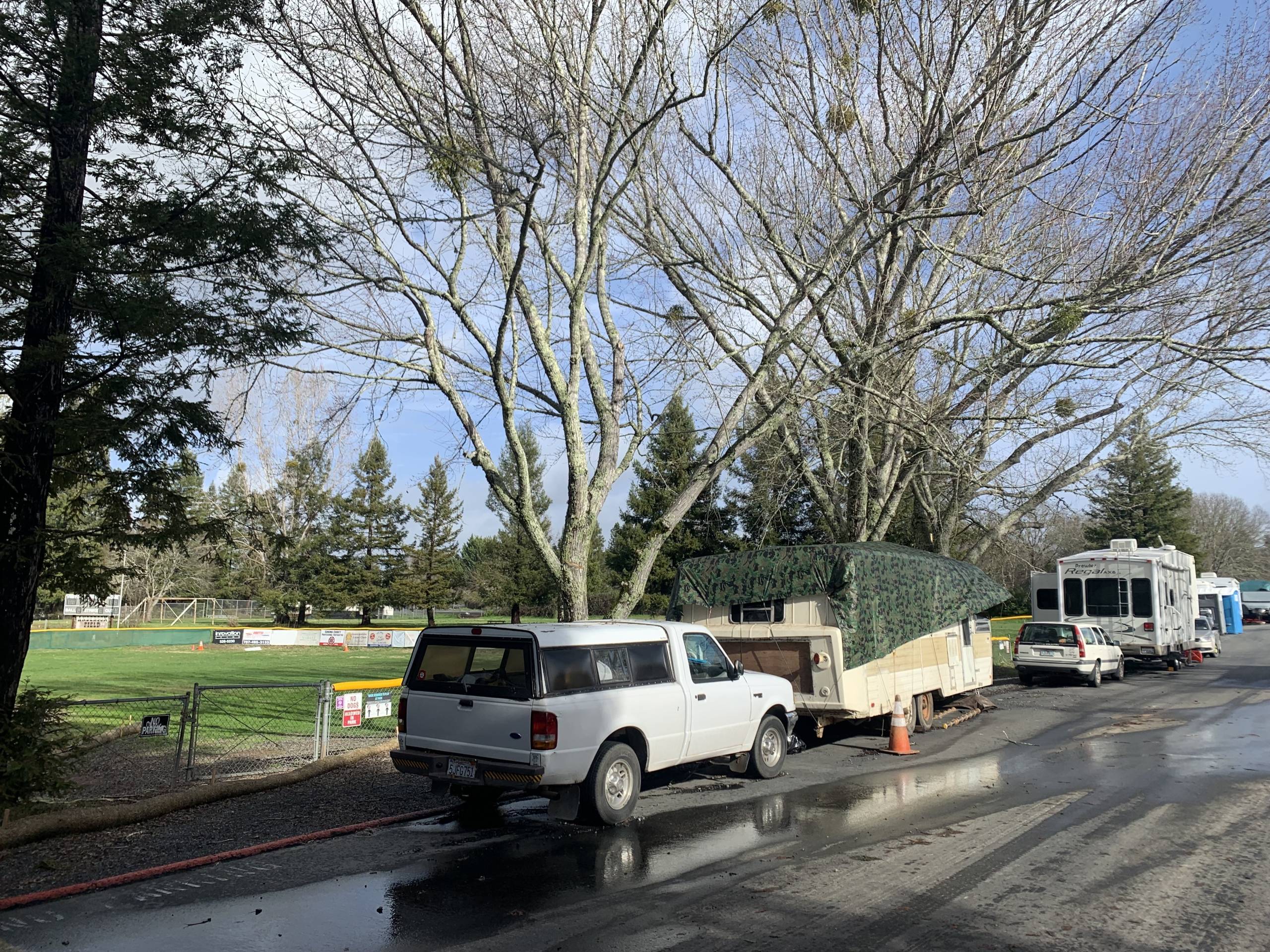
A line of RVs and cars along a rainy road, apparently during a sunny break in the storm, under tall, leafless trees and alongside a green athletic field.
About 29 RVs sought refuge at the Forestville Youth Park in Forestville after storms pummeled the Bay Area and prompted evacuation orders for two nearby RV parks along the Russian River, Monday, Jan. 9, 2023. (Danielle Venton/KQED)

On Tuesday, Miller said county workers also emptied refuse tanks for the RV dwellers.

“Which is terrific,” he said, “because people have been here for a while.”

In 20 years of working for the Red Cross and West County Community Services, Miller said he’s seen more intense flooding at the Russian River, but nothing quite so long-lasting.

“It’s just gone on for a really long time,” he said. “People living in RVs are pretty self-sufficient, but it’s expensive to live away from home.”

Without access to plumbing or power, the bills for potable water and food that can be eaten without refrigeration add up, Miller said.

“For people who are low-income, whether you’re homeless or in an RV, when you lose power or are displaced, the cost of living goes up,” he said. “And, that’s really taxing emotionally and financially.”

Update, 12:15 p.m. Tuesday: The National Weather Service is reporting that thunderstorms will be possible Tuesday across Northern California. And, a flash flood warning was issued for parts of San Francisco, Daly City and South San Francisco.

The most likely time frame for the thunderstorms was estimated to be from 12 p.m. to 8 p.m. Potential impacts could include lightning, small hail, heavy rain, strong wing gusts and possible funnel clouds or even brief tornados.

Update, 12:10 p.m. Tuesday: The National Oceanic and Atmospheric Administration posted a time-lapse video to Twitter Tuesday showing the massive atmospheric river that’s been battering the West Coast.

The time-lapse spans from Jan. 6 through Jan. 10.

Update, 12 p.m. Tuesday: The Sonoma County Sheriff’s Office lifted an evacuation warning late Tuesday morning that had been in place since Jan. 4 for the Russian River.

The order affected thousands of people in low-lying areas between Healdsburg and Jenner.

Early Tuesday morning, around 3 a.m., the river crested fractions of an inch below flood stage and is now expected go down.

Some roads are still closed, however, owing to flooded creeks and downed trees. The Sonoma County Board of Supervisors is planning to adopt an emergency declaration today, opening up a pathway for state and federal aid.

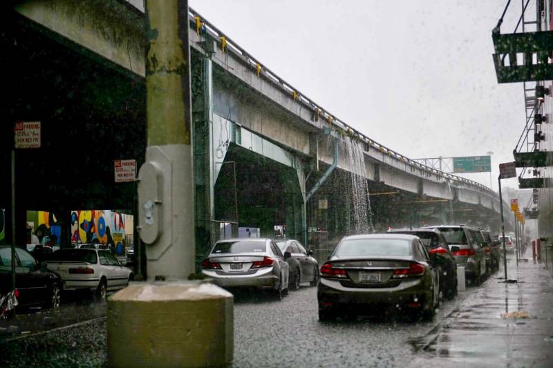
rain pours off an overpass on a stormy gray day in San Francisco
Rain pours off of the Central Freeway overpass near Folsom and 13th Streets in San Francisco on Jan. 10, 2023. (Beth LaBerge/KQED)

Update, 11:45 a.m. Tuesday: The San Francisco Chronicle reported Tuesday that millions of gallons of stormwater mixed with raw sewage has made its way into creeks, the San Francisco Bay, and city streets as recent rains overwhelm sewers and treatment plants.

Eileen White, executive officer of the San Francisco Bay Regional Water Quality Control Board told the Chronicle there were 90 reports of unauthorized wastewater or raw sewage discharges around the Bay Area between Dec. 30 and Jan. 3, totaling 14 million gallons.

Another 8 million gallons of unauthorized discharges were reported during the storm on Jan. 4 and Jan. 5.

“Don’t jump in puddles,” White told the Chronicle. “Especially in San Francisco — you want to be careful that there [could be] sewage in that.”

Update, 11:35 a.m. Tuesday: As of 11 a.m., at least 75,808 Pacific Gas and Electric households in the Bay Area were without power — down from the more than 93,700 customers without power earlier in the morning.

Residents in the South Bay were bearing the brunt of the outages, with 46,636 customers without power, followed by the Peninsula with 15,520 homes in the dark.

In the North Bay, 6,198 homes were without power; in San Francisco, the number was 3,909; and in the East Bay, 3,545 households were experiencing outages.

Update, 11:30 a.m. Tuesday: Officials in Santa Clara County say the recent storms have significantly affected county-maintained roads, causing closures due to mudslides, flooding and downed trees.

Crews are working to reopen the roads, including:

  • New Avenue from Leavesley to Buenavista due to wires on road
  • Mt. Charlie due to tree down with power lines
  • Idylwild due to tree down with power lines
  • Gist Road due to tree down with power lines
  • Bear Creek Road due to two slip outs
  • Castro Valley Road from Santa Teresa to Highway 101 due to flooding
  • Frazer Lake at Highway 152 to the San Benito County line due to flooding
  • Uvas Road from Watsonville Road to the Uvas Reservoir boat ramp
  • Bolsa Road from Highway 25 to Bloomfield due to flooding
  • Bloomfield Road from 152 to Frazer Lake due to flooding
  • Black Road from Thompson to Skyline due to mudslide
  • Santa Teresa Blvd. from Highland to California due to flooding
  • Calaveras Road from Felter Road to Alameda County line
  • Mines Road from Del Puerto Road to Alameda County line due to two washouts
  • Sierra Road from Skyview Drive to Felter Road due to slide/storm debris
  • Mesa Road from Santa Teresa to Highway101 due to flooding
  • Mt. Madonna Road (dirt section) from 1.75 miles east of Redwood Retreat Road to Summit Road in Gilroy

More emergency road closure information is available at www.sccgov.org/roadclosures.

Update, 11:15 a.m. Tuesday: The death tally from the recent storms has now risen to 15 as of 8 a.m., said Brian Ferguson, spokesperson for the California Office of Emergency Services.

The state began tracking weather-related deaths since the Dec. 30 storm, with one additional death reported overnight.

There is no estimate yet for the total cost of storm-related damage, he said, but “because of the scope of the damage, we do estimate that it will be substantial.”

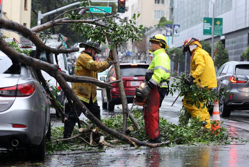
firefighters work to remove a tree from the road after a storm
San Francisco firefighters remove a large tree branch that fell onto a parked car due to high winds from the early Tuesday morning storm, Jan. 10, 2022. The San Francisco Bay Area and much of California continues to get drenched by powerful atmospheric river events that have brought high winds and flooding rains, toppling trees, flooding roads and cutting power to tens of thousands. (Justin Sullivan/Getty Images)

Update, 11 a.m. Tuesday: Mary Ellen Carroll, executive director of San Francisco’s Department of Emergency Management said in a tweet Tuesday that overnight wind and rain in the city caused 40 trees to fall or have damage.

“More rain, wind, high surf and possibly thunder and lighting on deck for today,” she said. “Be careful out there.”

Crews were out Tuesday clearing the debris. Residents can text their ZIP code to AlertSF at 888-777 for road closures and areas to avoid.

Update, 10:45 a.m. Tuesday: The San Francisco Department of Parks and Recreation reported Tuesday that several parks were closed due to the storms.

The TPC Harding, Fleming, Golden Gate Park, Lincoln Park and Sharp Park golf courses were closed, along with the Japanese Tea Garden, the San Francisco Botanical Garden, SOMA West Skate Park, Grattan Playground, Peixotto Playground, Stern Grove, Pine Lake, the Great Highway and all grass fields.

Update, 10:30 a.m. Tuesday: The CHP is reporting a number of road closures as a result of the wet weather battering the Bay Area Tuesday. Public transit also is affected.

In Alameda County, State Route 84 between Niles Canyon and Pleasanton Sunol roads in Fremont is blocked due to flooding and a landslide.

In San Francisco, the Great Highway south of Sloat Boulevard is closed due to storm-related erosion.

Further south, in San Mateo County, State Route 35 north of La Honda Road is blocked in both directions, due to downed wires.

And in Santa Clara County, the connector ramp to southbound State Route 87 on southbound Interstate 280 in San José is closed, as is the right lane in the area.

In Santa Cruz County, State Route 9 east of Graham Hill Road is blocked in both directions due to downed wires.

In addition, BART is running trains at slower speeds due to the wet weather. The agency is asking passengers to add 20 minutes to their planned travel times to factor in the delays.

Amtrak’s Capitol Corridors trains are also delayed, and as of 9:30 a.m., the Valley Transportation Authority reported the Green Line light rail continues to be replaced by buses between Diridon and Fruitdale stations, due to a power outage.

For more information on road closures and transit delays, visit 511.org/alerts/critical.

Update, 9 a.m. Tuesday: At least 93,742 Bay Area households were without power Tuesday morning, according to PG&E.

Residents in the South Bay were bearing the brunt of the outages, with 52,911 homes without power, followed by the Peninsula, with 19,053.

There were 8,221 people without power in the East Bay; 7,414 in the dark in the North Bay; and 6,143 households without power in San Francisco.

Update, 8:30 a.m. Tuesday: A flood warning for the Russian River near Guerneville has been downgraded to an advisory, according to the National Weather Service’s Brooke Bingaman.

“It’s still in ‘monitor’ stage,” Bingaman said. “That’s near flood stage, but not quite. So, folks near Guerneville and along the Russian River should still be vigilant.”

With another bout of rain expected Wednesday, Bingaman said the forecast could change.

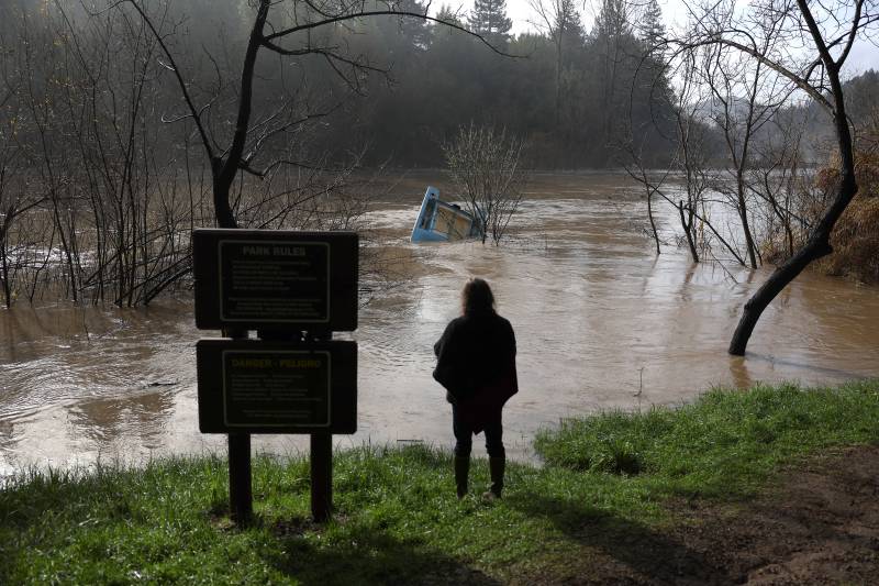
a person is seen from the back looking at a tree floating down a river in a storm
A resident looks at a boat that is caught in a tree in the Russian River on Jan. 9, 2023 in Rio Nido, California. (Justin Sullivan/Getty Images)

Update, 7:30 a.m. Tuesday: A series of punishing storms continued to dump rain Tuesday across the Bay Area, with winds of up to 70 mph and a flood watch in effect until the afternoon.

More than 189,000 PG&E customers are without power this morning, as the storm brought more than 100 cloud-to-ground lightning strikes as of 5:30 a.m., company officials said.

The thunderstorm began offshore around the southern portion of Marin County through the Big Sur coastline, said Brooke Bingaman, a meteorologist with the National Weather Service San Francisco Bay Area.

As the storm moved inland, San Francisco and Santa Cruz bore the brunt of it, she said, with the thunder rousing many from their sleep. But, it’s not the last of the storms for this week.

The Bay Area can expect intermittent showers later today, along with the chance of thunderstorms later in the morning and into the afternoon. More rain is expected Wednesday morning and in the early afternoon, followed by another storm over the weekend, Bingaman said.

With the ground already saturated and more rain flowing into rivers and creeks, she said the effects of the storm will continue to be felt for days or even weeks after the rain stops.

“The weather has definitely been unrelenting recently, and I know that it feels like we’re in a boxing ring and it’s just round after round,” Bingaman said. “We appreciate the fact that people are still paying attention to the advice [the National Weather Service is] giving and they’re listening to local officials, and we just ask that people continue doing that until we definitely get back into a dry spell.”

At least 14 people have died as a result of the storm — more than the past two years of wildfires combined — officials from the governor’s office said Monday.

“Our message to Californians is simple: be hyper-vigilant,” Governor Gavin Newsom said in a statement. “There are still several days of severe winter weather ahead, and we need all Californians to be alert and heed the advice of emergency officials.”

On Tuesday, Newsom planned to unveil his budget for the upcoming fiscal year, which begins in July. The proposal includes $202 million in new investments for long-term flood prevention.

Update, 7 a.m. Tuesday: The Monterey County Sheriff’s Office issued an immediate evacuation order for residents in the low-lying areas of the Salinas River early Tuesday morning, after flooding south of San Lucas in the county’s southeastern corner.

Residents are being told to evacuate the following areas located south of San Lucas on the east side of U.S. Highway 101: Zone G-028A, south of Lockwood San Lucas Road, and north and west of Cattleman Road.

Update, 9 p.m. Monday: Lynda Hopkins described the past week as a marathon marked with an occasional sprint.

The Sonoma County supervisor, whose district encompasses the coast and the Russian River towns of Guerneville and Forestville, said she’s been busy keeping up with water levels that sometimes rise fast and recede just as quickly in between rounds of storm.

“This has been a grind: a series of atmospheric rivers really devastating the electrical grid as well as our roads and infrastructure in western Sonoma County,” Hopkins told KQED.

Residents have been closely watching the river as it comes close to flood level.

Hopkins said county authorities prioritized evacuating residents who live in trailers and low-lying areas. The trailer parks provide affordable housing for people who make up the area’s workforce, but some of those residents don’t have trucks to move their trailers to higher ground, she said.

The county also opened community support centers to help residents who lost power recharge their electronic devices and to give out care packages that include a battery pack. She also heard from many small-business owners who were hampered by power outages and workers who had to evacuate.

“I’m expecting the economic ramifications of the flood to be substantial,” she said. “Even if the river doesn’t rise as high as we originally feared it would, we are looking at many millions, possibly tens of millions of dollars of infrastructure damage from this storm series, and we have had major catastrophic road failures.”

Update, 7:30 p.m. Monday: Evacuation orders have been lifted in many parts of Santa Cruz County as water levels near rivers and creeks begin to recede.

Authorities on Monday morning ordered residents who live near the rain-swollen San Lorenzo River and four other creeks to leave. Major flooding in the mountain community of Felton led firefighters to go by jetski and inflatable rescue boat to reach stranded residents. In one street intersection, the water reached as high as the bottom of a stop sign.

In Watsonville, residents in areas at risk of flooding were evacuated Monday morning as water seeped into homes. Orders remained in place for areas near the Pajaro River as authorities continued to monitor the levees that

hold the water back. A breach in the levees in 1995 caused widespread damage to homes and farms.

“There was a knock at the door and as we’re leaving … the water was already underneath [the] car so we have to make it out fast,” Dan Morales, 74, told KQED at an evacuation center set up at the Santa Cruz County Fairgrounds in Watsonville.

“That’s the only reason we’re here because [were it not] for the sheriff, we would have still been at home.”

UC Santa Cruz announced classes will be held online on Tuesday because of rapidly changing impacts of the storm. Student dorms were without power for most of Monday and power lines were in the roadway in parts of the campus, according to the university’s website.

Update, 6 p.m. Monday: The latest atmospheric river is causing flooding and widespread evacuations in many parts of California, and a second wave tonight is expected to bring isolated but intense thunderstorms.

The unstable atmosphere could pack in strong winds, hail and a small chance of tornadoes, said Sean Miller, a meteorologist with the National Weather Service’s Bay Area office.

“Not everybody is going to see it, but … for the folks that do see it, these thunderstorms can produce heavier rain rates,” Miller said.

And with the region already soaked from a series of atmospheric rivers that began on New Year’s Eve, Miller said, these thunderstorms could cause more flooding.

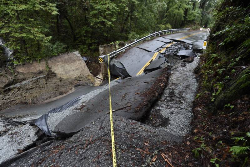
A mangled, twisted asphalt mountain road with yellow tape strung across it.
A view of road damage after storms and heavy rain in the Santa Cruz Mountains above Silicon Valley in Scotts Valley, on Jan. 9, 2023. (Neal Waters/Anadolu Agency via Getty Images)

The weather service issued a flood watch for a large portion of Northern and Central California, with 6 to 12 inches of rain expected through Wednesday in the already saturated Sacramento-area foothills.

Miller said the storms are anticipated to hit the Bay Area from 1 a.m. to 3 a.m., 5 a.m. to 7 a.m. and later Tuesday morning. He urged morning commuters to drive with caution or avoid getting in their cars if they can.

“We could have more issues with localized flooding in places that didn’t already receive it,” he said.

In Gilroy, traffic on both sides of U.S. 101 came to a standstill Monday afternoon when flooding overtook the roadway and there was no way for vehicles to turn around.

In this scenario, California Highway Patrol Officer Custodio Lopez advised motorists to pull over if it’s safe to do so and call 911 to report the flood. Make sure your now-stationary car is visible to others so you don’t get hit, he said.

A 5-year-old boy was swept away Monday morning after the truck he was riding in became stranded in floodwaters near Paso Robles in Central California. Bystanders were able to pull the boy’s mother out of the truck, but he was carried out of the vehicle and swept downstream, officials with the Cal Fire/San Luis Obispo County Fire Department said. There was no evacuation order in the area at the time.

Firefighters searched for the boy for more than five hours, but called off the search Monday afternoon because the current and rising water levels of the Salinas River were too dangerous for divers.

On the Central Coast, continuous rain, overflowing creeks and flooded roadways led the Santa Barbara County sheriff to evacuate nearly 10,000 people. The coastal community of Montecito was evacuated on the fifth anniversary of a mudslide that killed 23 people and destroyed more than 100 homes.

President Joe Biden issued an emergency declaration Monday to support storm response and relief efforts in more than a dozen counties, including Sacramento, Los Angeles and Santa Cruz.

The California Governor’s Office of Emergency Services reported Monday that at least 14 people have died as a result of violent weather during the past 11 days.

More than 91,000 homes and businesses were without power as of 5 p.m. Monday, according to PowerOutage.us.

PG&E said it brought in crews from out of state and Canada to cope with widespread damage to its power grid. The company is also providing power via portable electric generators to roughly 6,000 customers in Humboldt and Mendocino counties and bracing for the next round of storms, which could result in more outages.

“These storms have caused widespread power outages. Trees weakened by the drought in saturated soil have come down. Flooding and mudslides have affected many areas,” Pacific Gas and Electric COO Adam Wright said during a media briefing Monday.

“This has created a double whammy, if you will: a loss of power from downed wires and poles, and restricted access to make assessments and repairs.”

Daniel Swain, a climate scientist at the University of California, Los Angeles, expects a break in the rain after Jan. 18.

“That is my best guess right now, which is good because it will give the rivers in Northern California, and now in Central California, a chance to come down,” he said.

Update, 3:45 p.m. Monday: The Bay Area is experiencing a brief respite in stormy conditions late Monday, after 8 inches of rain fell over 12 hours. But the pause will be brief with more heavy rain and winds expected to bring several more inches early Tuesday “as a parade of strong wet Pacific systems pushes more heavy precipitation across California,” according to the National Weather Service.

Some northbound lanes of U.S. 101, a key coastal route, were closed, along with several other highways and local roads.

In Santa Cruz County, evacuation orders for up to 32,000 residents remained in place near rain-swollen rivers and creeks, said Melodye Serino, deputy county administrative officer. The San Lorenzo River was declared at flood stage, and drone footage showed numerous homes sitting in muddy brown water, the top halves of autos peeking out.

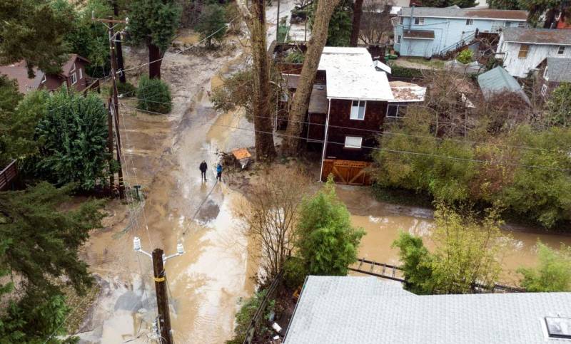
Flooded houses with people walking through it.
People walk along a flooded road near the San Lorenzo River in Felton, on Jan. 9, 2023. (Josh Edelson/AFP via Getty Images)

A large, muddy slide blocked both lanes of southbound Highway 17, a key but windy route into Santa Cruz from the San Francisco Bay Area. Vehicles were turned back at the summit as crews arrived to clean up. In Northern California, California Highway Patrol shared video of large boulders skidding down hillsides to block state roads.

More than 35,000 customers remained without power in Sacramento, down from more than 350,000 a day earlier after gusts of 60 mph knocked majestic trees into power lines, according to the Sacramento Municipal Utility District.

Update, 1 p.m. Monday: Some Bay Area cities are opening or expanding shelters as storms create unsafe conditions for the unhoused community.

In Oakland, the nonprofit Omni Commons has opened a 24-hour volunteer-run emergency shelter at 4799 Shattuck Ave. until noon Wednesday for people experiencing homelessness.

Omni Commons is currently prioritizing families, women and people who identify as LGBTQ+.

Volunteer Geraldo Amador says the space can accommodate 30 to 40 people on a first-come, first-served basis beginning at 8 a.m. every day. While intakes stop at 11 p.m., individuals can stay at the shelter overnight. Hot meals, sanitary products, COVID-19 tests, masks, bathrooms and beds with clean sheets are being provided.

“A lot of people we’ve talked to just need a place to not be in the rain,” said Amador. “They love that we were able to provide it to them free of charge and not have a lot of expectations in terms of if they can stay in the space for specific amounts of time.”

In Contra Costa County, Contra Costa Health Services (CCH) and community organizations are expanding capacity at shelters in the county for unsheltered individuals and families, as well as increasing outreach to deliver supplies to those who remain outdoors.

Anyone needing assistance with shelter placement should contact the Contra Costa Crisis Center by calling 211.

CCH has also temporarily expanded hours and staffing for the CORE unhoused-outreach program to help facilitate shelter placements and deliver supplies such as tarps, blankets, sleeping bag, gloves and beanies to unsheltered people who remain outdoors.

Outreach teams are in need of — in order of importance — sleeping bags, gloves and beanies, tarps and blankets. Donations can be dropped off at 2400 Bisso Lane, Suite D in Concord.

For more on where to find shelter throughout the nine-county Bay Area, go to our resource page.

Update, 12 p.m. Monday: The entire Bay Area is under a flood watch due to a series of major storms, with areas of greatest concern along the coast and in the North Bay, according to the National Weather Service.

At about 6:45 p.m. Saturday, the NWS issued a flood watch through Tuesday for the entire Bay Area and Central Coast, urging residents to prepare for widespread flooding, mudslides and the rapid rise of creeks and rivers.

Sonoma County along the Russian River from Jenner to Guerneville, and parts of Monterey County along the Carmel River, were elevated to flood warnings — the highest flood alert in the Weather Service’s three-tiered system.

All of Santa Cruz County is under a flash flood warning until further notice. An evacuation map for Santa Cruz County is here.

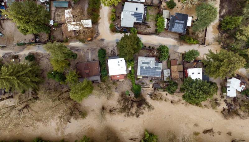
A bird's eye view of houses with flood waters flowing between them.
An aerial view of flooded homes in Felton, Santa Cruz County, on Jan. 9, 2023. (Josh Edelson/AFP via Getty Images)

A flood advisory was issued for most of the East Bay, South Bay, San Francisco and the Peninsula at about 10 a.m. Monday, and is expected to last until 4 p.m.

“A lot of our rivers and streams today are really at some of their limits,” said NWS meteorologist Brayden Murdock.

The risk of flooding is likely to be highest tonight for the region’s most affected areas as heavy rains continue and runoff from higher elevations filter down to already swollen waterways and saturated soils, Murdock said.

The current storm has already had a widespread impact across the Bay Area, with flooded roadways, downed trees and power lines creating hazardous driving conditions and leaving more than 14,000 PG&E customers without power.

As of 11:30 a.m., there were 7,823 without power in the North Bay, 3,763 on the Peninsula, 1,791 in the East Bay, 605 in the South Bay and 94 in San Francisco, according to Pacific Gas and Electric.

The storm has led to dozens of school closures in Santa Cruz County, the North Bay and San Joaquin County. Evacuation warnings and orders have been issued for parts of Monterey, Santa Cruz and Sonoma counties, as well as parts of Vacaville in Solano County.

The wet weather is expected to continue for at least the next week or so, with the largest amount of rainfall in the North Bay, Murdock said.

“The wet time is going to continue and our long-term outlook still shows wet conditions,” he said.

Daniel Swain, a climate scientist at the University of California, Los Angeles, expects a break in the rain after Jan. 18.

“That is my best guess right now, which is good because it will give the rivers in Northern California, and now in Central California, a chance to come down,” he said.

Original story, 9 a.m. Monday: Californians grappled with flooding and mudslides Monday as the latest in a series of powerful storms walloped the state, shuttering schools, toppling trees and leaving tens of thousands without power.

Evacuation orders were issued in Santa Cruz County for residents living near rapidly rising rivers and creeks. The San Lorenzo River was declared at flood stage, and video on social media showed the rushing river overflowing its banks, and inundating a nearby neighborhood with muddy water. Officials warned mudslides and flooding were blocking roads and urged residents to stay home.

In Monterey County, evacuation orders were issued for low-lying areas of the Carmel River.

Elsewhere in Northern California, several school districts were closed due to the storms, including many campuses in Sonoma County. Click here for a full list of Sonoma County districts and schools closed as of 11 a.m. Monday.

In the Bay Area, Sunday night’s storm saw gusts of up to 70 mph and caused outages that left around 16,000 Bay Area residents without power, according to PG&E. In Sacramento, more than 36,000 customers remained without power Monday morning, down from more than 350,000 a day earlier after gusts of 60 mph knocked trees into power lines, according to the Sacramento Municipal Utility District.

Related Posts

The National Weather Service warned of a “relentless parade of atmospheric rivers” — storms that are long plumes of moisture stretching out into the Pacific and are capable of dropping staggering amounts of rain and snow. The rain and snow expected over the next couple of days come after California has already been walloped by storms that last week knocked out power to thousands, flooded streets and battered the coastline with high surf.

President Joe Biden issued an emergency declaration Monday for California to support storm response and relief efforts in more than a dozen counties including Sacramento, Santa Cruz and Los Angeles.

Gov. Gavin Newsom said 12 people died as a result of violent weather during the past 10 days, and he warned that this week’s storms could be even more dangerous. He urged people to stay home.

The first of the newest, heavier storms prompted the weather service to issue a flood watch for a large swath of Northern and Central California, with 6 to 12 inches of rain expected through Wednesday in the already saturated Sacramento-area foothills.

In Aptos, the coastal community in Santa Cruz County, crews put down sandbags ahead of high tide. The area flooded last week, leaving sand piles and debris in the streets.

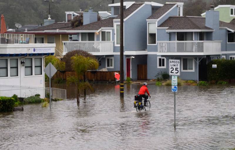
A flooded city neighborhood with a man riding by on a road bike.
A man rides his bicycle on a flooded roadway in Aptos, Santa Cruz County, on Jan. 9, 2023. (Josh Edelson/AFP via Getty Images)

In the Los Angeles area, stormy conditions were expected to return Monday, with the potential for up to 8 inches in foothill areas. High surf was expected through Tuesday, with large waves on west-facing beaches.

Since Dec. 26, San Francisco received more than 10 inches of rain, while Mammoth Mountain, a popular ski area in the Eastern Sierra, got nearly 10 feet of snow, the National Weather Service reported.

The storms won’t be enough to officially end California’s ongoing drought — but they have helped.

State Climatologist Michael Anderson said at a news briefing late Saturday that officials were closely monitoring Monday’s incoming storm and another behind it and were keeping an eye on three other systems farther out in the Pacific.

Daniel Swain, a climate scientist at the University of California, Los Angeles, said Californians can expect to see a break in the rain after Jan. 18.

“That is my best guess right now, which is good because it will give the rivers in Northern California, and now in Central California, a chance to come down,” he said.

This story includes reporting from The Associated Press, Bay City News and KQED’s Ted Goldberg, Danielle Venton, Emily Hung and Rachael Myrow.

Sponsored

Sponsored

lower waypoint
next waypoint