upper waypoint

Back-to-Back Storms to Wallop California. Expect Heavy Rain and Flood Danger

Save ArticleSave Article
Failed to save article

Please try again

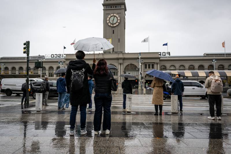
People with umbrellas walk near the Embarcadero in San Francisco on Nov. 20, 2024. (Beth LaBerge/KQED)

Updated 3:35 p.m. Thursday

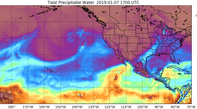
The atmospheric river storm that has dumped heavy rainfall on Northern California for two straight days is expected to wrap up by early Friday when another storm will move into the region.

Between Wednesday and Thursday, parts of the North Bay could receive 20 inches of rain, elevating the risk from the next round of rain, UCLA climate scientist Daniel Swain said Thursday. The deluge is prompting major flood concerns in counties north of the Golden Gate Bridge to the Oregon border.

“If this atmospheric river were to intensify and stall, not just sort of wiggle around, but just sit in the same place for three days, we could see escalation from minor flooding to more significant moderate and even major flooding,” Swain said.

Sponsored

“That appears to be what is happening because this atmospheric river truly has stalled out and will continue to be there for another 24 hours,” he added.

The greatest flooding risk will be in the hardest hit areas from Marin County north “as the peak of this system moves through in the early to mid-morning hours,” Swain said. The two storms could break rainfall records and will likely move south over the Greater Bay Area midday Friday into the afternoon.

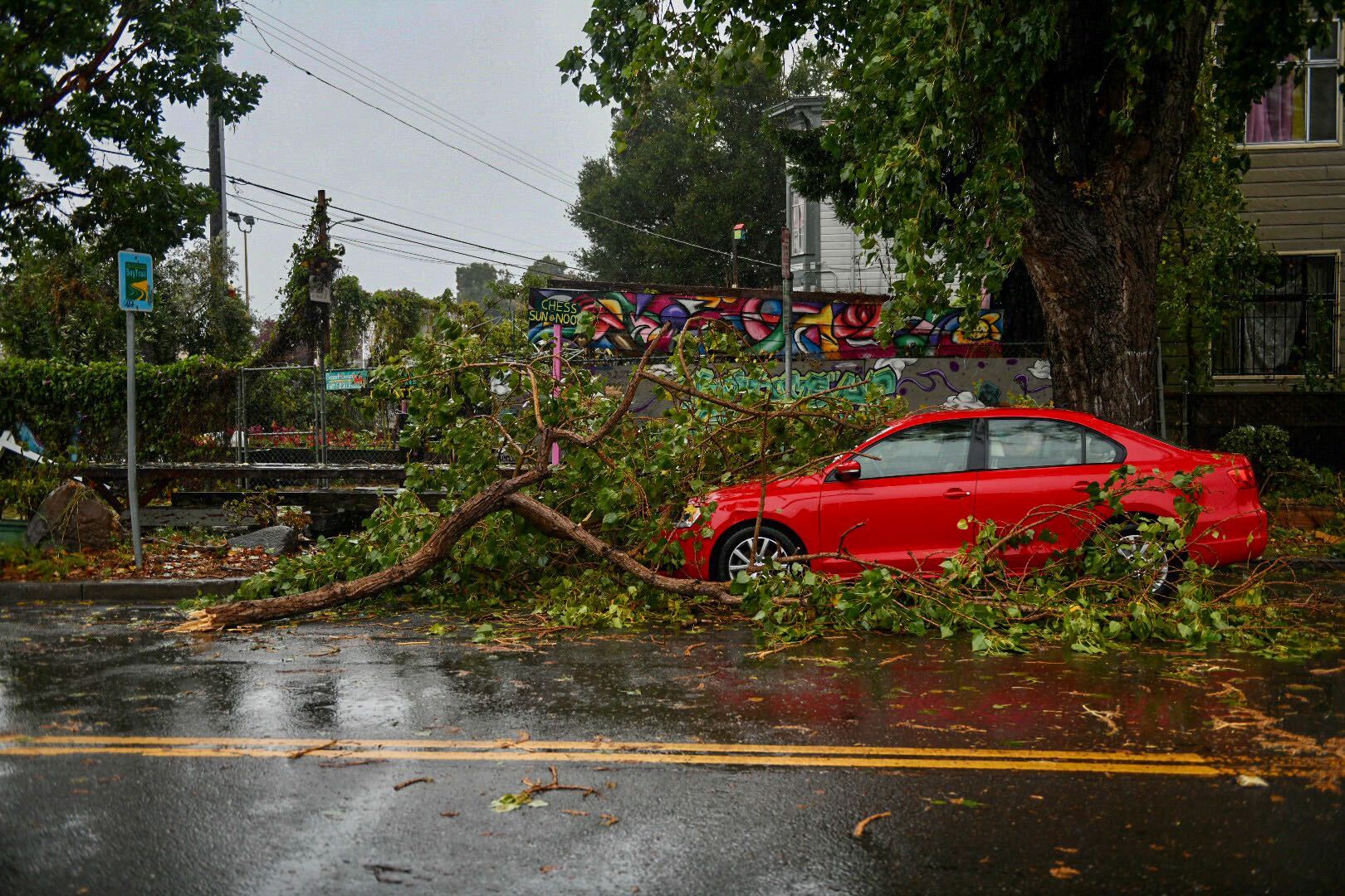
Large tree branch fallen on red parked car on rain-soaked two-way street.
A Category 5 atmospheric river brings heavy precipitation, high winds and power outages to the San Francisco Bay Area. The storm is expected to bring anywhere between 2 and 5 inches of rain to many parts of the area. (Beth LaBerge/KQED)

“We’re lucky this isn’t coming on the heels of a very wet pattern, but in and of itself, it’s going to be enough to create significant and life-threatening flooding in some places,” Swain said. “How’s that for the first storm of the season with any significance?”

But rain won’t immediately stop over the Bay Area this weekend. Instead, showers are expected into early next week. For now, the rain will continue over the North Bay.

“The momentum of the whole system itself has slowed down; all that rain is just holding out on the North Bay right now,” said Brayden Murdock, a meteorologist with the National Weather Service’s Bay Area office.

Already this week, the North Bay has seen more than 16 inches of rain at the highest elevations of the coastal mountains and over 10 inches of rain on Tuesday and Wednesday. Thursday, the storm dropped several more inches over the Napa and Sonoma areas.

“Rainfall totals are hitting those mountains, but luckily, it’s not happening within a short time,” Murdock said. “We’re even starting to see the prolonged effects, which are starting to add up, where we see some loosening of rocks around roads and some shallow landslides.”

Cori Reed, public information officer for CalTrans District 1, covering the northernmost part of the state, said rivers are rising, and the threat of flooding could lead to potential highway closures.

“We might get to flood stage by midnight tonight or 3 a.m. Friday morning,” she said.

James White, a meteorologist with the National Weather Service in Eureka, said Thursday that over the next 24 hours, the agency will be closely watching the Eel River, which is “expected to reach a major flood stage later tomorrow.”

If the river floods and roads are closed, he said, it could be difficult for people to move around the northern part of the state, leading to a “dangerous situation,” especially if there are landslides or rockslides.

“It’s not uncommon that Eureka and the North Coast gets cut off,” he said. “This is just kind of an extra long event, so folks just need to be prepared to lose power. Don’t travel around; just stay safe and hunker down.”

Since the storm began, PG&E has restored power to about 130,000 customers, according to the utility. Its outage tracker showed thousands more without power on Thursday afternoon.

The week’s second intense storm is expected to pick up Friday, when it will shift south and hit the rest of the Bay Area more directly.

On Wednesday, the strong winds downed trees, which crushed at least one home and damaged power lines in Santa Rosa, said Paul Lowenthal, division chief fire marshal for the Santa Rosa Fire Department.

“We had one tree come down that took out power lines, knocking out power to a couple of dozen individuals,” he said. “However, given the conditions, it could have been a lot worse.”

As the rain ramps up Friday, the potential for damage from falling limbs and flooding will only grow, Lowenthal said.

This week’s second storm system, moving south from the Gulf of Alaska, will veer toward the greater Bay Area on Friday and drop as much as 2 inches in San Francisco and 3 at higher elevations around San Francisco Bay.

“Tomorrow’s looking to be a lot wetter than initially believed,” Lowenthal said. “A lot of those same trouble spots we are dealing with will likely back up again and lead to another round of flooding and ponding in roadways.”
Since soils are now more saturated than they were two days ago, the likelihood of flooding is much higher when the storm ramps up later Friday, said Rachel Kennedy, a meteorologist with the National Weather Service’s Bay Area office. She said the weather service is paying close attention to rivers and streams nearing flood stages in Santa Rosa, Sebastopol, Windsor and Forestville.

“When the soil is saturated, it can absorb less water, which would lead to increased runoff, which could lead to faster rises in creeks and rivers, as well as ponding on roadways and nuisance flooding,” she said.

Water managers in the North Bay are gearing up for the second round of extreme rain but aren’t too worried about major waterways, like the Russian River, overwhelming their banks because reservoirs are way below capacity this early in the rainy season.

We’ll take this early rainfall and knock on wood to continue this rainfall pattern into the winter,” said Brad Sherwood, assistant general manager for Sonoma Water. “We want this storm door to remain open.”

Sherwood said the early rain could be a sign of a wet year, but “with the weather whiplash” California is known for, water managers are well aware that just a few years ago, the state was in a four-year drought.

“Getting [a massive] atmospheric river this early in the season is fairly rare,” he said. “So we’re always cognitive of climate change and extreme weather patterns. That’s why, as water managers, we have to save and preserve and efficiently use our water.”

KQED’s Sukey Lewis contributed to this report.

Sponsored

lower waypoint
next waypoint