upper waypoint

Santa Ana Winds Turned LA Fires Into Monsters. They’re Back, Prompting Dire Warnings

Save ArticleSave Article
Failed to save article

Please try again

Buildings are destroyed along Fair Oaks Avenue in Altadena, California, after the Eaton Fire swept through the area northeast of Los Angeles, California, on Thursday, Jan. 9, 2025. (Beth LaBerge/KQED)

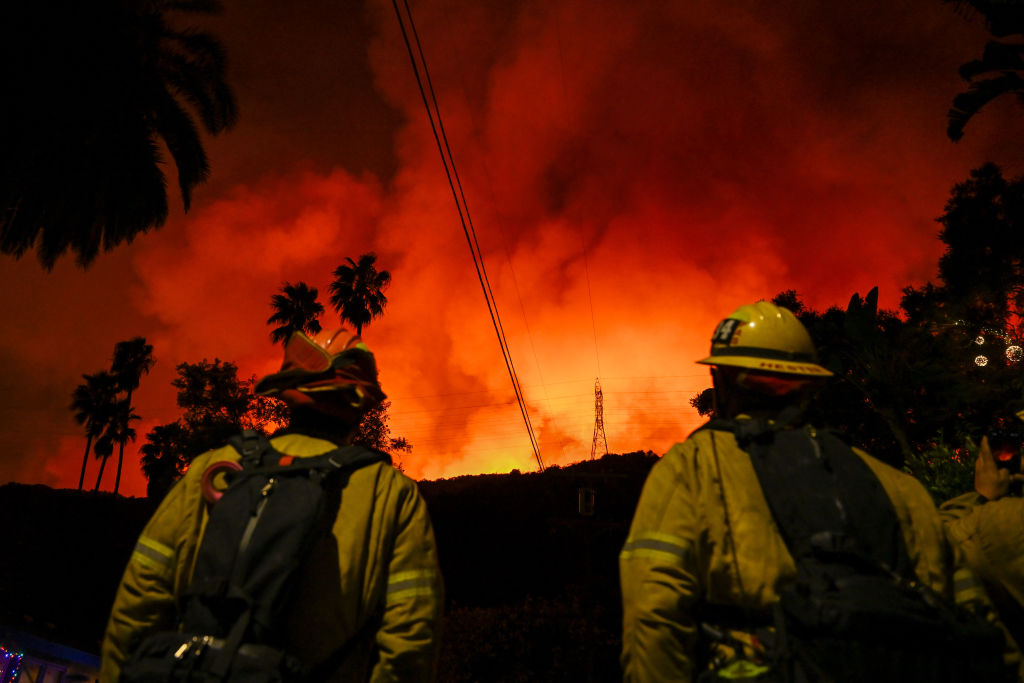
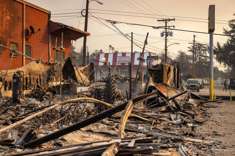
The strong Santa Ana winds that whipped flames into deadly and destructive wildfires last week are expected to again blow through Los Angeles this week, prompting dire warnings from forecasters and fire officials.

With no rain on the horizon, fuels will remain dry and firefighters battling the ongoing blazes will get little reprieve.

The National Weather Service issued its most serious red flag warning from early Tuesday through midday Wednesday across large areas of Los Angeles and Ventura counties, an advisory reserved for the “extreme of the extreme fire weather scenarios.”

The agency has issued three other “particularly dangerous situation” warnings in the last three months. Each of them precipitated a significant wildfire, Gov. Gavin Newsom warned Sunday, saying that fire crews will be pre-positioned around Southern California and emergency responders will be prepared.

“This setup is about as bad as it gets,” the National Weather Service posted on X.

Sponsored

The PDS warning covers the western Santa Monica Mountains and Malibu, where the Palisades Fire has spread, along with the northern San Fernando Valley, parts of Ventura County, including the cities of Ventura and Simi Valley, and Interstate 5’s Grapevine corridor in the mountains between Los Angeles and Kern counties. A broader red flag warning is in place in much of both Los Angeles and Ventura counties and extends as far north as San Luis Obispo. Within all of the red flag zone, high fire risk persists through Wednesday night.

“Areas in the Red Flag Warning, especially during the [Particularly Dangerous Situation] time frame, will have a high risk for large fires with very rapid fire spread, extreme fire behavior, and long-range spotting,” according to the National Weather Service’s forecast discussion on Monday morning.

Despite slightly lower wind speeds than last week, the wind event is expected to be long-lasting, according to UCLA climate scientist Daniel Swain.

The “reduction in peak intensity will be partially offset by the long duration and also the cumulative fuel drying that has occurred over this now dayslong period of very low humidity and strong winds in many areas,” he wrote on his Weather West blog on Sunday.

The second bout of offshore winds moving through California from the Pacific Ocean is also especially dangerous because gusts could feed fire areas that have been extinguished and are gasping for air. If heat and embers from a fire remain, high winds could reflash — or reignite — the blazes, especially if there isn’t water to cool the surrounding area or good ventilation to clear smoke.

Higher altitudes are at greater risk of winds matching last week’s speeds, while lower valley areas shouldn’t see any gusts near 100 mph like those that spurred the Eaton Fire into Altadena.

Much-hoped-for rain is not in the forecast for at least the next 10 days, and Swain said dry conditions could persist longer, pushing Southern California further into a record-dry year. The dry spell is also affecting Northern California, which was largely safe from the current wind events because of a rainy November and December. However, dry conditions this month could begin to dry out portions of the region where humidity is persistently low.

Over the next few days, the NWS is urging residents not to take any action that could start a fire, make sure they have multiple ways to receive emergency information and be prepared to evacuate.

lower waypoint
next waypoint