upper waypoint

Trump Orders and Atmospheric Rivers: How Prepared Are California's Levees?

Save ArticleSave Article
Failed to save article

Please try again

Flood waters cover most of Pajaro in Monterey County on March 12, 2023, after an atmospheric river storm caused a levee breach along the Pajaro River. (Shae Hammond/MediaNews Group/The Mercury News via Getty Images)

First, there was President Trump’s executive order to release billions of gallons of water from two reservoirs in the Central Valley, a move the Feds walked back after farmers and water experts decried it as wasteful, ill-conceived — and an unnecessary risk factor for levees in the region.

The mandate, said Nicholas Pinter, a professor of applied geoscience at UC Davis who studies California’s levees, amounted to “hydrologic insanity.”

“The volume they were initially starting to release and the lack of warning to local officials — it’s hard to characterize it as anything but insane,” he said.

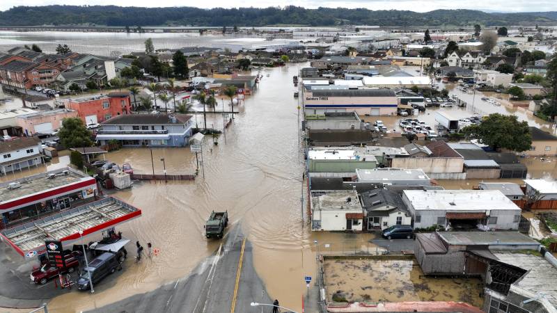
Then came this week’s atmospheric rivers, which keep people like Pinter on watch during California’s rainy season.

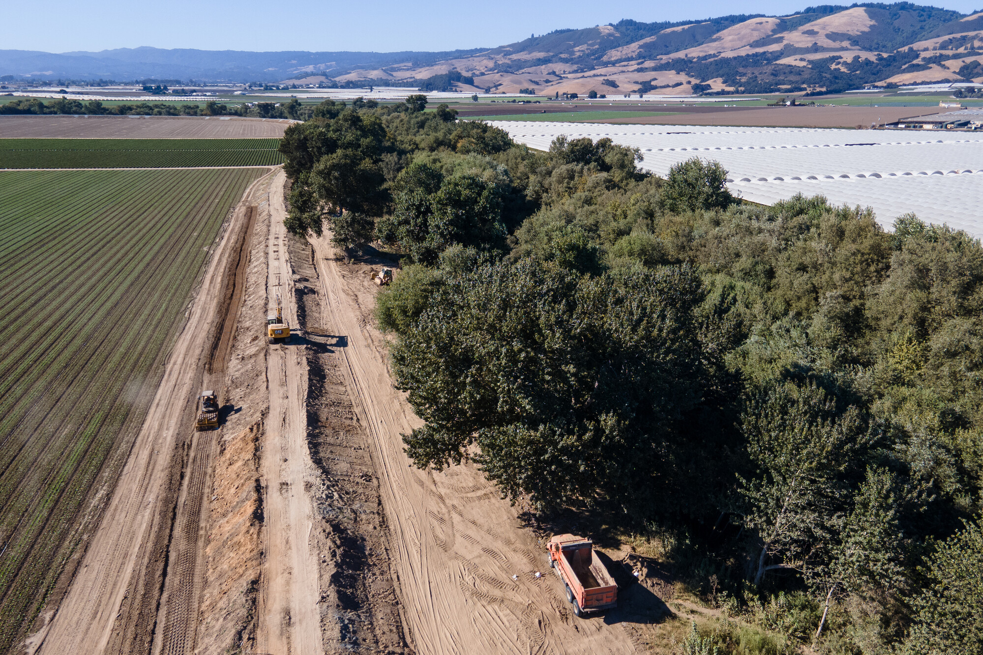
That’s because the condition of California’s levees is, by and large, already precarious. In its 2019 infrastructure report card, the American Society of Civil Engineers gave the state’s levees a ‘D,’ citing that despite significant investments, much more work is needed to rehabilitate and improve them.

With more rain in the forecast, here’s what to know about California’s levees:

Sponsored

What are levees?

Levees are barriers constructed alongside rivers, streams and other waterways to prevent land and property from flooding, according to the U.S. Army Corps of Engineers. Levees generally take the form of either an earthen embankment or a floodwall made of concrete or other materials.

Levees are different from dams, which are built across waterways to hold back and collect water in reservoirs. When water is released from a reservoir, it can put levees downstream to the test.

And the consequences of levee failure happen fast. By some accounts, 80% of New Orleans was flooded by Hurricane Katrina in 2004 due to levee breaches, with water depths reaching 7 feet.

In California, levees are managed by a patchwork of federal, state and local agencies, as well as by private landowners. This means that information about the condition of levees across the state can be difficult to find.

“Some levees were simply built haphazardly and aren’t easily found on any map or database, let alone information about their quality and current condition,” said Ann Willis, California’s regional director of American Rivers.

Two of the major players in levee management in the Golden State are the U.S. Army Corps of Engineers, which has a hand in managing approximately 2,300 miles of California levees, and the state, which manages about 1,550 miles of levees, mostly in the Central Valley.

A construction project to stabilize and add height to the Pajaro levee takes place on Aug. 20, 2024, after a breach in the levee flooded the community of Pajaro in 2023. (Beth LaBerge/KQED)

The Army Corps’ National Levee Database contains information on over 1,600 federal, state and local levees in California and paints a picture of the communities those structures protect: more than 5 million Californians live behind levees, which protect about 3,000 “critical structures,” like schools, fire stations and electric substations and about 750,000 acres of agricultural land.

How safe are levees?

While levees are a common part of California’s infrastructure, Willis said it’s important to remember that at the end of the day, they’re just human-made structures trying to hold back a powerful force of nature, whether that’s an atmospheric river or 2 billion gallons released from reservoirs with little warning.

That doesn’t mean all levees are on the brink of collapse, Willis said, but it’s a cause for ongoing and increasing concern.

“There are certainly areas where work and maintenance is being done to strengthen the levee system,” she said. “But that is really more of an exception. And this problem is really not going away.”

Trouble is, most people don’t know it. “I think people see a levee and assume that they have a level of flood protection that doesn’t exist,” she said. “Levees aren’t a guarantee. The best protection is to not be in the floodplain in the first place.”

Even though the Central Valley’s levees seem to have withstood the water that flowed after Trump’s surprise executive order, the brief surge put stress on an already precarious system, Willis said.

“The decision to release this much water this quickly,” she said, “increased the flood risk of the communities that the Army Corps of Engineers is tasked with protecting.”

As Pinter put it, “That risk never goes away.”

California saw the consequences of that risk in 2023, when a levee along the Pajaro River that was decades overdue for maintenance failed during a winter storm, flooding a Monterey County community that housed a vulnerable farmworker community of about 1,200.

That same year, winter storms threatened to breach a levee in the Central Valley town of Corcoran, which would have put the city of about 22,000 underwater.

These recent levee failures point to a growing concern in California: as climate change brings more intense storms, the state’s levees are not prepared to handle them.

“There is no infrastructure that was built for a climate-changed future,” Willis said.

On the bright side, Pinter noted, things have started to improve: “There is awareness in California that there was not 20 years ago.”

Who is most at risk?

Nationwide, a disproportionate number of people of color, people with less education and people living in poverty live behind levees, according to a 2023 study by the American Geophysical Union.

The study found that Hispanic people were the most overrepresented group living behind levees nationwide.

In California, this frequently means that low-income people, migrant farmworkers and undocumented people are disproportionately impacted, according to Michael Méndez, assistant professor of environmental policy and planning at UC Irvine. Many of those at risk are in the Central Valley, where hundreds of levees protect farmland and agricultural workers.

“Our communities that are low income are not able to prepare or safeguard from these disasters because they’re not being provided with adequate resources to do so,” he said.

“These are some of the most disenfranchised and stigmatized populations that are seen as being less worthy of infrastructure, resilience and upgrading,” he said. “It doesn’t happen by accident or by coincidence that time and time again, the same communities are being hurt.”

Sponsored

lower waypoint
next waypoint