“There’s a trend towards the atmospheric river storms that make landfall getting warmer,” he said. “They’ll tend to produce more rainfall than snow, which creates runoff right away.”
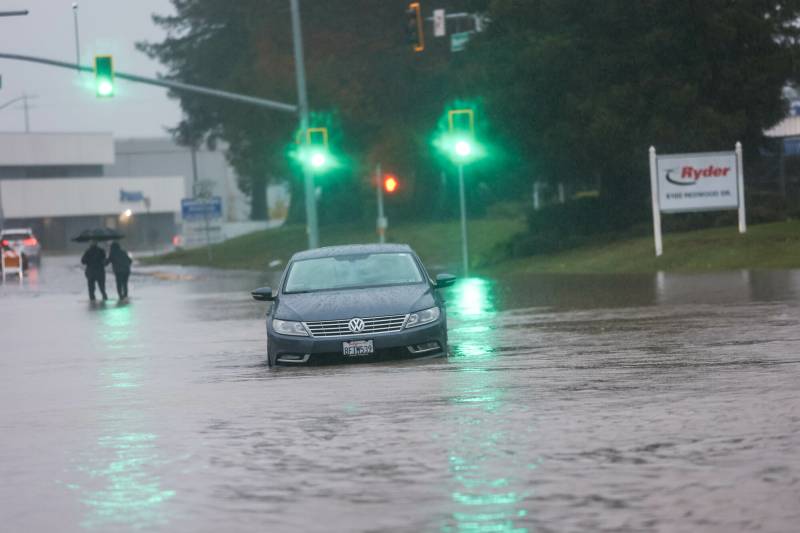
All that water is spilling into roadways, which is causing traffic issues, especially in the North Bay, said Sgt. Andrew Barclay, public information officer with the California Highway Patrol Golden Gate Division.
“We’re seeing flooding, we’re seeing debris, and we are seeing people that are driving too fast in those conditions that are losing control and spinning out,” he said.
In San Francisco, the weather service wrote in its most recent flood advisory that “downtown is the most likely place to experience minor flooding” and that on Thursday afternoon, “flooding may transpire, mainly in areas of hilly terrain.”
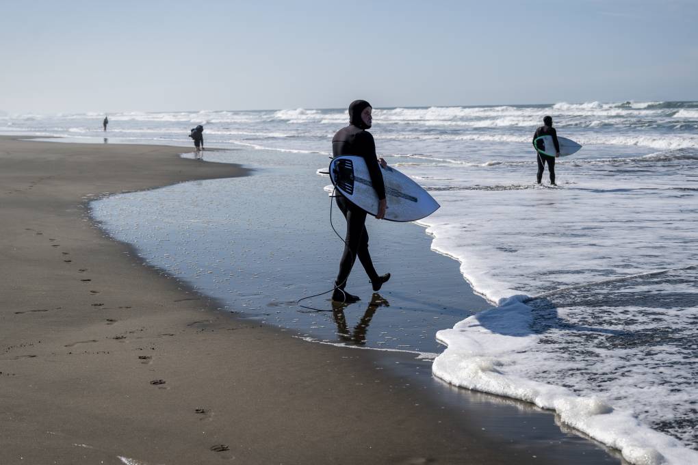
The weather service forecasts high surf with waves up 45 to feet through Saturday and has issued a flood watch through Saturday evening for the entire Bay Area and Central Coast, except for regions south of Hollister. Heavy rainfall may also continue to cause landslides.
“While the rain and wind grabs everybody’s attention, the most deadly weather we have here in the Bay Area is high surf and people getting swept out to sea,” Flynn said.
Flynn said scattered showers will pick up Thursday afternoon with a chance of thunderstorms, but the rain will be spottier than what happened overnight.
“By Friday afternoon, the sun will make a triumphant return, and the rain will stop,” he said.
Meteorologists expect a weaker storm to move through the region Sunday, with light rain focused on the North Bay. Forecasters wrote that the long-range discussion for the rest of the month is “split, but the majority of solutions point to a much drier second half of February as our roller-coaster rainy season continues.”