upper waypoint

California Snowpack Rebounds Amid a Wobbly Winter, With More Storms On the Way

Save ArticleSave Article
Failed to save article

Please try again

California Department of Water Resources staff members conduct the first media snow survey of the 2025 season in the Sierra Nevada in El Dorado County, Jan. 2, 2025. California is set to have a near-average Sierra Nevada snowpack, and at least three more storms this season will likely give it a necessary boost.  (Courtesy Nick Shockey/California Department of Water Resources)

Across the Sierra Nevada, this winter has been a tale of ups and downs, wets and dry and cold and warm temperatures. Now, the snowpack looks to be back on track for a normal year, with more storms on the way.

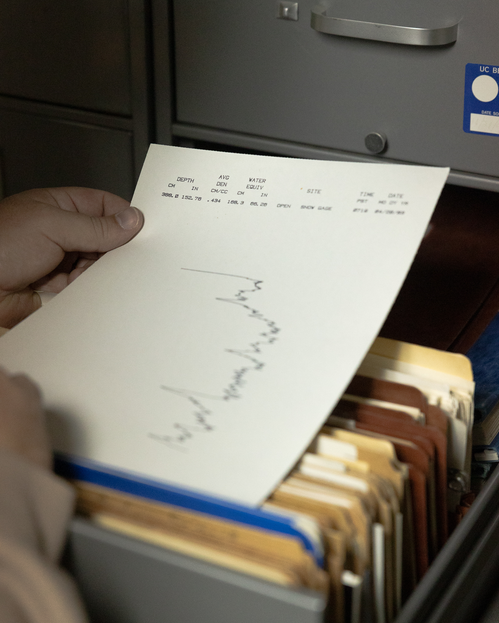
The mountain range received an early-season dusting in August, several feet of snow in December, a relatively dry January and several storms in February. With less than a month of winter left, the Sierra snowpack is at 73% of the April 1 average, which is closely watched by water managers to understand how much they can rely on snowmelt to recharge watersheds and reservoirs for the remainder of the year.

“We’re roughly at average again, which is really good news,” said Andrew Schwartz, lead scientist at the UC Berkeley Central Sierra Snow Lab. “Most, if not all, of our really big water storage reservoirs are above capacity at this point. To have an average snowpack to help maintain those levels is fantastic.”

Sponsored

The Northern Sierra snowpack is slightly above average, the Central Sierra is slightly below average and the Southern Sierra is below average. Luckily, forecasters expect the snowpack to grow over the next month as multiple cold storms bring beneficial snow to the region.

Three storms are already setting themselves up to hit the Sierra Nevada with up to 8 inches of snow starting Saturday, said Courtney Carpenter, warning coordination meteorologist with the National Weather Service’s Sacramento office.

Andrew Schwartz, director of the University of California Berkeley’s Central Sierra Snow Lab, holds a decades-old print out of snow measurements at the University of California, Berkeley’s Central Sierra Snow Lab, based in Soda Springs in the Sierras near Donner Summit, Jan. 16, 2025. (David M. Barreda/KQED)

Carpenter said that so far, the storms will be on the colder side, hopefully avoiding high-elevation rain that could melt some of the existing snowpack like several warm storms did earlier this season.

Anne Heggli, a mountain hydrometeorologist with the Desert Research Institute who studies rain-on-snow events, said there were several such storms in December and a large one from the end of January into early February. But the good news is that most were minor.

“The majority of the rain-on-snow events aren’t actively melting the snowpack, but those big rain-on-snow events, the ones that we remember, do melt the snowpack,” she said.

The larger issue with more rain than snow earlier in the year is that it can limit how much is stored in reservoirs. That’s because operators have to make the hard call to let the excess water go to make room for likely more precipitation with so much of the wet season still ahead.

Jeffrey Mount and Greg Gartrell of the Public Policy Institute of California wrote about this in a recent blog post, noting most of February’s precipitation fell on the northern part of the state into reservoirs above “their historic averages thanks to two preceding wet years.”

“Dam operators had no choice but to let the water go to make space for possible future floods,” they wrote. “And they let go a lot of water.”

From Feb. 1 to Feb. 18, Shasta Lake and Lake Oroville operators released more than 2 million acre-feet of water — enough to supply 6 million homes for a year, Mount and Gartrell noted.

Long-term trends, partly due to human-caused climate change, indicate that the coming decades will bring increasing rain-on-snow events that hurt the snowpack. Heggli said the Sierra could reach a “low- to no-snow future within the next 35 to 60 years.”

This year, the real worry is that winter or early spring heat waves could melt the snowpack prematurely, as they did in recent years, Schwartz said.

“If we get into April and we’re 10 degrees above average or 15 degrees above average, then we’re going to melt out really quick,” he said. “Then the worry turns to impacts on the ecosystem and fire danger.”

Noah Molotch, a hydrologist at the Institute of Arctic and Alpine Research and NASA’s Jet Propulsion Laboratory, said he’s waiting to see what happens over the next month as he and his team prepare snow accumulation data using a mix of satellite imagery, radar, climate modeling and on-the-ground observations.

“When I look at the complete picture for this particular winter, the story is that it is relatively dry, but it is not catastrophically dry,” he said.

Molotoch said the average snowpack and relatively full reservoirs at this point are a good sign for this year’s water supply. Still, he recognizes that hot weather or warm rain could drastically alter the April 1 snowpack amount.

“If we don’t get a lot more snowfall between now and April 1, the April 1 percent of average could be much lower,” he said. “We might end up at like 50% of average.”

lower waypoint
next waypoint