upper waypoint

Bay Area Storms Are About to Bring Days of Wind, Rain and ‘Unsettled Weather’

Save ArticleSave Article
Failed to save article

Please try again

A sign reads, "Possible Flooding" in Marin City on Nov. 22, 2024. A wind advisory is in effect for the Bay Area on Wednesday, and rain will pick up by midday, with the South Bay mountains and Central Coast expected to be hit the hardest. (Beth LaBerge/KQED)

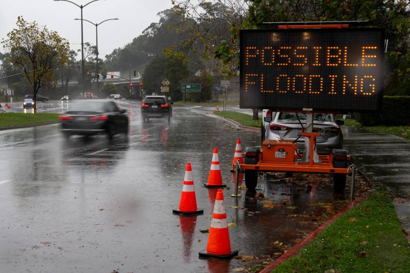
The Bay Area is in for a wet rest of the workweek as a series of storms promising waves of wind and rain roll into Northern California on Wednesday.

After early morning rain along the coast, the main weather system will hit the North Bay by late morning and spread south, hitting San Francisco around midday. The South Bay mountains and Central Coast are expected to get hit the hardest, according to Roger Gass, a meteorologist in the National Weather Service’s Bay Area office.

Consistent, heavy rainfall and strong southerly winds will make for “nasty” conditions in the early afternoon, the weather service said, before a cold front arriving in the evening changes the storm pattern across the region. It said to be prepared for downed trees and related disruptions to roadways and power lines.

Sponsored

A wind advisory is in effect until 8 p.m. Wednesday, with gusts up to 45 mph in many places and up to 55 mph along the coast and on ridgelines, according to the weather service.

As steady rain turns into more unstable showers, volatility will continue into Thursday, with heightened chances for thunderstorms and possibly hail. Rainfall is expected to ebb in the evening, offering a brief reprieve before more storms arrive through the weekend.

“We’re forecasting unsettled weather conditions to persist and be generally at or below average for this time of year, but the strongest storm system is the one today,” Gass said. “We’re expecting the subsequent ones to be less impactful, and the next week will be kind of unsettled and cool.”

Through Thursday afternoon, forecasters are expecting half an inch to an inch of rain across San Francisco. The highest totals will be in coastal ranges like the Santa Cruz Mountains, which could see up to 2 ½ inches, Gass said.

The storm will also bring more snow to the Sierra Nevada with colder conditions Wednesday night. It could dump 8 to 12 inches on the Lake Tahoe area overnight, according to Gass, and another few inches throughout the day Thursday.

The second of three storms this week will arrive Friday, bringing more steady rain similar to Wednesday, though likely less intense, according to the National Weather Service. A third similar storm is expected to hit the Bay Area on Monday.

The rainfall totals aren’t expected to threaten river flooding like the Bay Area saw in February, according to Gass, but streams, creeks and ponding on roadways could come as repeated storms dump a few inches at a time over the coming days.

Past Monday, the forecast is fairly uncertain, but the weather service said conditions continue to look “unstable,” so don’t expect spring sunshine just yet.

“We’re not seeing much dry weather,” Gass said. “There will be breaks in between the systems, but we’re not expecting them to last long as more systems are on the way.”

lower waypoint
next waypoint