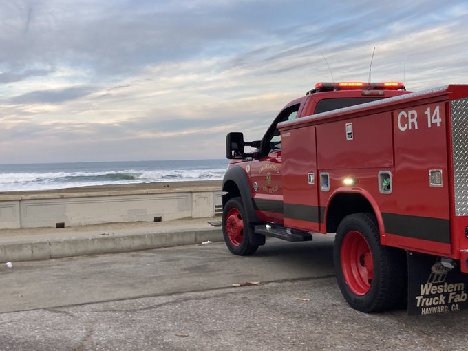
Emergency crews are seen patrolling Bay Area beaches, like Ocean Beach in San Francisco, after a tsunami advisory in January 2022. (Ted Goldberg/KQED)
While December 2024 may feel like a lifetime ago at this stage, it was only a little over three months ago that a magnitude 7.0 earthquake off the coast of Humboldt County triggered a widespread tsunami warning for at least 5.3 million Northern California residents.
Reactions to the Dec. 5 message — which warned “You are in danger” and urged people to “Get away from coastal waters” — varied. Some people panicked as residents in areas like West Berkeley fled their homes following evacuation orders and Oakland schools sheltered in place. Other people posted through it on social media — as many are inclined to do in anxiety-provoking situations:
In a few hours, the alert was withdrawn — causing many Californians to dismiss the warning’s validity altogether. And while there is an “imperfect science” behind tsunami warnings, experts said they wanted to make sure people didn’t see that day as a “false alarm.”
“The alert issued today was the highest level of tsunami warning that we have,” Justin Schorr, a rescue captain with the San Francisco Fire Department, told KQED that day. “If we weren’t prepared today to evacuate inland or to higher ground, this gives us a great opportunity to be prepared for next time.”
Sponsored
‘Seriously, think about what could happen’
Preparing for that “next time” is the mission of Tsunami Preparedness Week, an initiative from several government agencies, including the Governor’s Office of Emergency Services and the National Oceanic and Atmospheric Administration. And experts said that the need to be aware of tsunami hazard zones is even more pressing in the light of research showing the risk of damaging tsunami flooding to coastal cities may be even greater than realized.
“It may be to our advantage that [the December alert is] fresh in people’s minds,” said Lori Nezhura, deputy director of planning, preparedness, prevention at the Cal OES. “I hope that recent experience will drive people to seriously think about what could happen and how they should prepare for a tsunami in California.”
Nezhura called the act of preparing for an emergency as developing “muscle memory” — and “you’ve got to stretch and exercise it every now and then otherwise, you forget you’ve got that muscle.”
So if you were one of the many people who took little or no action — or just didn’t know what to do — on Dec. 5 after that tsunami alert, what should you do if that “next time” comes, and your phone receives another warning one day? Keep reading for what experts advise.
Do tsunamis even happen in California?
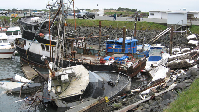
The aftermath of a tsunami in Crescent City harbor, Del Norte County, March 12, 2011. (Craig Miller/KQED)
Tsunamis — giant waves that can be triggered by an earthquake, undersea volcanic eruption, seismic activity or landslide — are relatively rare along California’s shores, but they do happen. According to the state, since 1800, more than 150 tsunamis have hit parts of California. But even though many of those have been “barely noticeable,” the officials at Cal OES stress that “the entire California coastline is vulnerable to these events.”
The state’s most destructive tsunami hit in 1964 in Crescent City near the Oregon border. Several hours after a magnitude 9.2 earthquake rocked Alaska, waves reaching up to 21 feet crashed against the Del Norte County shoreline, causing the deaths of 12 people and destroying many homes and buildings.
In 2011, the tsunami that devastated large parts of the Tōhoku region of Japan also caused $100 million of damage to harbors across California. And more recently, in 2022, the collapse of a volcano near New Zealand and Fiji led to a tsunami that caused up to $10 million (PDF) in damage along California’s coasts, with Santa Cruz and Ventura particularly affected.
Who sends tsunami alerts, and how serious are they?
Monterey-based National Weather Service meteorologist Brian Garcia told KQED that local offices are “wholly and completely dependent” on the National Tsunami Warning Center, which is run by the National Oceanic and Atmospheric Administration — a federal agency that faced major cuts by President Donald Trump.
When the Center issues a tsunami warning, “it triggers the Wireless Emergency Alert that hits your phones immediately from their office,” Garcia said. “So it doesn’t even come to our local [NWS] office before it hits the Wireless Emergency Alerts across phones.”
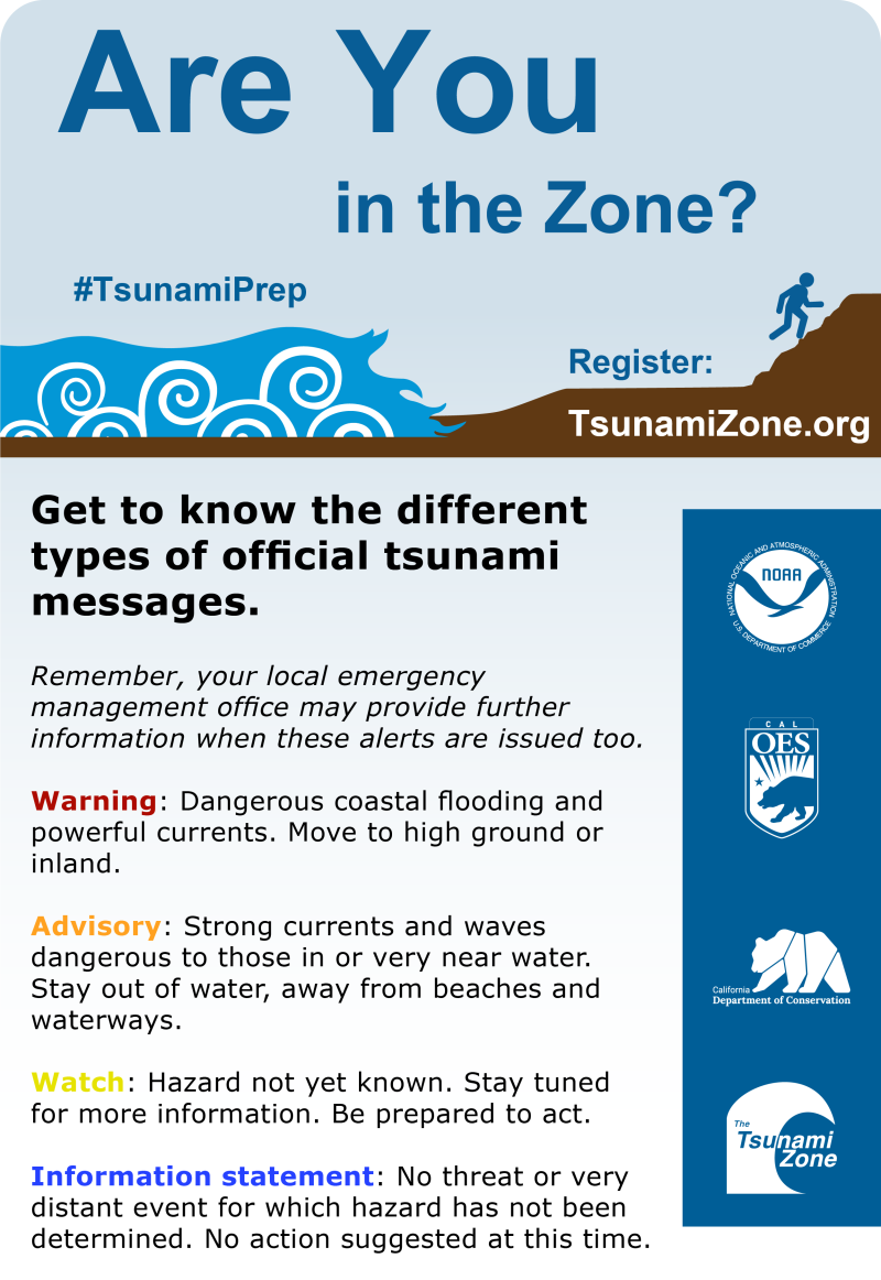
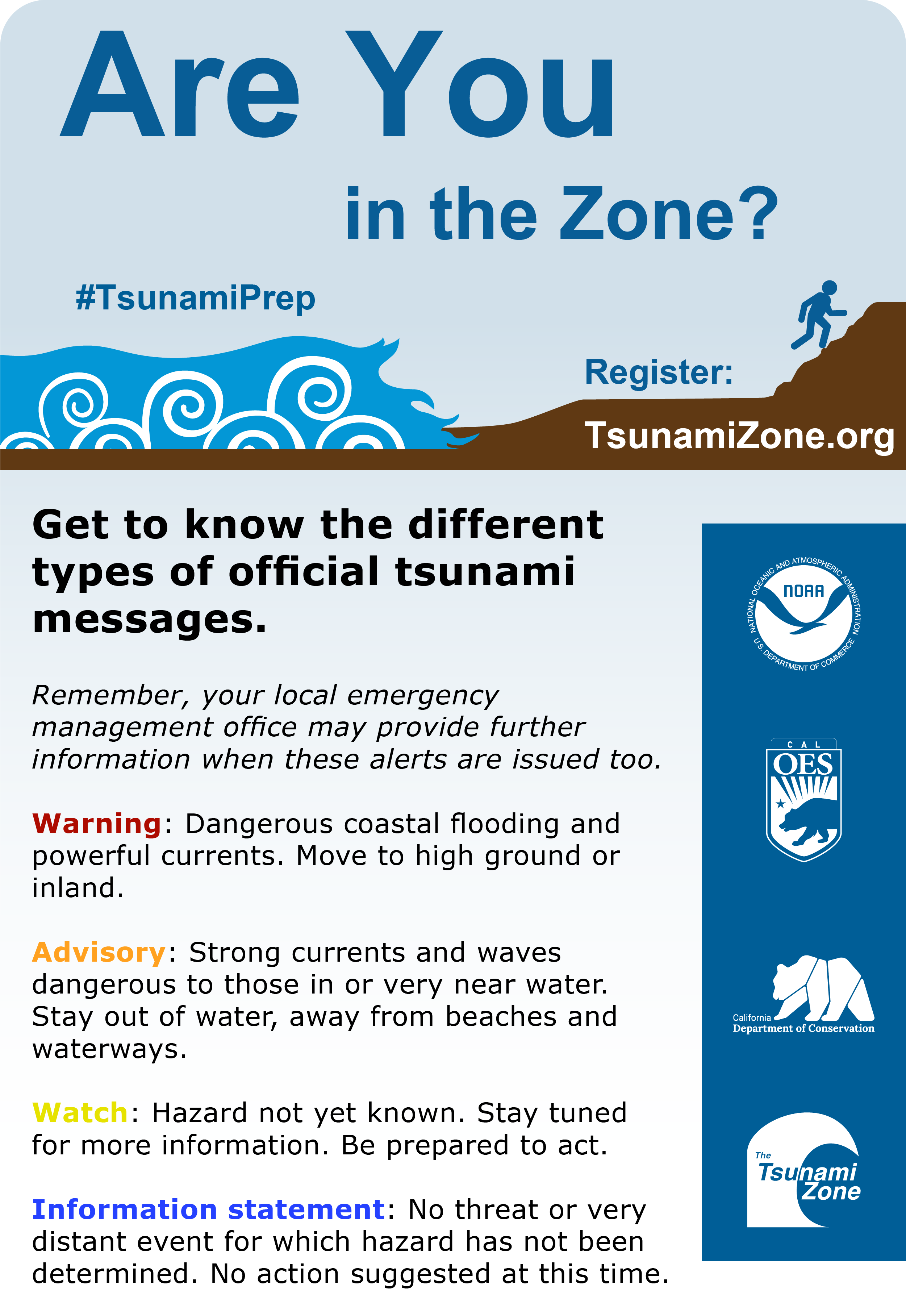
Different types of alerts pop up on your phone during natural disasters — like an earthquake, or a tsunami — and they require different responses from you:
A tsunami warning is issued when “a tsunami with the potential to generate widespread inundation [flooding] is imminent, expected, or occurring” and is the highest level of alert. Emergency management officials will start to take action immediately. Warnings can be updated or downgraded, but usually will urge people to move to high ground or inland. (More on this below)
A tsunami advisory is given when a tsunami has the potential to generate strong currents or dangerous waves to those nearby. An advisory may lead to closed beaches and evacuated harbors.
A tsunami watch is issued when a tsunami may impact the area, and people “should prepare to take action.”
A tsunami information statement is given when there is no threat of a destructive tsunami, but an earthquake or a tsunami has occurred that may be of interest to residents.
Where in the Bay Area is most at risk during a tsunami?
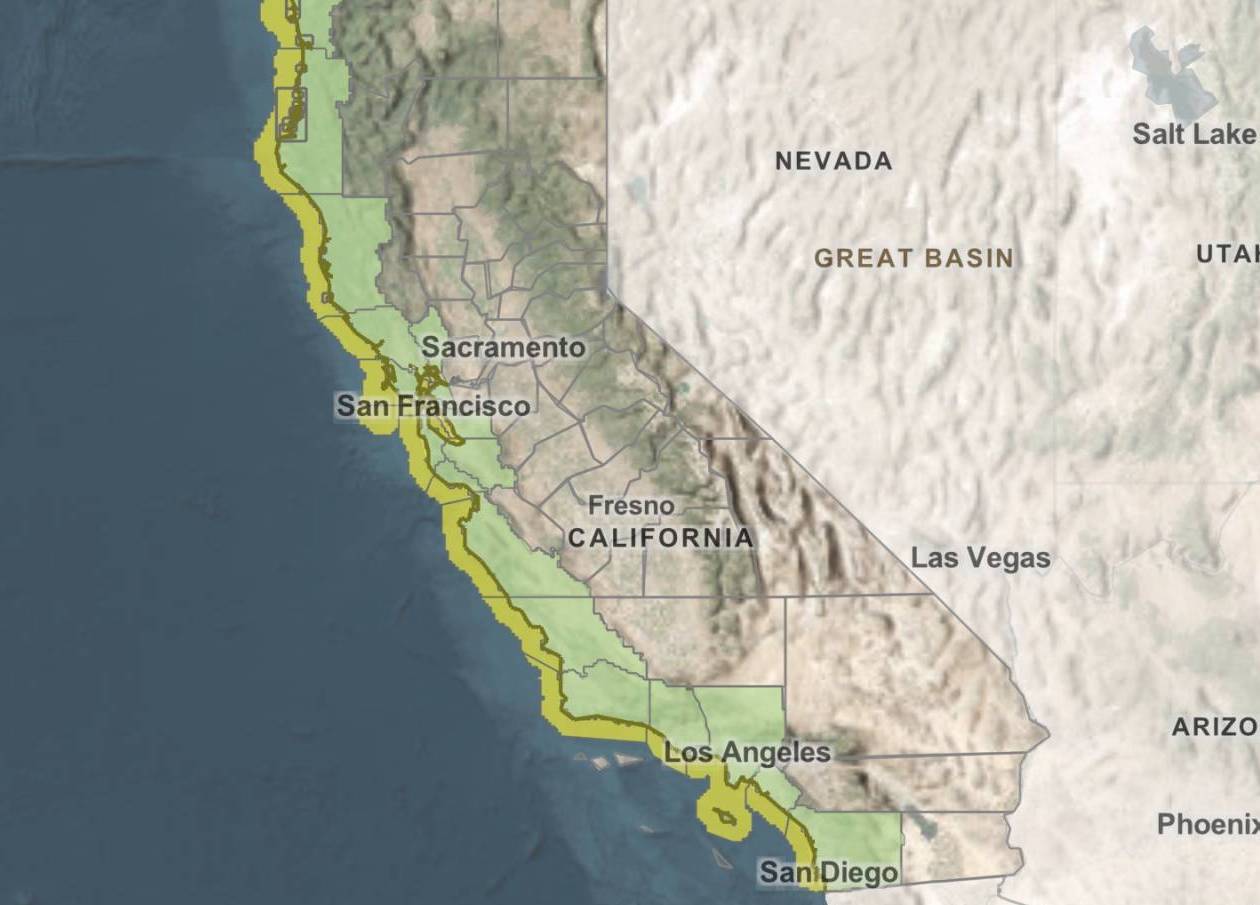
Bay Area residents can look up their neighborhood’s risk of being flooded by a tsunami online using:
The Cal OES MyHazards maps (which you can also use to look up your flood, earthquake and fire risks).
California’s Department of Conservation Tsunami Maps.
These maps highlight “hazard areas,” meaning areas you should leave immediately if a tsunami warning was issued.
“I’d say anywhere you have people in close proximity or a large urban population in a tsunami zone, it’s extremely vulnerable,” said Nezhura from the Cal OES.
She emphasized that residents should use the maps to zoom into specific areas and zero in on neighborhoods with highest risk. For example, in San Francisco, places deemed at high risk from a tsunami include:
The Ferry Building
The Palace of Fine Arts
Fisherman’s Wharf
Parts of the Marina
Parts of SOMA
Parts of the Richmond
Parts of Outer Sunset
Another example would be the East Bay, where the city of Alameda is labeled as high risk, as well as parts of Oakland. In past tsunamis, places like Santa Cruz have also been hit especially hard.
Your county may also have its own map to assess the tsunami risk where you live or work, including:
If I get another tsunami warning, what should I do?
If you are in an earthquake, take cover
While a tsunami in California could be triggered by an earthquake as far away as Japan, tsunamis can also be caused by more local quakes — meaning you could technically face an earthquake followed by a tsunami in quick succession.
In general, the Bay Area is more likely to see a tsunami triggered by further earthquakes rather than local ones. And despite every Bay Area resident’s anxiety about the “Big One” hitting our region, experts told KQED in 2017 that an earthquake specifically along the San Andreas fault is unlikely to produce a major tsunami due to the type of movement exhibited by these tectonic plates. However, the Cascadia Subduction Zone (PDF) — a fault that stretches from Northern California to Vancouver Island, Canada — could pose a future earthquake and tsunami risk to the state.
Even during small earthquakes, if you are near a beach, experts recommend that you run to high ground — like a nearby hill — immediately.
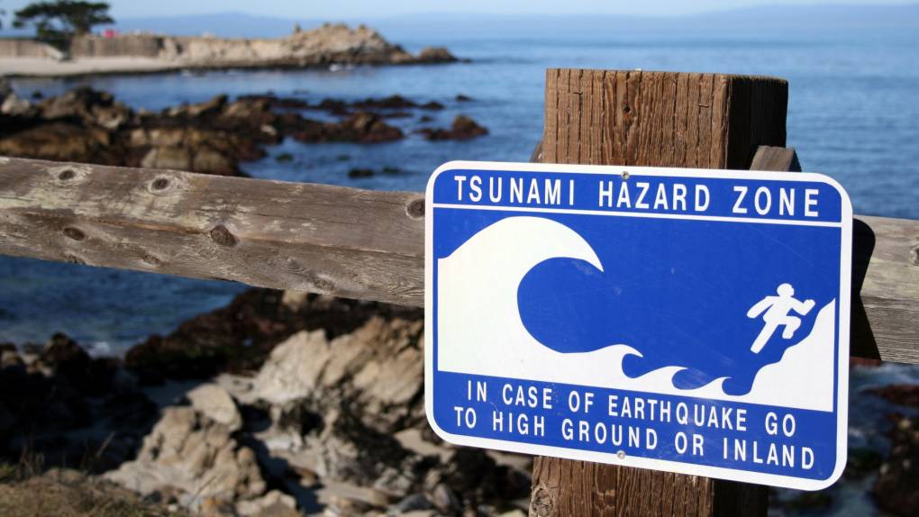
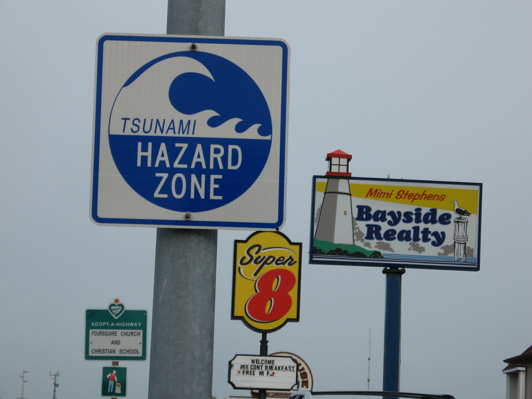
A tsunami warning sign from Crescent City, Del Norte County, on March 11, 2011. (Craig Miller/Climate Watch)
Know your evacuation routes — and how long you have to flee the coast
A large tsunami can flood a coast for a mile inland — and even small ones can cause damage by sweeping up debris that can hit people.
A tsunami that’s been triggered by an earthquake far away could take several hours to hit the Bay. But a tsunami that’s triggered by a local earthquake will begin much faster and could only give you a few minutes to get away from the coast before the wave hits.
Find high ground, like a hill that is 100 feet or more above sea level.
Or go to the upper floors of a sturdy building if you’re unable to find or reach high ground.
As a last resort, climb a tree.
To plan an evacuation route, use the Tsunami Hazard Map to determine if you live or work in a hazard “yellow zone” and how far you need to travel to reach a safer “green zone.” Bear in mind that you may need to evacuate on foot if the tsunami has been caused by an earthquake that’s damaged nearby roads.
If you are outside of the hazard zone when a tsunami hits, the good news is that you should be safe — and in fact, officials urge you not to contribute to traffic by trying to evacuate, too.
Once you’re away from the coast, stay away from the coast
Don’t return to coastal areas, even after the first few wave surges — instead, wait for official word that it’s safe to go back. Why: There could be more waves to follow, and it’s hard to predict which wave will be the most dangerous.
Have a disaster kit prepared
This is advice you’ve likely heard when preparing for a wildfire: Have an emergency kit prepared to transport crucial items like food, water, medication and flashlights in the case of a tsunami. This is especially important if you live in a tsunami hazard zone and may not be able to return to your home immediately after evacuation.
KQED has a thorough guide on what to pack in a “go bag” in the case of a natural disaster.
You can make sure these alerts show up on your phone by heading to Settings and then Notifications. Usually, the list of government alerts (like emergency and public safety alerts) are at the bottom of this page. Here, you can opt in and out of these alerts.
Reasons you may not get an alert may be due to your phone being in airplane mode, using a VPN set to a different location or your cell service does not work with the warning system. Read more about troubleshooting emergency alerts on your phone.
You can also sign up for state or county-specific alert system, like:
KQED Youth Takeover: Oakland Ballet Explores Immigrant Stories From Angel Island
Ellis Island might have been a welcoming place for many immigrants to the United States, but Angel Island in the San Francisco Bay tells a more troubling history of immigrant detention. Starting next ...