upper waypoint

Enjoy the Sun, Bay Area. After Brief Spring Heat Wave Comes Another Chance of Rain

Save ArticleSave Article
Failed to save article

Please try again

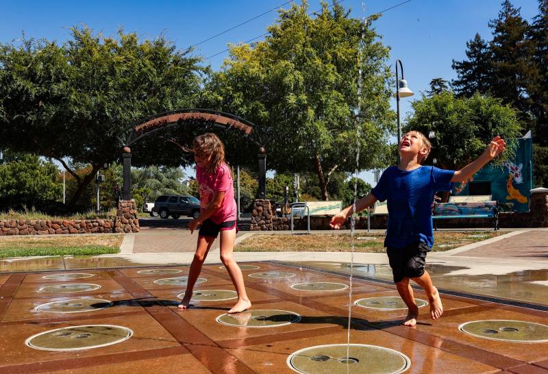
Siblings enjoy the spray grounds at Prince Gateway Park in Santa Rosa as the temperature reached 100 degrees on July 11, 2024. As summer-like weather sweeps across Northern California, some places could hit record-high daily temperatures Monday and Tuesday before a cold front arrives. (Gina Castro/KQED)

In the Bay Area, it’s time to bring short sleeves and sandals out of storage — but don’t put your raincoats away just yet.

Some parts of the region could hit record-high daily temperatures on Monday and Tuesday during a brief spring heat wave, bringing highs in the 70s and low 80s to much of the Bay Area. The weather service has issued a minor heat warning for particularly sensitive populations.

Oakland is expected to push toward 80 degrees on Monday, handily beating its former record of 75 degrees for the calendar date. Other locales will rival records from the 1920s, but those long-standing highs are likely to stay in place, said Brayden Murdock, a meteorologist at the National Weather Service’s Bay Area office.
Sponsored

If you blink, you could miss the summer-like weather. Mild temperatures and even chances for rain will return by the end of the workweek and span the rest of the forecast period, according to the weather service.

“As Wednesday comes through, a cold front starts to arrive, and we’re actually going to have some chances for a drizzle, maybe some light rain finally accumulating later into the day,” Murdock said. “Compared to seeing the 80s across the board for today and tomorrow for a good portion of the region? Yeah, Wednesday is going to feel quite different.”

It will be a good time to store up some sunshine since the yo-yoing weather patterns that indicate spring in the Bay Area will be on full display this week.

“We kind of call this the ‘shoulder’ season where you start seeing that mix of more summer-like patterns versus more winter-like patterns,” Murdock said. “There’s a lot more uneven heating and cooling as you go into the spring months.”

After midweek, current forecasts show a return to average seasonal temperatures — mostly in the high 50s and low 60s — spanning at least until the end of the month. Some weather models also predict a significant storm system during the first few days of April.

Murdock said that the longer forecast is pretty uncertain, especially given the transitional time of year. But weather suited to shorts and sandals, at least, will only last a few days, so be sure to enjoy some time in the sun before winds and rain clouds whisk it away.

lower waypoint
next waypoint