upper waypoint
Satellite view of the Sierra Nevada and western Nevada from Yosemite National Park, at lower left, to Walker Lake, at the top of the images toward the right. The 'before' image was taken Feb. 16, 2018; the 'after' image on Feb. 11, 2019. Planet
Satellite view of the Sierra Nevada and western Nevada from Yosemite National Park, at lower left, to Walker Lake, at the top of the images toward the right. The 'before' image was taken Feb. 16, 2018; the 'after' image on Feb. 11, 2019. (Planet)

Before and After: See California's Monster Snow Year by Satellite

Before and After: See California's Monster Snow Year by Satellite

Save ArticleSave Article
Failed to save article

Please try again

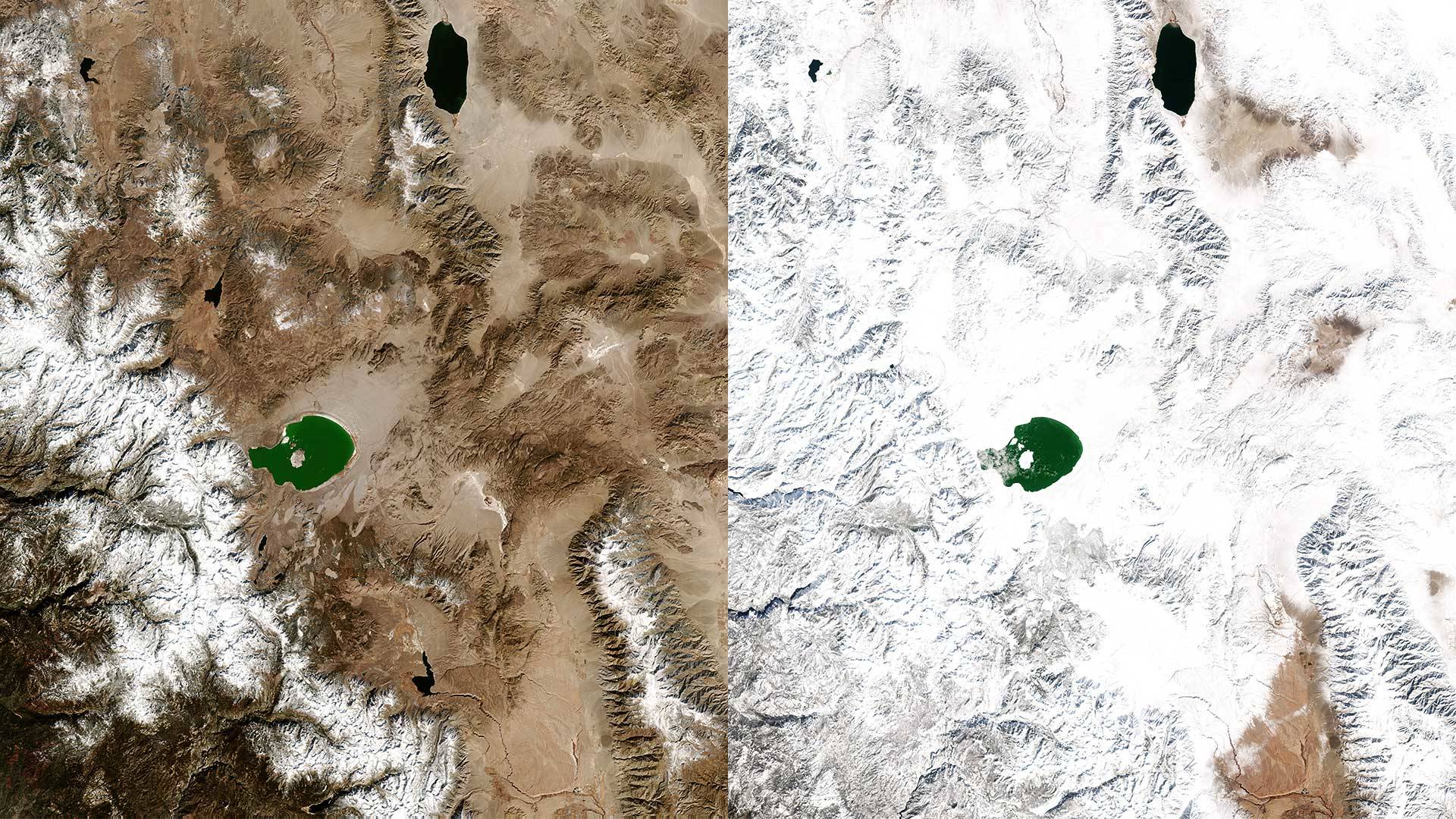
A rolling conveyor belt of storms this winter has left the Sierra Nevada blanketed in a thick layer of snow. The year started modestly, with the snowpack measuring around 70 percent of average on the first of the year. A robust January and February has brought the snowpack up to around 145 percent of normal for this time of year. April 1 typically marks the peak of Sierra snowpack accumulation and the start of the spring runoff. Move the sliders below to view the terrain before and after snowstorms.

Sierra Nevada Mountains
Before: Feb. 8, 2018
After: Feb. 11, 2019


South Lake Tahoe Flyover Simulation
Before: Feb. 16, 2018
After: Feb. 11, 2019


Lake Tahoe
Before: Feb. 16, 2018
After: Feb. 11, 2019


Mammoth Lakes
Before: Feb. 16, 2018
After: Feb. 11, 2019


Kings Canyon National Park
Before: Feb. 16, 2018
After: Feb. 11, 2019


Sponsored

lower waypoint
next waypoint