NASA’s LANCE data system, which makes enormous amounts of satellite information available to scientists around the world almost as soon as it’s collected, is powerful.
How powerful?
NASA’s LANCE data system, which makes enormous amounts of satellite information available to scientists around the world almost as soon as it’s collected, is powerful.
How powerful?
“We have been known to pick up a really hot barbecue,” said Diane Davies, operations manager for the program. “We have been known to pick up the old solar factory or oil rigs. We can pick up gas flares, volcanoes.”
Even as those false alarms have to be filtered out, that kind of sensitivity allows for the precise location of newly ignited areas over vast amounts of land, a huge advantage in the age of climate-driven catastrophic wildfires.
With the lightning strike fires in August that sprouted up and down the state like the heads of the mythical multiheaded hydra, California wildfire season returned with a fury this year after a relatively mild 2019.
Part of grappling with the sweep of conflagrations plaguing the state is knowing their size and location. In past decades, lookouts kept watch from towers around the West; a few are still in use. Occasionally someone driving or looking out a window sees smoke and calls authorities. In recent years, California has invested in expanding a network of fire-spotting cameras. Planes, including National Guard aircraft, can locate flames and track their spread. In September, NASA initiated aerial surveys to study burn areas, as well as landslide and debris-flow hazards.
But data, particularly for fires that spark in remote areas, can still be hard to come by.
In these cases, the watchers get help from on high.
More specifically, from low Earth orbit.
Satellites thousands of miles above the surface have been spotting fires since the 1960s, capturing images that have grown continuously sharper and more sophisticated over the decades. New satellites launched by NOAA and NASA in just the last few years are providing a wealth of information about the surface of the planet, keeping scientists busy as they work to harness the full potential of the data.
Researchers say satellites are key to improving our knowledge of fires. Not only can they detect a burgeoning blaze, they can measure its size and predict firefighting hazards. They can also forecast smoke and study the accelerating effects of climate change.
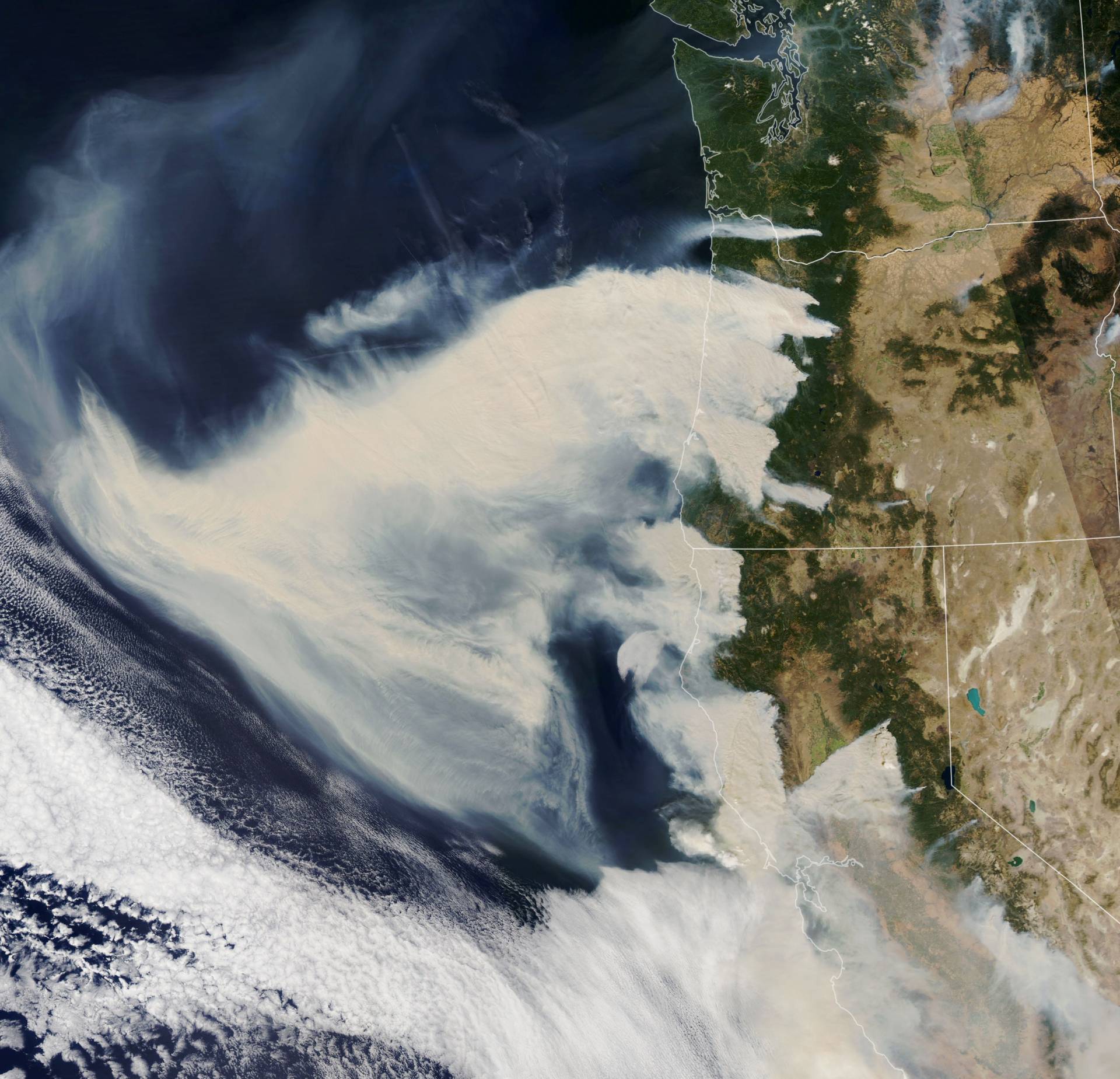
In early September, lightning and extreme wind and heat combined to cause some of the worst fires seen in decades and extremely dirty air. On the left in the image above, a satellite view of North America shows thick brown smoke blowing from fires along the West Coast. On the right, orange and blue pixels show the intensity of aerosol pollution coming from fires (identified in red). Both images are from the NOAA-NASA Suomi NPP satellite, using different sensors.
Modern Life, Beamed to You via Satellite
Satellites either rotate around or with the Earth. They use antennae to communicate with fixed spots on the ground, relaying images, weather data, telecommunications and other information. Russia famously launched the first mechanical satellite, Sputnik, in 1957, marking the start of the space age. Currently, an estimated 2,787 functioning satellites are in orbit around Earth, and even more that are no longer operational.
Satellites have improved weather forecasts and tracked changes in agriculture, forests and sea ice. They have shrunk the globe by carrying live television broadcasts from around the world and allowing connections between far-flung points on the map. They have also revolutionized how we navigate — when is the last time you needed to ask for directions? In many ways, they make our modern lives what they are.
The fire community uses satellites equipped with instruments that can quite literally see heat. Sensors pick up hot spots by detecting infrared radiation. To avoid false alarms — like homing in on the heat generated by someone’s barbecue, as mentioned above — the data is filtered through algorithms that govern what to ignore.
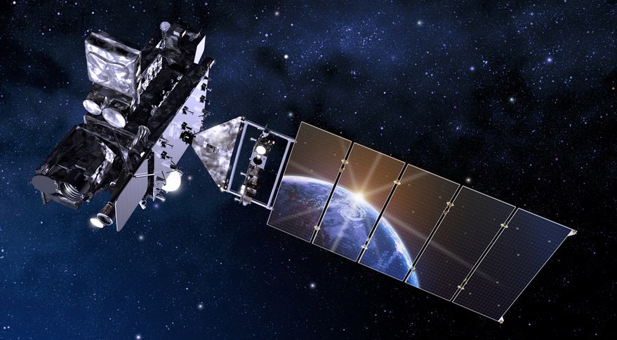
Polar-orbiting satellites like NASA’s Aqua and Terra are currently the best at spotting fires. These have the finest-scaled resolution, but because they image both hemispheres, only relay information twice a day. That’s useful for extremely remote areas like the Amazon. But California responders, responsible for population zones all over the state, need to keep a constant watch. That’s where geostationary satellites come in: Rotating with the Earth, they appear to hover in place if you were to view one from the ground.
NASA and NOAA launched the most advanced geostationary satellites in 2017 and 2018, respectively. But “the algorithm isn’t yet good enough for us to use,” NASA’s Davies said. “There are still quite a lot of false alarms.”
But she is hopeful these orbiting eyes in the sky will eventually change the fire-spotting game.
A number of research groups are working furiously toward that goal.
How to Spot Fires Faster
“Sometimes people who are in charge are under the impression that they know for sure when a fire starts, that they know early enough,” said Alexander Koltunov, a scientist with the Center for Spatial Technologies and Remote Sensing at UC Davis.
But they are often mistaken, he says, asserting that some fires in California go undetected for hours. Koltunov hopes to cut that time down considerably by creating a second-generation algorithm for the GOES Early Fire Detection system, which provides image analysis that aims to spot ignitions sooner.
In a retrospective case study using the 2013 Rim Fire, the system identified the blaze 15 minutes before the actual initial report, and beat NOAA’s fire detection algorithm by 15 minutes as well.
“The newer version in development is showing even greater promise,” because “the new GOES is so much better than the old one,” Koltunov said.
Though he’s quick to stress that satellites will not be able to spot every ignition quickly enough to make a difference in response time, fire agencies can use the satellite’s data to understand the characteristics of a particular blaze and the landscape around it.
“It helps them appropriately allocate resources and plan their risks and tradeoffs,” Koltunov said. That’s important because in a year like this, resources are shrinking compared to the growth of the problem, he says.
Avoiding Snags and Keeping Tabs
During or after a wildfire, dead standing trees, called snags, pose a danger to anyone on the ground, and they’re especially hazardous for firefighters working on windy nights. So Koltunov is spearheading another UC Davis project designed to help firefighters avoid injury from falling trees in infernos like the Creek Fire, which has burned about 380,000 acres, mostly in the Sierra National Forest. More than half of the trees were killed in some areas.
“Where are dead trees?” said Koltunov. “How long have they been dead? Are they standing or fallen down?”
The U.S. Forest Service is using a beta version, known as the Ecosystem Disturbance and Recovery Tracker, or eDaRT, to generate snag hazard maps in order to assess the risk of sending crews to certain areas.
Koltunov says an agency might think twice about sending people into an area where “trees are going to fall over.”
In massive wildfires, heat signatures picked up by satellites can keep firefighters and fire mappers informed about the size, border and movement of a blaze.
“This has been revolutionary for the fire scientists to be able to study how the perimeters grow,” said James Randerson, an Earth science professor at UC Irvine. “A lot of the records you get from fire agencies, like from Cal Fire, are actually derived … from satellite data.”
So when Cal Fire announces that 4 million acres have burned, it uses satellite images to help calculate that total.
Researchers like Randerson also use the information to track climate change and its effects around the world.
He’s seen fires increasingly more destructive in California and northern boreal forests. He’s tracked fires in the Amazon linked to deforestation. He’s noticed the disappearance of wildfire from tropical savannas and grasslands where it traditionally supports large grazing animals.
And he hopes information about previously hidden fires in the understory of tropical forests, now viewable by satellite, can guide conservation efforts.
Satellites are part of the unseen — and uncelebrated — firefighting arsenal. To members of the public, the information they bring can seem magical, even if it is generally taken for granted. Peel back the map, the image, the forecast though, and ingenious researchers and sophisticated sky machines are hard at work.
To learn more about how we use your information, please read our privacy policy.