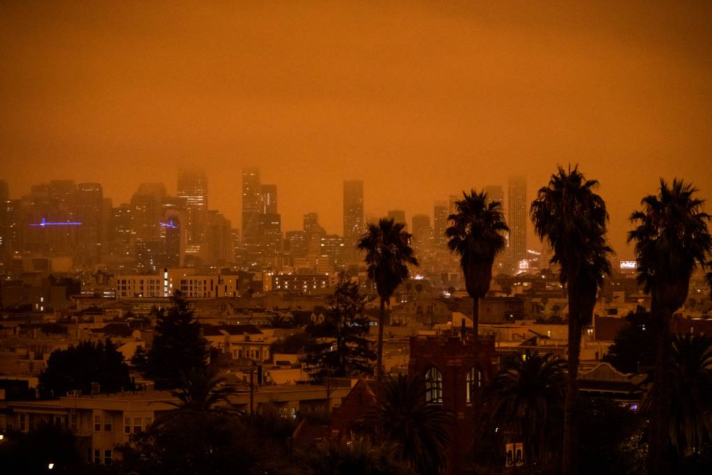
Many in the Bay Area are going to remember Sept. 9, if not the date at least the weather conditions. The region woke up that morning under the odd gloom of reddish orange skies, as numerous wildfires generated thick smoke high in the atmosphere, blocking the sun, forcing streetlights into late-morning duty, and generally freaking people out. On social media, a search on the word “apocalyptic” retrieved numerous declarations of dismay.
The rest of wildfire season has also been awful, if not quite as weird. Smoke choked the Bay Area for weeks on end, leading to a record 43 “Spare the Air Days” declared by the Bay Area Air Quality Management District, including 30 that were consecutive.
With the increasing number of incidents in which the region is inundated with smoke, a heightened focus has emerged on its negative health impacts, including harm to the lungs, heart and brain, as well as the immune and endocrine systems. Smoke can also contribute to asthma, stroke, diabetes, Alzheimer’s and many other diseases.
So knowing more about when it will be wafting our way has become increasingly important. But while the government issues warnings about heat waves, gusty winds and red flag conditions, smoke forecasting is more difficult than predicting the weather, and residents have mostly had to rely on checking air quality websites for real-time guidance when they want to know if it’s okay to take a walk during a smoke event. That’s because beyond a few hours, it’s tough to know if smoke will clear out or linger due to weather conditions.
The complexity that goes into any smoke forecast is fairly mind-boggling. To know what might happen with smoke, you need to know what is going to happen with the wildfire producing it. And predicting fire behavior is extremely difficult, because variables like wind, storms, and the success firefighters are having containing a particular blaze can change moment to moment.
“It’s very hard to take into consideration, mathematically, the behavior of these fires,” said Ravan Ahmadov, a smoke forecaster for the National Oceanic and Atmospheric Administration at the University of Colorado. “So, that’s a major problem.”
Ahmadov works with the High-Resolution Rapid Refresh model, which provides hourly high-resolution updates of where wildfire smoke is as well as where it’s likely to travel. The model absorbs data from four polar-orbiting satellites from the National Oceanic and Atmospheric Administration and NASA; several times a day, these eyes in the sky relay information about the amount of heat a fire is giving off and the kind of fuel it’s burning, both of which impact the amount of smoke emitted.
“Is it forests, grassland, or maybe cropland?” Ahmadov said.
Other factors the model takes into account are wind, weather and geography. For example, is rain imminent? Are there canyons or flatlands? Large bodies of water nearby?
Ahmadov says comprehending the dynamics of a particular fire can make understanding the behavior of smoke emissions easier.
“Still, the distribution of the smoke for a region like the Bay Area is a complex process,” he said. “It’s possible that in one part of the city, the smoke will be much denser than in another part of the same city.”
