upper waypoint

Bay Area King Tide Floods Foreshadow Future Climate Risk

Save ArticleSave Article
Failed to save article

Please try again

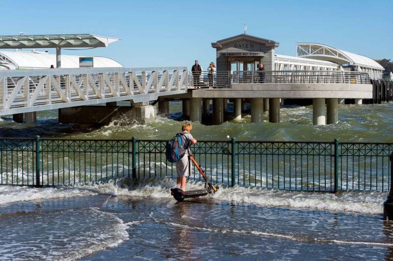
Bay waves wash over San Francisco's Embarcadero as a young boy stands ankle deep, watching the waves.
King tides at Ferry Gate G in San Francisco. (Courtesy of the California King Tides Project)

This weekend, the dramatic winter tides known as king tides may flood the shoreline around San Francisco Bay, offering photographers some amazing shots and foreshadowing what rising seas could be like across the Bay Area because of human-caused climate change. 

San Francisco Bay has already risen about eight inches since the mid-1800s. Over the next 20 to 30 years, seas could rise by about a foot along the California coast, says Ben Hamlington, NASA’s Sea Level Change Team leader.

“These king tide events really do give us an idea of what we might be seeing in the not-too-distant future,” he said. “This will be our new baseline.”
King tides, which happen every winter, produce both the highest and the lowest tides of the year. Ocean levels fluctuate when the moon and Earth orbit close to the sun. This natural occurrence increases gravitational pull on the ocean. When a winter storm coincides with a king tide event in an El Niño year, water levels and flooding can be even higher. 

Sponsored

Hamlington says small floods today could become extreme floods in just a few decades. But how far inland the seas reach after 2050, he says, is up to humans and whether we dramatically reduce or stop relying on fossil fuels, which, when burned, emit gases that warm the atmosphere. 

“These very big increases in sea level rise become more of a concern if we continue down a bad path in terms of emissions,” he said. 

This weekend and on Jan. 1-3, king tides in the Bay Area could be as high as 7 feet and flood low-lying communities and tourist areas. The National Weather Service has issued a coastal flood advisory from Friday through Sunday afternoon. Hamlington says tides will be about a foot higher, and lower, than they normally would be. 

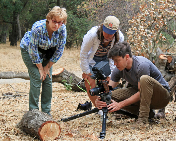
The California King Tides Project encourages people to send photos of the high tides as part of an ongoing citizen science project. Manager Annie Kohut Frankel says the images will help planners, researchers and communicators understand current coastal vulnerabilities and how severe sea level rise could inundate areas around the bay in the coming decades. 

“If you go out during these high tides, and you see a beach that’s underwater or a trail or road that’s flooded, you can picture the water being at least that high every single day in the not-too-distant future,” she said. 

During king tides, flooding may intensify all around the Bay Area; the tides often flood parts of San Francisco’s Embarcadero, where water splashes over the sea wall. Last October an atmospheric river inundated parts of the Embarcadero, says Matt Wickens, an engineer for the Port of San Francisco Waterfront Resilience Program.

“There were places on our waterfront where we just couldn’t get water from land out to the bay fast enough, and it resulted in flooding,” Wickens said of efforts to pump water from streets.

But what he’s worried about is a king tide aggravated by a big storm or an atmospheric river, which he says is a combination we haven’t yet seen in the Bay Area.

In November, the SF Port Commission released a report saying the city will need to raise parts of the Embarcadero between 2 and 7 feet to forestall flooding as the climate emergency continues. The port may detail a series of projects as early as next year to respond to sea level rise and prepare for earthquakes.  

lower waypoint
next waypoint