A nearly statewide heat wave is expected to bring 90-degree temperatures to inland California, which will begin to melt the massive snowpack — record-breaking in the southern Sierra Nevada — and flow into rivers and reservoirs.
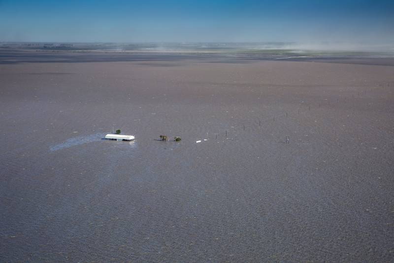
The flows have the potential to flood mountain and valley communities; the bounds of Tulare Lake will likely only grow more prominent. In response, state and local governments are taking action to build up levees where possible, modeling how runoff will flow into the valley and taking every chance to protect people in the region.
Michael Anderson, the state’s climatologist, said one of the big reasons the big melt will likely occur is because temperatures at night are supposed to stay warm.
“Towards the end of the week, we’re gonna see things warm up, and warmer outcomes mean more snowmelt,” he said.
But just how much snow will melt is determined by the sun’s angle, the length of the day and how much radiation makes it into the snowpack, Anderson said.
“This week is just going to get progressively worse and then maybe relent a bit the following week,” said UCLA climate scientist Daniel Swain. “The problem is there’s nowhere else for this water to go, and the Tulare Lake basin is just going to fill up like a bathtub.”
The state is running models to see what the impact of snowmelt might be like in places like the Tulare Lake basin, said Brian Ferguson, deputy director of crisis communications and media relations for the state Office of Emergency Services (Cal OES), at a media briefing Monday.


