upper waypoint

California's 'Normal' Winter and High Snowpack Could Curb Wildfire Risk, Prevent Drought

Save ArticleSave Article
Failed to save article

Please try again

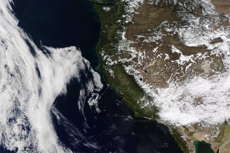
The California snowpack exceeds 100% of the average for this season, with meteorologists forecasting a weekend storm to further increase its depth. At this time, climate scientists don’t see extreme flooding or fire risk this year.  (Satellite photo from NASA Worldview)

The California snowpack is glistening white at more than 100% of the average for this time of year — and meteorologists forecast a storm this weekend could deepen it even more.

The snowpack could grow by as much as 2 feet at the highest elevations as a typical winter-like storm passes over the Sierra Nevada as soon as Friday and lasts through Sunday, said National Weather Service Sacramento meteorologist Dakari Anderson.

Water managers consider California’s snowpack as a frozen reservoir that plays a significant role in providing water to farms and cities as it slowly melts into reservoirs, rivers and streams.

“The storm won’t be like anything we saw in the last few storms,” Anderson said of weather patterns that piled as much as 12 feet of snow in parts of the Sierra. “Overall, we are looking at above-normal amounts of snow across the Sierra because of what happened in February.”

Currently, California’s snowpack is 100% of the average for this time of year and 104% of the average of the April 1 snowpack, which is the timeframe water managers look to as an indicator of potential water supply for the rest of the year.

Sponsored

“If these storms pan out, we could go from 100% of our April 1 average to potentially above that,” said Andrew Schwartz, lead scientist at the UC Berkeley Central Sierra Snow Lab. “We’re in a good spot.”

Even without the coming storm, California is on track to have an average snow year, which is a big deal because residents are used to bouncing back and forth between extremes: droughts, when Californians conserve water, and extremely wet years when the flood risk is highest.

“It’s infrequent that we actually get somewhat of a normal winter, and so far, it’s shaped up to be just that,” he said. “It’s that thing that we really want to aspire to.”

Significant snow years can increase flood risk as it melts into rivers and streams, but Schwartz and state officials said it is hard to tell if flooding will happen this year because of the snowpack melting. What could cause flooding is if spring heatwaves melt snow rapidly.

“The question now is how the snowpack translates into snowmelt and how much runoff reaches our reservoirs during the spring and summer,” said David Rizzardo, California Department of Water Resources hydrology section manager. “It is still possible that snowmelt runoff will be below average if we don’t see much added to the snowpack this month.”

On top of a heatwave, Alan Rhoades, a Lawrence Berkeley National Lab atmospheric scientist, is aware that the world’s oceans have experienced a year of unprecedented heat. He said temperatures are way outside the normal range globally, which could impact the snowpack locally. The ocean temperature can significantly alter how much or how little rain or snow falls over the Sierra and how warm or cold the region is.

More on Climate Change

“With our snowpack, things like heat waves are something to keep in mind; they could lead to a potential ripening of the snow and an abrupt melt,” he said. “As we’re moving into a climate-changed world, we’re starting to see these heat waves start to occur more frequently in late spring and early summer.”

The positive news is that now that the state has had two wet winters, its reservoir storage is above average, meaning the threat of drought is virtually zero heading into the summer.

It’s a similar story for wildfire risk with two back-to-back wet years. UC Berkeley’s Schwartz doesn’t expect much fire danger at higher elevations because the forest is covered in thick snow, preventing brush and grasses from growing fast. The concern, he said, is primarily at lower elevations where rain has been more predominant in recent storms.

“It’s always a concern during an above-average year down at the lower elevations, where grasses and shrubs experience a burst of growth as the temperatures warm up and then die off in the summer heat,” he said.
lower waypoint
next waypoint