upper waypoint

Rising Seas Already Flood Some Bay Area Schools. The Risk Will Only Get Worse

Save ArticleSave Article
Failed to save article

Please try again

The entrance to Mill Valley Middle School on Tuesday, June 4, 2024. The school has closed down in the past due to flooding and storm damage caused by rain-induced flooding and high tides. (Gina Castro/KQED)

The Bay Area will become much wetter in the coming decades as rising sea levels push water into shoreline communities, putting highways, homes and schools in the path of flooding.

A new analysis from KQED and Climate Central, a nonadvocacy science and newsgroup, found that more than 50 public schools are so close to the bay’s high-tide line that they’re already in danger of being inundated with ocean and groundwater — and the risk will grow as seas continue to rise from the effects of climate change.

While many major sea-level rise solutions could indirectly protect schools, our analysis alerts the public to areas that may flood and gives school districts around the Bay Area agency to prepare for what’s to come.

Sponsored

The big picture: Human-caused climate change is raising seas around the globe, and Bay Area scientists believe that will wreak havoc on the region in the coming decades. We’ve known that unless action is taken, much of the 400-plus miles of bay shore will be inundated and shallow groundwater will be pushed up to the surface, flooding property and potentially damaging underground infrastructure. Our new analysis shows how schools are already being affected by flooding due in part to sea-level rise.

Richardson Bay, the body of water next to Mill Valley Middle School, is seen on Tuesday, June 4, 2024. In October 2021, Mill Valley Middle School closed down for two days due to flooding and storm damage caused by rain-induced flooding and high tides. (Gina Castro/KQED)

The context: The high-tide line in the San Francisco Bay has risen by 8 inches over the last century as heat trapped by pollution has melted ice and heated and expanded the world’s oceans. As human-caused climate change accelerates, scientists expect floods to become more regular because about 250 square miles of the Bay Area sit just above — and in some cases below — that line.

Warning signs: Three Marin County schools already cope with routine floods: Redwood High School has installed a pump to keep its parking lot dry during high tides, Mill Valley Middle School’s drop-off zone floods multiple times a year, and Tamalpais High School’s parking lot sits below the bay’s high tide levels, causing the storm drains to sometimes run backward from the bay onto campus.

Zoom in: Flooding is a significant reason parents are upset that the district plans to rebuild the aging Mill Valley Middle School in the same spot it’s been in for more than 50 years rather than find a new site on safer ground. The Mill Valley School District shares the concerns about flooding, and board members said they’re determined to rebuild the school in a way that will keep its students safe, using bond dollars to modernize it.

But even if the district raises the school above the area that will likely flood in the coming decades, climate scientists said it won’t take much more sea-level rise to turn the school periodically into an “island.” The school’s sea-level rise solution might protect the property, but the district’s choice to raise the school doesn’t fix the parents’ woes of getting kids to class on flooded streets.

Zoom out: Across the Bay Area, 52 schools are already at risk of groundwater floods linked to sea-level rise, and seven also face coastal flooding. By 2050, 16 schools will face both risks. San Mateo, Alameda, and Marin are the counties with the most flood-prone schools.

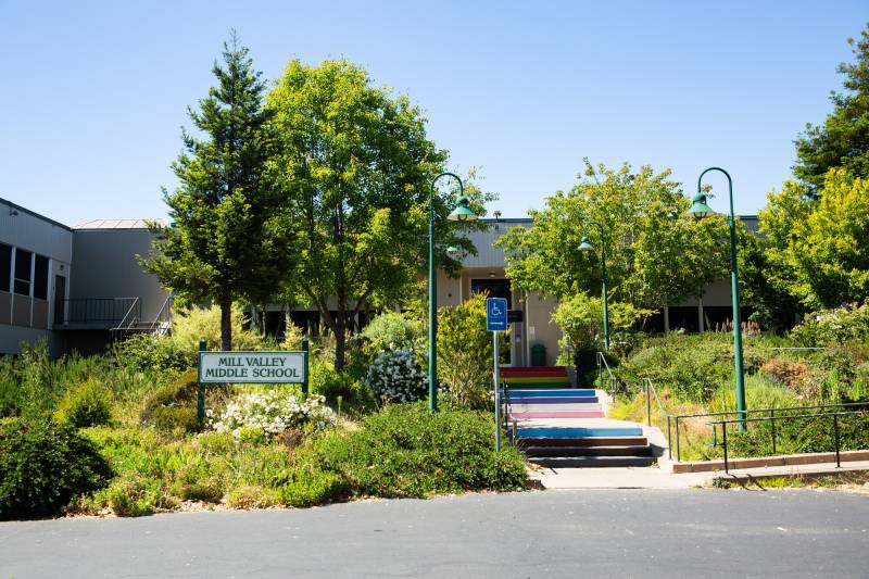
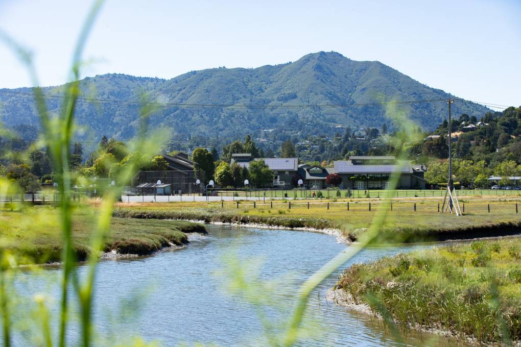
Solutions: School districts can rebuild schools at elevations above flood zones or move them entirely away from risky areas. But there’s an equity issue for school districts that may want to address the rising sea level independently.

Districts in less economically privileged communities may not have the funds or ability to move a school and must rely on community or region-wide efforts — sea walls, levees, or out-of-the-box solutions — to protect schools. That means city, county, and state leaders must come alongside communities to develop plans for a wetter future.

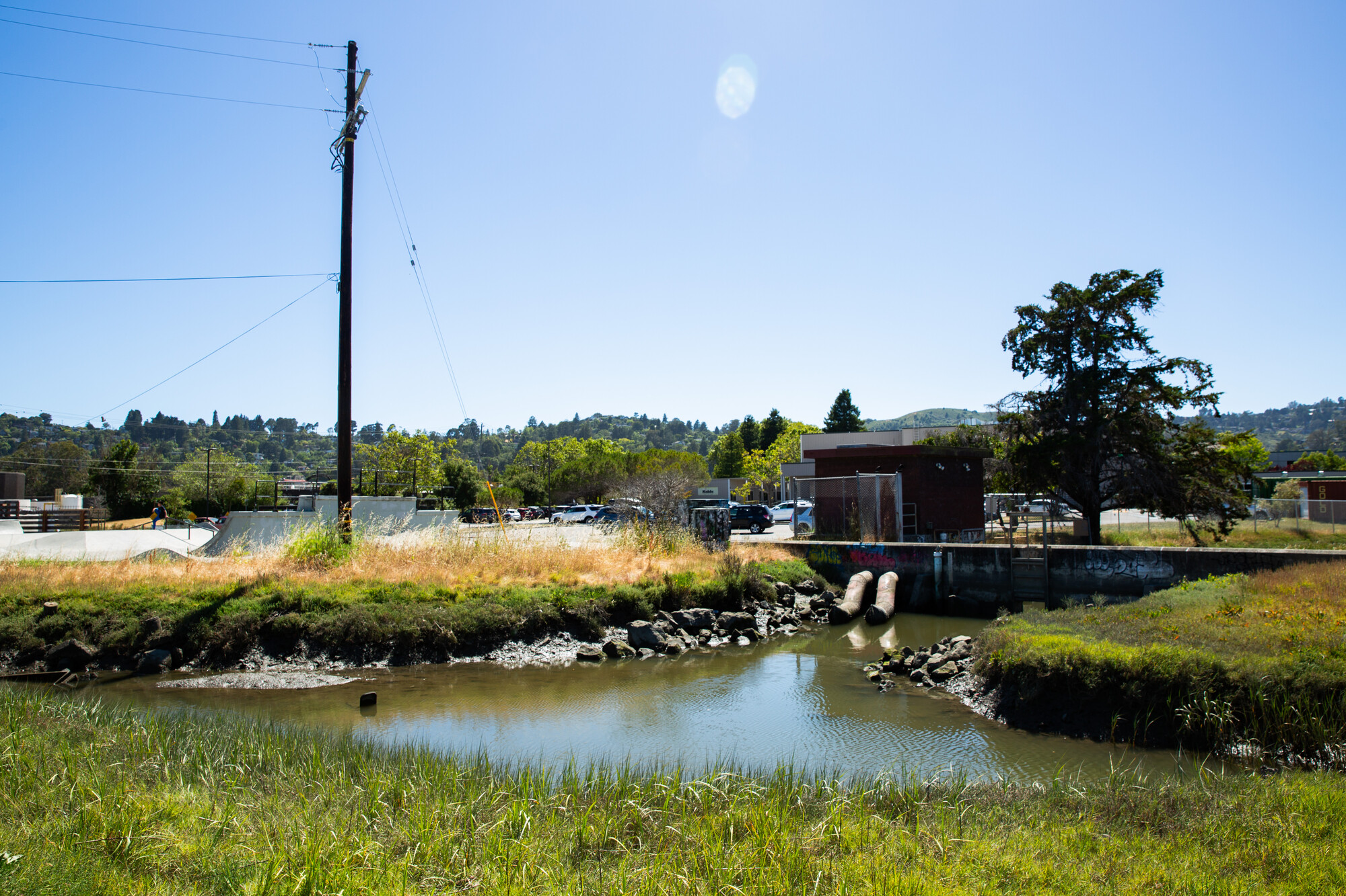
What’s new: While seawalls and levees are the usual options to protect communities from floodwaters, they come with a sizable price tag. Plus, sea-level rise scientists behind a new paper published in Scientific Reports suggest that sea walls or other shoreline barriers “can backfire,” leading to more groundwater flooding inland, said Xin Su, a research assistant professor at the University of Memphis. As a result, the researchers suggest any solution with a barrier in mind needs a secondary plan — like pumps — to deal with the extra water inland.

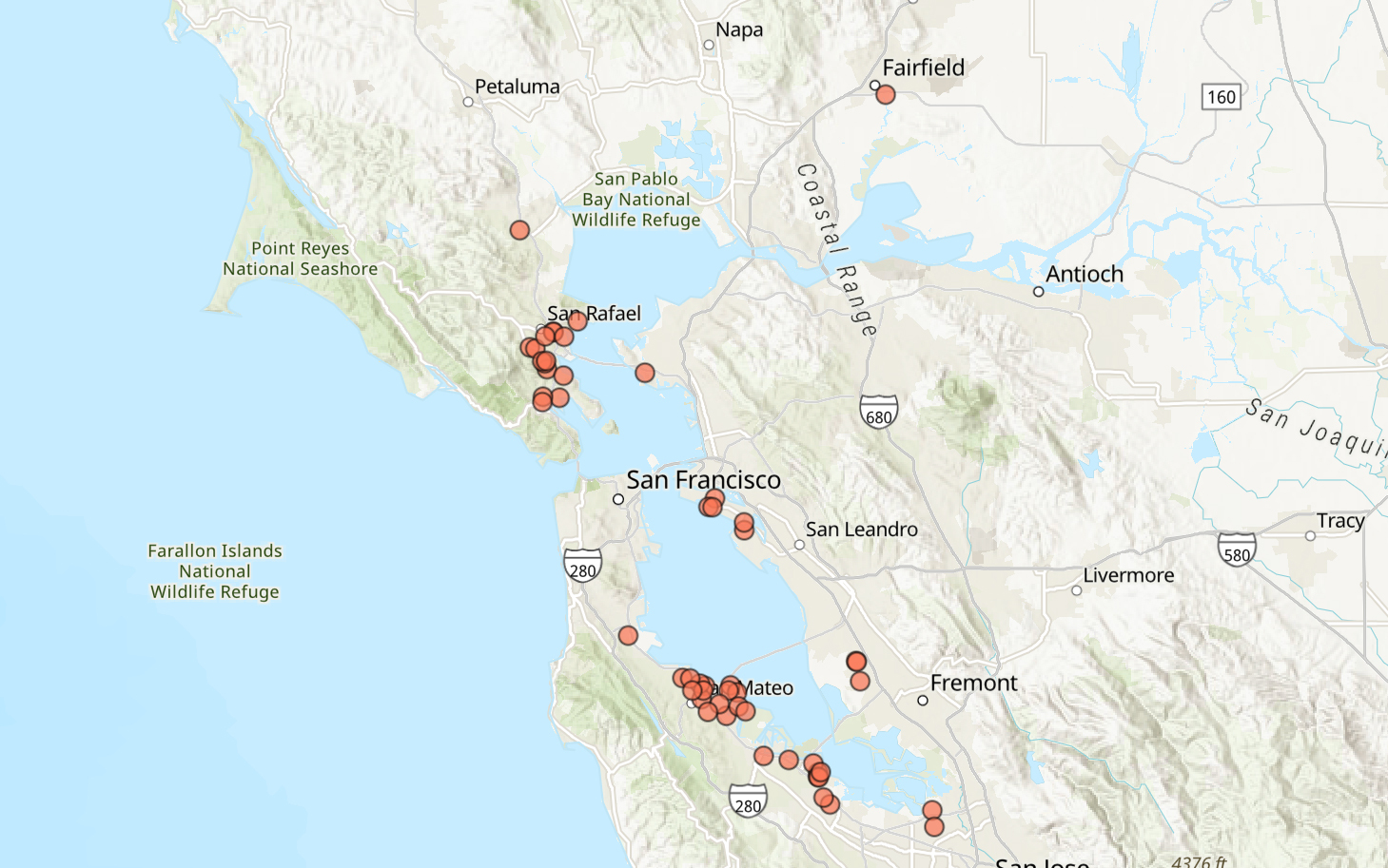
The bottom line: The Bay Area needs to develop large-scale sea-level rise solutions — for schools, highways, homes, major infrastructure, etc. — in the coming decades as the pace of flooding increases. It will cost as much as $110 billion to protect the entire bay shore from nearly a foot and a half of sea-level rise and a 100-year storm, according to a funding report from last summer by various Bay Area governments. Failing to do so could push the cost of preparing the region for rising tides to over $230 billion, the authors note. The good news is that the Bay Area Conservation and Development Commission is working on a regional sea-level rise plan with a draft due at the end of the year.

lower waypoint
next waypoint