The long-running program in charge of drilling rock cores from the ocean floor has set a new goal that will thrill those of us who remember all of The Sixties. The Integrated Ocean Drilling Program (IODP) intends to carry out a task last tried in 1961: drilling the first hole through the Earth’s crust, past the Mohorovicic Discontinuity at its base (the Moho) and into the rocks of the Earth’s mantle.
The U.S. did a lot of pioneering things in the early 1960s. For instance, we launched our first astronauts into space in 1961 and set foot on the Moon eight years later. That turned out a great success. Another was sending two men in a special submarine down to the deepest spot in the ocean, in 1960. That feat wasn’t repeated until just last year.
Another effort of the time was Project Mohole, an attempt to drill a hole through the Moho by picking an offshore spot where the crust is thin. In 1961, an experimental ship sent a drill string down through nearly 12,000 feet of seawater and into the seafloor near Guadalupe Island, west of Baja California. Several holes were drilled, the deepest more than 600 feet long. It penetrated completely through the ancient mud at the bottom of the sea and recovered a few feet of core from the crustal rock beneath, but that proof-of-concept exercise was as far as Project Mohole ever got.
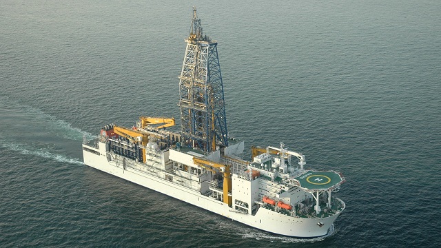
Since then, drillers of the offshore oil industry and the IODP (which started as the Deep Sea Drilling Project in the late 1960s) have advanced the art well past the bleeding-edge techniques used in Project Mohole. And the long-running research project is now thoroughly international. Although deep-sea drilling is still a challenge, the world scientific community now has decades of experience and is ready to try again.
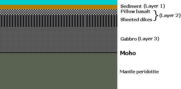
Let me outline the scientific problem. Earth consists of a big core of molten iron and the mantle, which is a thick blanket of rock that wraps around it.. Between them they amount to 99 percent of the planet and the Earth’s crust—continents, ocean floors and everything else—is like a coat of tarnish on the top. The crust is an extract of the mantle: wherever plate tectonics releases enough pressure on the mantle it starts to melt. That fraction of melt, enriched in a few key elements (silicon, oxygen, aluminum, sodium and calcium), has evolved over the age of the Earth into the land we know with its thick, high-riding continents and low-riding seafloor. The oceans are where the crust is thinnest, as thin as a few kilometers, whereas drilling through the continents is hopeless because they’re tens of kilometers thick. Here’s a diagram showing the structure of the oceanic crust as we understand it.

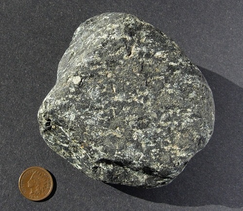
At the bottom of the ocean we first find mud, which changes to rock as we drill deeper. Below it is lava in various forms: layers of pillow-shaped bodies on top where the lava erupted into ice-cold seawater; farther down are the vertical cracks, which once were conduits filled with hot magma, but are now frozen basalt of the same composition as the pillows. Deeper still is the original mantle melt, which cooled very slowly to form the coarse-grained rock gabbro. And below the Moho is the dark, heavy mantle rock that gave rise to the gabbro and basalt: peridotite.


