Every summer and fall, some corner of California suffers the sorrowful distinction of becoming the scene of a terrible wildfire, a blaze so vast or frightening in its speed and destructive power that it inspires equal parts awe and horror. Those disasters have been more visible during four years of drought that have dried out California's countryside and created explosive conditions from one end of the state to the other.
In 2013, that most terrible conflagration was called the Rim Fire, which burned more than 257,000 acres -- 400 square miles -- in the dense woodlands in the northwestern part of Yosemite National Park and the adjacent national forest. In 2014, the sprawling Happy Camp Fire burned 134,000 acres along the Klamath River and its tributaries in Northern California's Siskiyou County. Elsewhere in the county, the Boles Fire raced through the town of Weed, burning more than 150 homes in a single afternoon.
In 2015, the heart of Lake County, 75 miles north of San Francisco, was the scene of not one but three major fires. The Rocky Fire burned nearly 70,000 acres in late July and early August; as it neared containment, the 25,000-acre Jerusalem Fire broke out. Those blazes burned a total of about 50 homes.
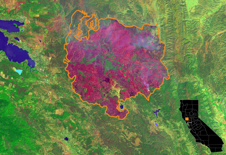
Then Sept. 12, a fire near a residence on Cobb Mountain, north of Middletown, ignited. The incident rapidly metamorphosed into a wind-driven firestorm that forced as many as 20,000 people to flee their homes. The blaze, dubbed the Valley Fire, incinerated 1,200 homes and 800 other structures and became one of the costliest fires in California history.
Now, Reveal has taken a second look at the Lake County fires, using data and imagery from firefighting and meteorological agencies, the U.S. Geological Survey and other organizations to assess how the fires progressed. Reveal's takeaway: California is afflicted with a wide range of conditions beyond the drought, including forest lands overloaded with fuel, that serve as "a cautionary tale of what is in store for many living near wildlands."
