Almost 200,000 people were under evacuation orders in Northern California Monday after a threat of catastrophic failure at the United States' tallest dam. Officials said the threat had subsided for the moment as water levels at the Oroville Dam, 75 miles (120 kilometers) north of Sacramento, have eased. But people were still being told to stay out of the area. (JOSH EDELSON/AFP/Getty Images)
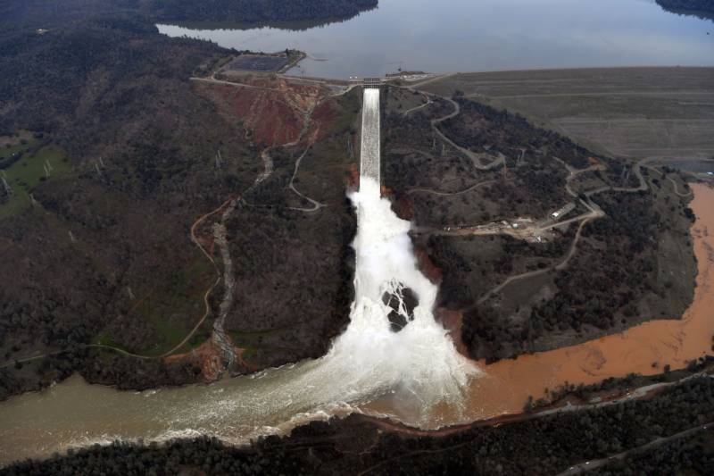
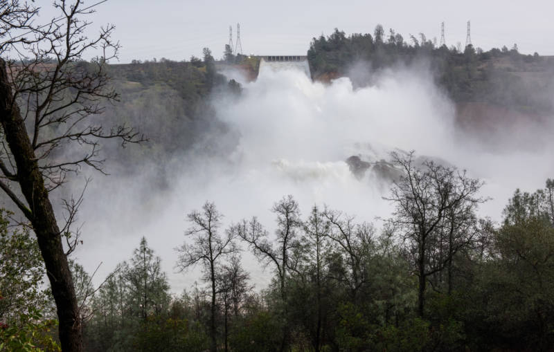
Large-scale releases of water are ongoing at Oroville Dam, where the water level has fallen to about 12 feet below the emergency spillway structure that engineers believed was on the verge of failure on Sunday.
Here are some photos of the main and emergency spillways, the evacuees and the flooding.
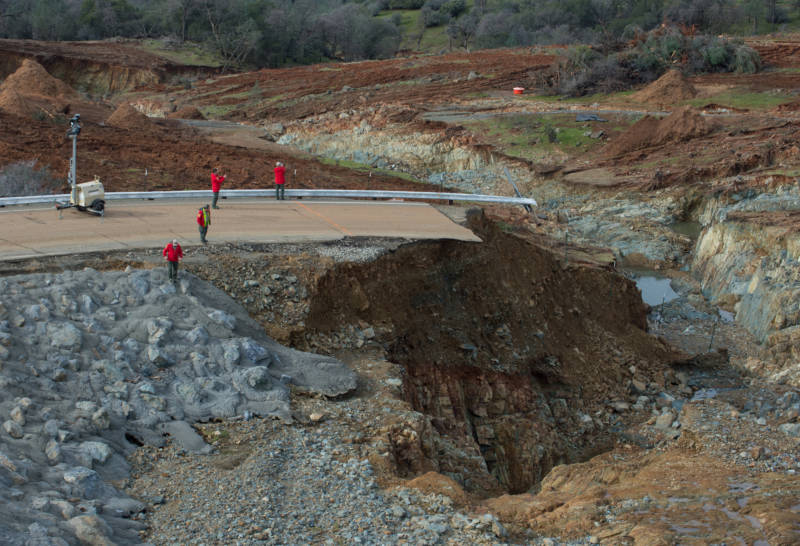
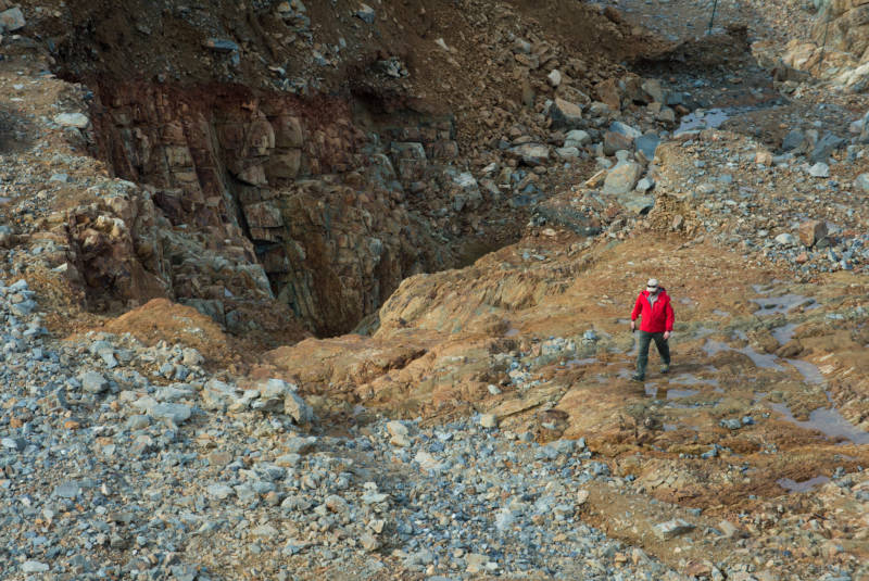
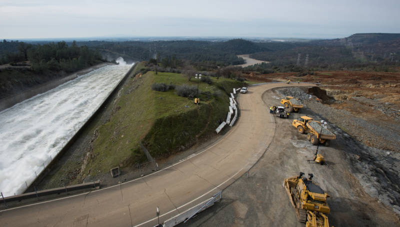
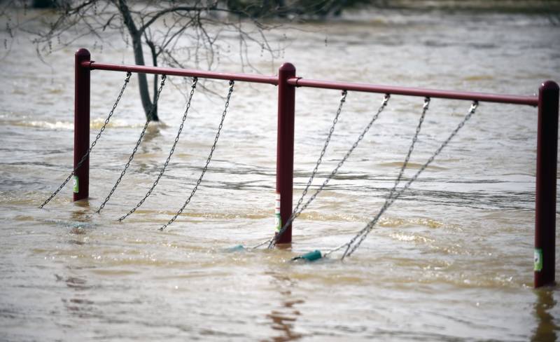
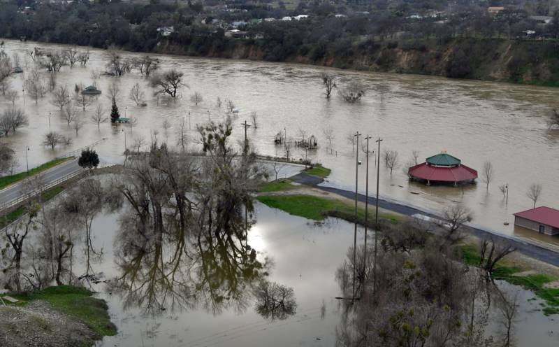
California Department of Water Resources crews inspect and evaluate the erosion just below the Lake Oroville Emergency Spillway site after lake levels receded on Monday morning. The outflow from the primary Oroville Spillway remains at 100,000 cubic feet per second (cfs) to decrease the lake level by 50 feet to handle the next round of storms this week. Photo taken Feb. 13, 2017. (Kelly M. Grow/ California Department of Water Resources)The Oroville Dam spillway releases 100,000 cubic feet of water per second down the main spillway in Oroville, California, on Feb. 13, 2017. (Josh Edelson/AFP-Getty Images)California Department of Water Resources crews inspect and evaluate the erosion just below the Lake Oroville Emergency Spillway site after lake levels receded on Monday morning. The outflow from the primary Oroville Spillway remains at 100,000 cubic feet per second (cfs) to decrease the lake level by 50 feet to handle the next round of storms this week. Photo taken Feb. 13, 2017. Kelly M. Grow/ California Department of Water Resources (Kelly M. Grow/ California Department of Water Resources)Crews inspect and evaluate the erosion just below the Lake Oroville Emergency Spillway site on Monday Feb. 13, 2017. Kelly M. Grow/ California Department of Water Resources (Kelly M. Grow/ California Department of Water Resources)A huge spray cloud hangs over the Oroville Spillway as the California Department of Water Resources continues to release 100,000 cubic feet per second (cfs) from the damaged spillway to decrease the lake level by 50 feet to handle the next round of storms expected this week. Photo taken Feb. 13, 2017. (Kelly M. Grow/ California Department of Water Resources)Evacuees Steve Allen (R) and Alicia Castro (L) lay on a cot at the Placer County Fairgrounds evacuation center in Roseville, California, on Feb. 13, 2017. (JOSH EDELSON/AFP/Getty Images)Evacuee Karina Garcia (L) looks on at the Placer County Fairgrounds evacuation center in Roseville, California, on Feb. 13, 2017. (JOSH EDELSON/AFP/Getty Images)A swing set sways from rushing water at Riverbend Park as the Oroville Dam releases water down the spillway in Oroville, California, on Feb. 13, 2017. Nearly 200,000 people were under evacuation orders in Northern California after a threat of catastrophic failure at the United States’ tallest dam. Officials said the threat had subsided as water levels at the Oroville Dam, 75 miles north of Sacramento, have eased. But people were still being told to stay out of the area. (JOSH EDELSON/AFP/Getty Images)Riverbend Park is seen under flood water in Oroville, California, on Feb. 13, 2017. (JOSH EDELSON/AFP/Getty Images)
An orchard is turned to swamp land as flood waters rise near Oroville, California, on Feb. 13, 2017. (JOSH EDELSON/AFP/Getty Images)
Sponsored
lower waypoint
Stay in touch. Sign up for our daily newsletter.
To learn more about how we use your information, please read our privacy policy.
How free is America's free speech? Morning Edition asks Americans across the country about a Constitutional guarantee. Many wanted us to obscure their names, while others are louder and bolder than ev...