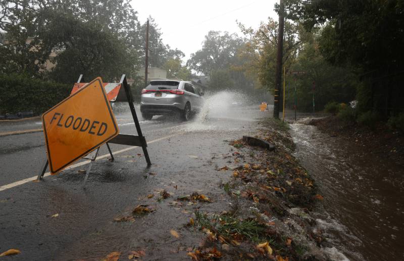
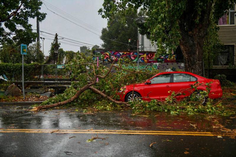
A powerful storm roared ashore Sunday, flooding highways, toppling trees and causing mudflows in areas burned bare by recent fires as forecasters predict record-breaking rainfall.
'Historic Rain' Drenches Bay Area Amid Evacuations and Power Outages

Drenching rain and strong winds accompanied the arrival of an “atmospheric river” — a long and wide plume of moisture pulled in from the Pacific Ocean that was predicted to move south over the next few days. The National Weather Service’s Sacramento office warned of “potentially historic rain.”

San Mateo County has issued an emergency evacuation order to the CZU Lightning Complex burn area. The evacuation was elevated Sunday morning from a warning to an immediate order due to increasing danger of power outages, debris flows and downed trees.
“The heaviest rains are expected later tonight … So if you think you gotta get out, you should get out now,” said David Cosgrave, a spokesperson for Cal Fire. The temporary evacuation point was moved from Half Moon Bay High School to the Ted Adcock Community Center.
Flash flood warnings have also been issued for portions of the LNU Lightning Complex Fires and Glass Fire burn areas in east-central Sonoma County, including Santa Rosa, and in rural central Napa County.
A flash flood watch has been issued for the Russian River in Hopland, and meteorologists say it’s possible Highway 175 could flood this evening.
“What happens if that rain falls heavy on those locations is the soil can become unstable and then start moving,” said Sean Miller with the National Weather Service Bay Area. He said some wind gusts are clocking in at 70 mph. He’s particularly worried about areas in the North Bay scarred by wildfires.
Jan Null with Golden Gate Weather Services said it’s been 19 years since we’ve had a storm this strong. “The classic storm that every meteorologist in the Bay Area should be able to tell you about was back on December 12 in 1995, and that had a perfect score of 10 on the Bay Area storm index,” said Null. “Today is probably going to be about a 9.5 that would tie it as the fifth-highest storm that we have seen.”
Null said this storm will effectively end the fire season in Northern California, but the state will still need more than 140% of normal rainfall for the entire season to end the drought.
Emergency crews responded to flooded roads and downed trees at several locations, and urged residents to stay at home and use caution if they need to venture out.
“Water levels are on the rise in many of our creeks right now due to the storm,” the Santa Rosa Fire Department posted on social media. The department posted video of the rushing waters of a rain-swollen waterway at Flat Rock Park, at the confluence of Brush and Santa Rosa creeks. The waterbed was mostly dry just a week ago.
“Please stay away from the edges of these fast-moving waterways,” the department said on Twitter.
The National Weather Service said the rains will continue into the evening and warned motorists to be aware of surroundings and to avoid driving on flooded roads.
As of around 2 p.m. Sunday, more than 130,000 Bay Area households were without power, according to Pacific Gas and Electric. So far, Sonoma County is the hardest hit, with 28,000 customers affected by the outages.
PG&E spokesperson Megan McFarland said the utility has been preparing for this storm for days and will work on restoring power once it is safe for crews to access the affected areas.
“Typically when we see a storm like this with heavy rain, high winds, there can be damage to our equipment. We’ll see damage to transformers, we’ll see wires down, we’ll see pole damage. And as soon as the weather clears and it’s safe to do so, our crews are out there,” McFarland said.
KQED’s Holly J. McDede, Natalia Navarro, Beth LaBerge and Annelise Finney contributed to this report.
