upper waypoint

California Still Deep in Drought Despite Stormy Weather Capped by 'Atmospheric River'

Save ArticleSave Article
Failed to save article

Please try again

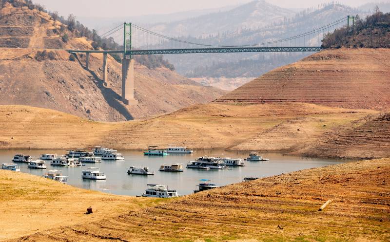
A wide shot framed by steeply inclined, dry shores and a handful of houseboats close together in the low-lying lake in the middle, with a bridge high above in the distance.
Houseboats sit in a narrow section of water in a depleted Lake Oroville, in September 2021. (Josh Edelson/AFP via Getty Images)

The deluge California received from a powerful atmospheric river made streams and waterfalls come alive while coating mountains with snow, but as the storm headed east to the Plains on Tuesday, it left the Golden State still deep in drought.

The atmospheric river, a long plume of moisture pulled in from the Pacific, capped a series of back-to-back storm systems that abruptly switched the state's immediate emergency concerns from wildfires to flooding.

But the long-term problem of a drought that scientists say is part of a warming and drying trend driven by climate change was not washed away.

“One storm this early in the water year does not predict the rest of the winter storm season,” state climatologist Michael Anderson said in a statement. “After this system we see a period of dry conditions return to California.”

The National Oceanic and Atmospheric Administration's 2021 winter forecast shows the probability of precipitation in California to be significantly below average while temperatures run well above average.
Sponsored

And the state is already running a water deficit.

During normal years, the winter snowpack in the Sierra Nevada supplies about 30% of water statewide when the spring melt comes and water runs off to be captured in the state's system of reservoirs.

Winters, however, have not been normal lately.

Last April 1, the date when the snowpack is typically at its deepest and contains the greatest amount of water, the state Department of Water Resources' system of electronic monitors found it was only 59% of average.

Then, in a stunning development, about 80% of the predicted runoff never appeared. Soils were so dry and temperatures so warm that the water instead was soaked up or evaporated, and reservoir water storage fell to shocking levels.

Related Coverage

One of those huge reservoirs, Lake Oroville, has risen more than 20 feet since the series of storms began last week, but the Department of Water Resources website showed it was at just 27% of capacity Tuesday.

The early season storms were beneficial, but officials say much more rain is needed.

“We have much less accumulated precipitation over the past few years than we should normally receive and the soils are particularly dry. We cannot fix this condition with one storm,” Anderson said.

The northern Sierra generally received 2-20 inches of snow, with a few sites reporting more, but snow depth dropped to 1-2 inches in the central Sierra and just a trace fell in the southern end of the range, according to the department.

Even before the rains, the pace of California wildfires that have burned nearly 3,900 square miles this year was slowing, and then the wet weather pushed several of the remaining huge blazes to 100% containment.

In Sequoia and Kings Canyon national parks, the lightning-sparked KNP Complex Fire was 69% contained after receiving several inches of rain and snow. Firefighters sheltered in place Monday and on Tuesday supervisors were to assess conditions. “When safety permits, the crews will reengage the fire,” a situation report said.

Most of this year's major fires have occurred in now-saturated Northern California. In Southern California, however, the fire season typically begins in fall, when the region's powerful, dry Santa Ana winds blow.

lower waypoint
next waypoint