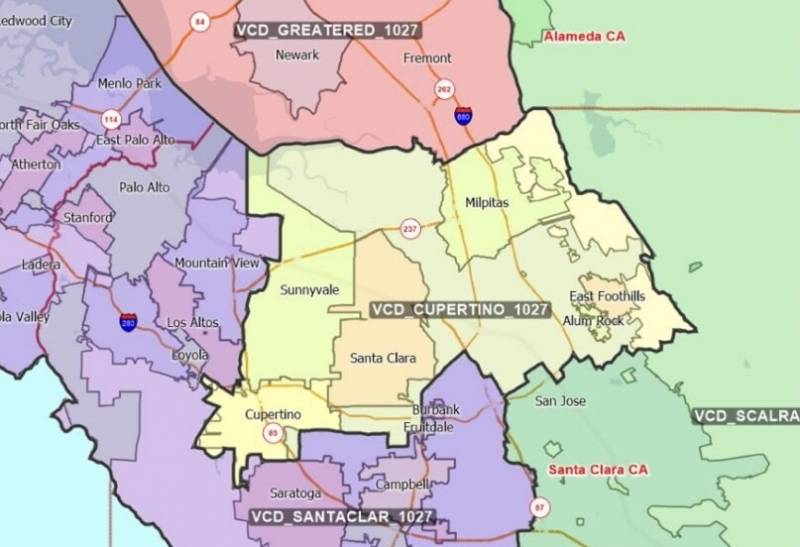
What if parts of the Bay and parts of the Central Valley were represented by the same person in the U.S. House of Representatives? What about Filipino voters in Daly City and Chinese voters in the western part San Francisco? Or South Asians living in Santa Clara County?
These are just a few of the thorny questions being debated right now during California’s redistricting process. Soon, California will have a new political map that will decide how we’re all represented — in the state legislature and in the U.S. House — for the next decade. And unlike most states where politicians are in charge of redistricting, California has a public process where residents can make their voices heard.
Guest: Guy Marzorati, KQED politics and government reporter and producer of the Political Breakdown podcast
Follow The Bay to hear more local Bay Area stories like this one. New episodes are released Monday, Wednesday and Friday at 3 a.m. Find The Bay on Apple Podcasts, Spotify, Stitcher, NPR One or via Alexa.