upper waypoint

It's Another Atmospheric River Storm. Here's What You Need to Know

Save ArticleSave Article
Failed to save article

Please try again

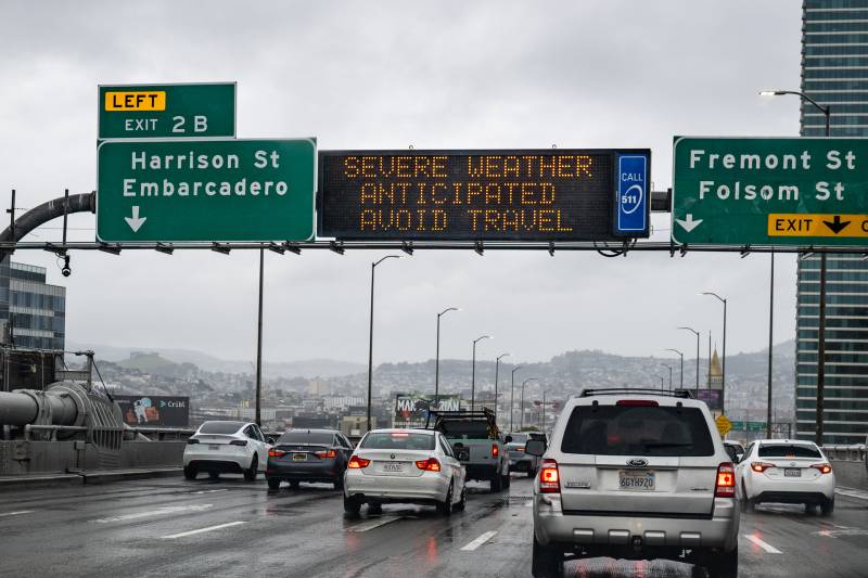
Cars head west, at the end of the Bay Bridge, toward San Francisco on a rainy day. A highway digital sign says 'Severe weather anticipated - avoid travel.'
A Caltrans sign on the western span of the Bay Bridge, heading into San Francisco, urges drivers to avoid travel, amid 'severe weather anticipated,' on March 9, 2023. (Beth LaBerge/KQED)

T

he Bay Area and the rest of Northern and Central California are about to see the onset of a powerful storm tapping into an unusually warm atmospheric river drawing moisture to the coast from the tropics well beyond Hawaii.

What can we expect?

The latest thinking from the National Weather Service's San Francisco Bay Area office is that Thursday morning's light, scattered rain will intensify and spread across the entire region into the afternoon.

That more intense rain is expected to continue overnight and begin lightening up in much of the Bay Area on Friday morning, but will likely remain heavy in the Santa Cruz Mountains and Santa Lucia Range through mid-afternoon.

Here in the Bay Area, we'll see lots of typical wet weather effects: some local flooding, "water ponding" on roadways and, most likely, some vehicle collisions, because not all of us get the "slow down!" memo.

But here's the reason we're a little obsessed with what happens in the next 48 hours, and the 48 hours after that, and the 48 hours after that …

This warm atmospheric river storm arrives after a long series of much colder storms that have resulted in an immense snowpack. The snowpack is not only phenomenally deep — parts of the Sierra Nevada have gotten more than 50 feet of snow this season — it also covers an unusually expansive area, stretching into the foothill regions across the state.

related coverage

Thursday's storm is expected to trigger a rapid melting of snow below the 5,000-foot level in Central California and below 4,000 feet to the north, leading to dramatically increased runoff into streams and rivers, heightening risks of flooding.

Higher up, the ultra-deep snowpack is expected to absorb most of the rain that falls, but as UCLA climate scientist Daniel Swain pointed out earlier this week, that poses a different kind of hazard.

"If you add a bunch of water to that snowpack, it doesn't necessarily get deeper, but it sure gets heavier as that snow absorbs more water," Swain said. That added weight will increase the risk that structures will collapse under the load.

Although the arriving atmospheric river system is warm, it will drop more snow at higher elevations. The NWS office in Sacramento, which handles forecasts for the central and northern Sierra and the Sacramento Valley, says as much as 8 feet of new snow — relatively heavy, dense "Sierra cement," as opposed to the powder that's fallen in recent weeks — will fall at elevations above 7,000 feet.

Here's a breakdown of major storm features and impacts:

Onset and duration: The storm begins with showery weather Thursday morning, intensifies early in the afternoon, and lasts through Friday morning in most of the Bay Area and into Friday afternoon in the Santa Cruz Mountains and the Santa Lucia Range above Big Sur.

Rain amounts: Per the NWS San Francisco Bay Area office on Thursday morning, forecasted totals for inland regions is 1–3 inches; inland hills, 3–6 inches; the Santa Cruz Mountains, 4–6 inches, with locally higher amounts up to 8 inches; and the Santa Lucia Range, 8–10 inches, with locally higher amounts at the highest peaks of up to 12 inches.

Winds: Again via NWS Bay Area, we can expect a prolonged, very windy period from early Thursday afternoon through Friday morning, with sustained winds from 20 to 30 mph and gusts as high as 50 mph. With soils already deeply soaked, the high winds could blow down trees and create widespread power outages. So far this winter, millions of California residents — yes, millions — have lost power at some point due to stormy weather.

Flood watch: NWS offices throughout Central and Northern California issued flood watches earlier this week. For the Bay Area forecast area — a region stretching from Monterey and San Benito counties in the south up to Sonoma, Napa and Solano counties in the north — the flood watch continues through Sunday.

Flood locations: In addition to possible flooding of roadways and neighborhoods, including in parts of San Francisco and Oakland with persistent drainage problems, the NWS points to several areas south of the Bay Area as sources of particular concern, particularly those near the Salinas, Pajaro, Carmel and Big Sur rivers. The NWS' California Nevada River Forecast Center is also projecting the Russian River at Guerneville will crest just above flood stage late Friday night. However, no major impacts are expected in that high-water forecast.

The center also forecasts that many points on Central Valley rivers and streams will reach monitor or flood stage in coming days, including the Sacramento, Mokelumne, Cosumnes, Tuolumne and San Joaquin rivers. One stream that experienced severe flooding in January, Bear Creek just outside the city of Merced, is expected to flood again.

Reservoirs: Several of the big reservoirs along the Sierra foothills — from Oroville Dam on the Feather River, south to Pine Flat Dam on the Kings River east of Fresno — have risen to the level where managers must release water to maintain space to provide flood protection for downstream communities. The California Department of Water Resources is expected to begin releasing water down the rebuilt spillway at Oroville Dam on Friday for the first time since 2019.
Sponsored

lower waypoint
next waypoint