Episode Transcript
This is a computer-generated transcript. While our team has reviewed it, there may be errors.
Olivia Allen-Price: Hey everyone, Olivia Allen-Price here. And I want to take you back for a moment to April 2015, when you could have been scanning the radio …
(sounds of switching through the radio dial)
Olivia Allen-Price: And settled on 88.5 KQED to hear the very first airing of a Bay Curious story.
Archival Tape of KQED’s Joshua Johnson: OK, time for something fun. Today, we’re launching a special series about local oddities, mysterious and curiosities. We’re calling it Bay Curious.
Olivia Allen-Price: It was about this old wrecked car that hikers pass often on Mount Tamalpais. Reporter/Producer, Katrina Schwartz, and I hiked out to the wreck to check it out.
Olivia and Katrina in archival tape: Holy cow that’s it! What a piece of junk. That is really unexpected…
Olivia Allen-Price: In some ways, that was the perfect story to kick off what is now nearly a 10-year-old journalism experiment. It took us through some Bay Area history. We learned about car manufacturing in the 1940s. We talked to some fascinating people. It was a story that had all the elements that I hope Bay Curious has come to be known for. And … it was about a car. Which, really, isn’t that surprising. Because, over the years, more than 10,000 questions have poured in from you, our dear audience, and transportation is one of the topics that we get the most questions about. Maybe it’s because getting around our region … has some pain points? I dunno.
Olivia Allen-Price: Today, as we barrel toward our 10-year anniversary, we thought we’d answer a bunch of your transit questions that have been lingering in the Bay Curious inbox. Like “how much toll money gets collected on our bridges, and where does it go?” “Why has one toll booth been closed on the Bay Bridge for years?” And “Are there more vanity license plates in California than in other places?” It’s a transit lighting round, so hold on tight, and we will get going to pick up some answers.
(Start and rev engine in background)
Olivia Allen-Price: When a transit question strikes, KQED editor and reporter Dan Brekke is the person that I always go to to ask. He’s been covering transportation in the Bay Area for more than 20 years, and he’s, I think it’s fair to say, an OG transit nerd. Welcome, Dan.
Dan Brekke: Hi Olivia
Olivia Allen-Price: So we have a pile of questions to get through this morning, but more than half of them have to do with our bridges. So I want to start there. Now, every time you cross one of our major bridges, you should probably hear a little ka-ching sound go off because they all come with a toll, usually somewhere in the vicinity of $8 to $10 … less if you’ve been smart enough to carpool. Now, multiply that by thousands of motorists crossing those bridges every hour, and a listener and longtime San Francisco resident, named Dani Robillard, has been seeing dollar signs.
Dani Robillard: Where does all that toll money from Bay Area bridges go? It’s got to be over $20 million a week, right?
Olivia Allen-Price: What do you know, Dan?
Dan Brekke: So that money goes to maintaining the bridges and to lots of other things. Your guess of $20 million a week isn’t too far off. There’s an organization called the Bay Area Toll Authority. And that’s an agency that was created to collect all the revenue from all the bridges — the seven state-owned bridges — and then to allocate it for various projects that we’ve agreed to as a region over the years. So they say that they bring in about $880 million in the current fiscal year, and that comes out to about $17 million a week.
Olivia Allen-Price: Can we dig in a little bit deeper because Dani wants us to break it down further…
Dani Robillard: We have so many bridges and prices are increasing at an alarming rate. And I just really question, when I see the roads, and at times the conditions of our cities, where does all that money go?
Olivia Allen-Price: I always thought the toll was to pay for the bridge. And once the bridge was paid off, the toll maybe go away. But that’s clearly not the case because some of these bridges have been around for decades and I imagine some of these bridges are paid off by now.
Dan Brekke: Well, the bridges themselves might be paid off. You know, the Bay Bridge opened nearly 90 years ago. Next year will be the 90th anniversary. But, you know, there are ongoing costs, right? You build something that big and complex, and you have many needs over the years just to keep it up, to pave it, to reconfigure it if you need to. And so when you look at the toll dollars we spend going into this fiscal year, the Bay Area Toll Authority said about 60% of the toll funds were going into bridge stuff, right, all the things that I was just talking about, but the other 40% goes to a bunch of things that have, on the surface may be little to do with the bridges themselves but are all very important to the Bay Area’s transportation network. And those are things that range from BART’s brand new fleet of cars, to bike and pedestrian paths around the Bay Area and everything in between. So how did we decide to apportion 40% of those funds that we’re paying at the toll booth for these other things that you don’t see on the bridge? Well, there have been a series of regional measures called, cleverly enough, regional measures one, two, and three that we passed in 1988, 2004, and 2018. Those measures did two things. They raised tolls over time, and they apportioned the money from the new tolls to all these other projects.
Music
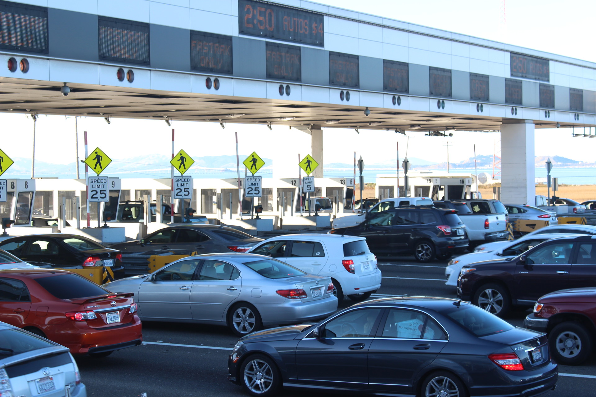
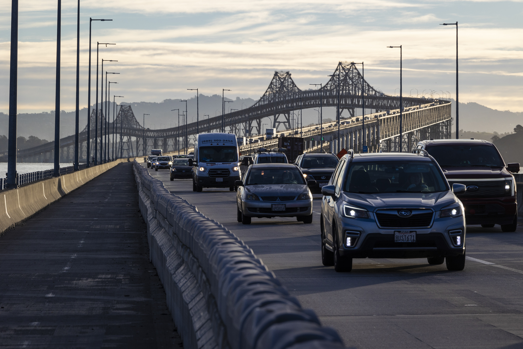
Olivia Allen-Price: All right, so let’s move on to our next question. And we have a few about the San Francisco-Oakland Bay Bridge specifically, which, again, not surprising, because, according to the Metropolitan Transportation Commission, the Bay Bridge carries more than a third of all the state-owned bridge traffic, something like 42 million cars or so crossed in 2022–2023 fiscal year. Let’s hear our first question about it!
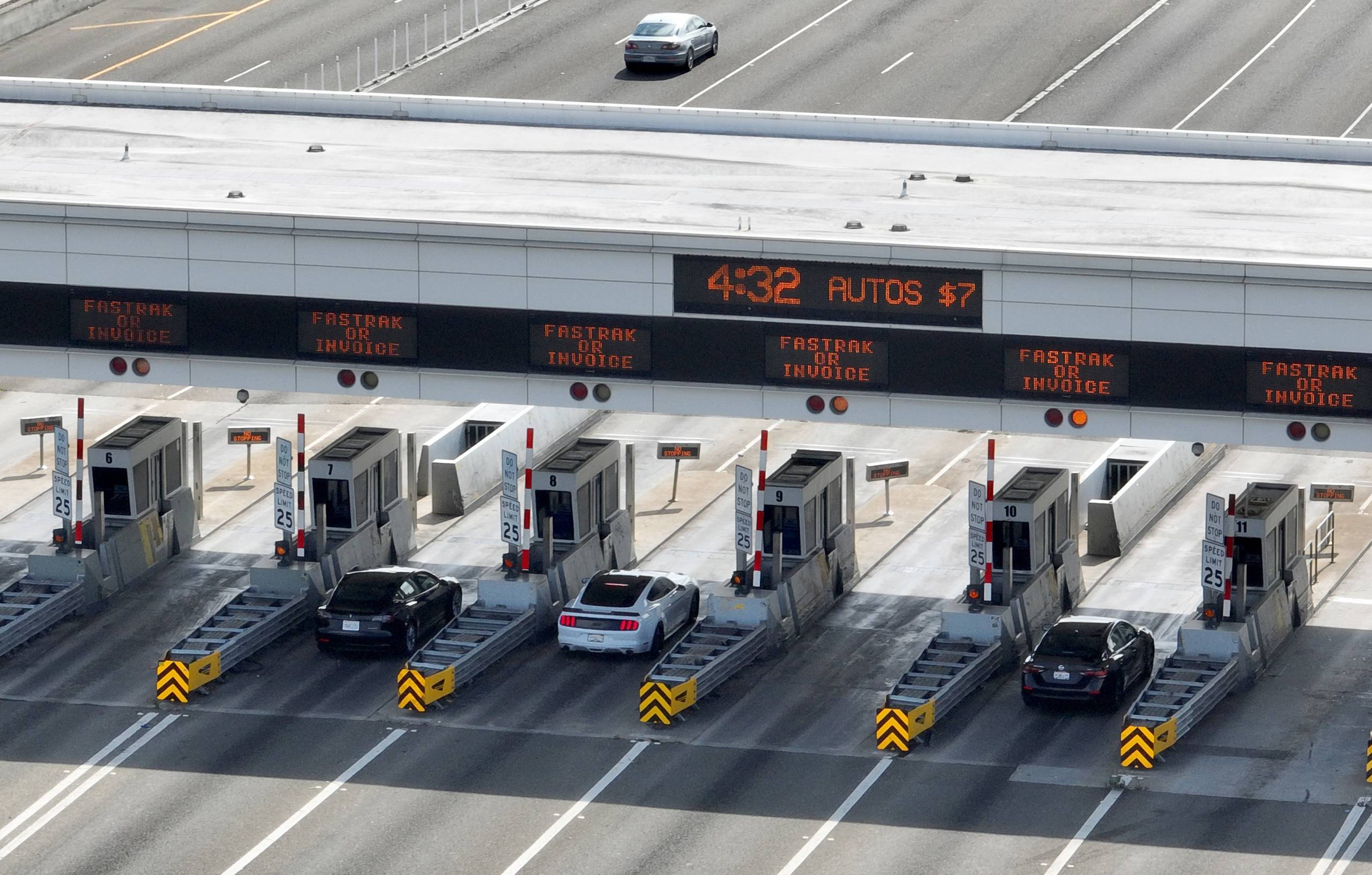
Andrés: Hi my name is Andrés and I live in San Francisco. My question is why has that single lane at the toll plaza for the Bay Bridge been closed for years, and why won’t they open it again? Every time I’m passing, somebody’s always making a last second swerve to avoid the closed lane.
Dan Brekke: Well, that’s a tragic story, actually. But first, I want to say I know exactly what he’s talking about. When you’re approaching the Bay Bridge toll plaza, especially if it’s not super crowded, right? You’re approaching at some speed, and you’re kind of lining up what lane you’re in. And then all of a sudden, there’s this one lane that’s closed, and you might have to change out of that lane to get into one of the other ones. So what happened there was that toll booth was wrecked, and the toll taker inside was killed when a truck smashed into it in December 2017. And Caltrans afterward decided not to rebuild immediately. The damage was really extreme. And a construction project in the toll plaza brings a lot of complications with it. The toll booth was still not fixed at the beginning of the pandemic in early 2020. And there was a big change in how tolls were collected at that point. All the toll takers were removed from the plaza, as well as all the other toll bridges around the region, and toll collection became automated. So there was little need to replace that lane at that point, right? You still have 16 plus other lanes that drivers can use. And, you know, the pandemic started five years ago, and you would think, well, maybe there’s time to go in and do that work. Well, there’s actually a plan to replace the entire toll plaza. So that’s why it’s not getting done now. And what’s going to replace the toll plaza? Something called open road tolling. You can see how that’s going to work if you go to the north side of the toll plaza, where there are a couple of carpool lanes. They’re actually called high occupancy vehicle lanes for buses and carpools. And they’ve got overhead toll tag readers that you can drive through going 60 miles an hour, and your toll tags will be read automatically. And so this technology is going to come to the Bay Bridge and other Bay Area bridges in the next two or three years.
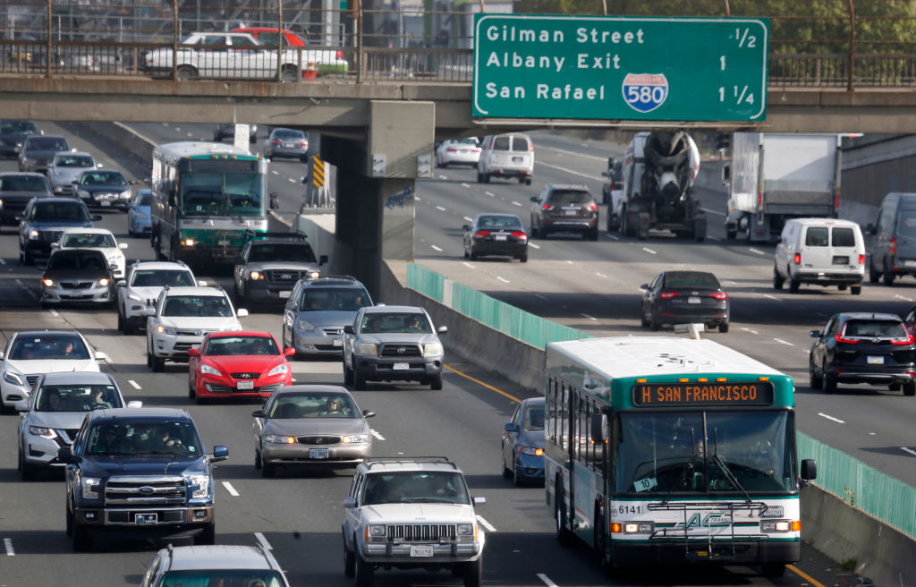
Olivia Allen-Price: All right, let’s move on to our next question, which also has to do with a lane on the Bay Bridge, not too far away from the one we’ve been talking about. Listener Sam wrote in with this: “Outside rush hour, the right carpool lane westbound onto the Bay Bridge is labeled busses only, but there’s always a constant stream of cars. Do they not enforce that at all, even with photo tolls? Can I use it too?” Dan, what have you got on this?
Dan Brekke: So there are a couple parts to this question. I asked John Goodwin from the MTC what the story is with this lane, and he answered with a delightful email. I’m going to read from that. “Outside of weekday commute hours, that right-hand carpool lane can be lawfully used only by buses.” So, let’s stop there. Only by busses. Everybody else is not legal. So if you see cars over there, they’re actually breaking the law. He goes on to say, “Every one of the drivers in that constant stream of cars you cite is a scofflaw, a miscreant, and a scoundrel.”
Olivia Allen-Price: Burn.
Dan Brekke: OK burn, exactly. So it’s a little judgmental, but it is very clear. You can only use that lane during carpool hours. That’s part one of the answer. But Sam is also asking, is there any enforcement there? And the answer is yes. The CHP is under contract with the Metropolitan Transportation Commission to pull drivers over when they’re violating the toll pool regulations. If the CHP is there and they pull you over, yes, you’re gonna get a ticket and you’re gonna get hit with a several hundred dollar fine. So essentially you’re taking your chances if you do that. Sam asked about the photo enforcement that’s there. Well, the photo equipment that’s there is not there for any kind of enforcement. It’s there to collect your toll. So if you drive through there in a non-carpool hour, that equipment will see you, it will record your license plate and you will be charged a toll. That’s all that will happen there. But remember, once you get through that point, sure, you’ve paid your $8 toll on the Bay Bridge, watch out for the CHP just waiting for you down the road.
Music transition
Olivia Allen-Price: This next question takes us across the bridge to the San Francisco side of things now, still on the Bay Bridge, though, and still in the westbound direction. On the upper deck, there are structures on both sides of the roadway, and they kind of look like shelters of some sort. They have sort of openings the size of garage doors. And we’ve had a few listeners write in asking what they were. Now, I actually dug into this question a few years ago and Caltrans told me that they were once bus stops back from the era when buses could stop on the bridge, and they haven’t been used since probably about the 1960s. Dan, I was hoping you could kind of take us back to this era of bus stops on the bridge and even commuter trains on the Bay Bridge. Just what did the Bay Bridge look like in the ’60s?
Dan Brekke: So to begin with, the bridge was configured to have two-way traffic on the top deck, three lanes going in each direction. You also had to pay a toll each way. So you’d pay a toll coming into San Francisco and you’d pay a toll when you got back to the East Bay. That sounds like a treat, doesn’t it? And on the lower deck, there were train tracks for commuter train: The Key System, the Sacramento Northern, and the interurban electric railways all ran into the old Transbay Terminal across those tracks. There were also lanes set aside for truck traffic. No truck traffic was allowed on the upper deck. When the Key System abandoned service in the late 1950s, 1958 to be exact, a big project was undertaken to reconfigure how the bridge worked. So those train tracks were removed from the lower deck, and the two decks were made one way. Westbound traffic on the upper deck, eastbound traffic on the lower deck, just the way we see it today. And there were all sorts of little differences to the way the bridge worked. So as you said, yes, there were bus stops at the beginning of the bridge, on both sides actually and those were done away with when the bridge was reconfigured in October 1963.
Music transition
Olivia Allen-Price: Our next question comes from Martin Aguilera, and he wants to know: “Why do so many Bay Area freeways end with 80, i.e., 880, 680, 280, 580?” And I have to admit, as somebody who, you know, gets around our region by car quite a bit, all those 80s can be sort of confusing. It makes me think of how Olympian boxer George Foreman famously named all five of his sons George, and I’ve always wondered what it’s like to live in a house with five Georges, six Georges. So Dan, why all these 80s?
Dan Brekke: So, you know, we actually have encountered this topic before in the Bay Curious newsletter.
Olivia Allen-Price: Which I’ll gently remind listeners they can subscribe to at BayCurious.org. Halfway down the page, just look for the big pink box!
Dan Brekke: The simple explanation for this numbering system, all those three-digit routes are considered to be branches of Interstate 80 in the Bay Area. So Interstate 80 is the main drag, right? That’s the one that goes all the way across the country to the George Washington Bridge in New York City. And it ends right there in San Francisco where U.S. 101 comes in and heads south. And all these other 80s, the 580, the 680, the 280, 780 in the North Bay, those are all considered to be branches of one type or another of Interstate 80. There are two kinds of these branch routes. The ones that begin with even numbers, like 280, 680, and 880, are considered to be loop routes that provide a way around the periphery of the region. And I’ll observe while I say those numbers that none of those are really loop routes in and of themselves. Although 280 and 680 kind of make a loop. 880 is really a straight shot from Oakland down to State Highway 17 and San José.
The ones that begin with odd numbers are considered to be spur or radial routes and they’re basically to connect busy routes. And so we have 380, 580, 780 and 980.
Music
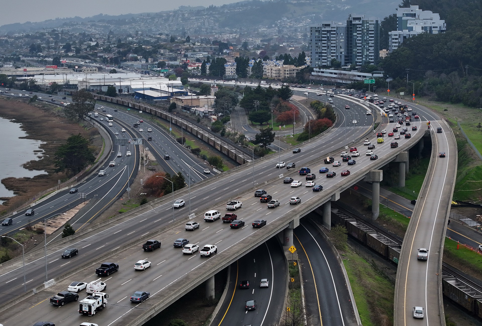
Olivia Allen-Price: OK, so we’re moving a bit north of the Bay Bridge now, on 580 I will add, to answer this question about the Richmond-San Rafael Bridge.
Phil Narodick: Hi my name is Phil Narodick. I live in Berkeley and here’s my question: There’s a third lane on the eastbound span of the Richmond Bridge that’s seemingly opened and closed based on the vibes. No rhyme or reason provided. What’s going on and why do they sometimes not want you to drive in it?
Olivia Allen-Price: Now Dan, the answer for this one might benefit from a little bridge history first — because the third lane in both directions on that bridge has had a number of uses over the years. Can you take us back?
Dan Brekke: This bridge opened in 1956 with three lanes in each direction, right? Upper deck, westbound, lower deck, eastbound. We had a really bad drought in 1976 and 1977. Marin was out of water. So where was it going to get water? An agreement was made for East Bay MUD to build a pipeline across the Richmond-San Rafael Bridge. Where did they put it? They put it in the right-hand lane of the upper deck. So, that lane was taken away, and it went from a three-lane to a two-lane bridge right there. Now, the pipeline was sort of a desperation measure and was very useful, but it was only needed for less than a year. And then it was taken out five years later, but traffic was never restored to that right-hand lane on the upper deck. It just became kind of a breakdown lane. And then a few years after that, on the lower deck, for no reason that I can actually determine, Caltrans decided to close the right-hand lane on the lower deck as well. There’s no reason given for it, except for the fact there wasn’t enough traffic to justify it.
That changed a few years ago when Caltrans and other agencies started a pilot project to restore a third lane of traffic on the lower deck, the eastbound deck that Phil is talking about. And the reasons for doing that were that there’s enough congestion in the afternoon commute headed back to Contra Costa County from the North Bay, that something had to be done about it and restoring that lane seemed to be a possible answer. So, there is a project to get that done. The lane opened, as I say, a few years ago. And the simple answer from the Metropolitan Transportation Commission is Caltrans operates that lane and they open it from 2 to 7 every day, including weekends. Those are the operational hours, period.
Olivia Allen-Price: Why would you have a lane closed at other times of the day?
Dan Brekke: Oh yeah, well, the reason you would see the lane closed at some times of day is because that third lane could still be used for construction activities, right? There’s lots of maintenance that happens on the Richmond-San Rafael bridge, and so there are other things that that lane can be used for.
Olivia Allen-Price: Now while we’re talking about this, the third lane on the upper deck has been in the news a lot lately, can you give us a quick update on what’s going on up there?
Dan Brekke: The upper deck is a focus of attention right now because there’s a bike and pedestrian path in that right-hand lane now that went into service in 2019 as part of a pilot project. And it’s proven to be, I mean, it depends on who you ask. Cyclists absolutely love it. It’s gotten more use than any of the other bridge bike paths in the Bay Area. But there are questions about whether it’s making congestion worse in the morning hours going from Contra Costa County into Marin. There’s a proposal that would actually remove that bike lane four days of the week and restore it as a breakdown lane so that if somebody has a problem up there they get flat tire, run out of gas, have a little collision, they can pull over to the side, and they don’t impede traffic in the other two lanes. That’s been a big problem up there. And I want to say, this is a hugely fraught topic. I mean, there have been studies done about whether that bike lane has affected traffic and the delay getting onto the bridge in the morning. And the conclusion is, it hasn’t made a lot of difference. But there are people who feel passionately that it is really screwing with their lives and they wanna see it change. So that’s what’s going on up there.
Music Cue
Olivia Allen-Price: And we’ve reached the final question of this transit lightning round, and it’s about license plates. Now I’ve always had sort of the boring numbers and letters assembly that is randomly assigned, but all over our state, you will find vanity plates where people have paid a little extra to be able to choose what their license plate says. And one listener feels like they’re seeing more of these plates in California…
Marissa: This is Marissa from Oakland, and I’m wondering why there are so many vanity license plates in the Bay Area? I grew up in Connecticut and remember going on road trips hoping to find some on our route and never really saw any. Living in Massachusetts for years after that, I didn’t see very many either. But now that I’ve been in California for about 8 years, they’re literally everywhere I look. If I’m walking down the street, if I’m in a car, and I was just wondering why that is.
Dan Brekke: Well there was actually a study about this. Done a while ago. It’s the only study I can find — a survey actually, let’s call it a survey. And it was done in 2007 and what it found was California at that time ranked 22nd of the 50 states in the number of personalized or vanity plates. The number one state was Virginia. 16% of the plates in Virginia were personalized plates. And then given Marissa’s question and her regional roots, this is kind of interesting because the top 10 includes several states in the Northeast. Including New Hampshire, Maine, Connecticut, I think she said that’s her home state. And New Jersey. So, they’re out there somewhere. Maybe they were all parked up when you were looking. Of course, this was a survey done a long time ago and we did reach out to the Department of Motor Vehicles to see if there were some updated statistics. And one thing they could tell us for sure is that there are more personalized plates on the road than there used to be. So, in 2007, California had 1.1 million personalized plates, it now has about 1.6 million, so that’s quite a bit more.
Olivia Allen-Price: But it’s interesting if California’s vanity license plate incidence has grown since the study was done, that’s kind of a trend happening across the country. So it could just be that as time has gone on, more people are choosing to do vanity plates, maybe they’re just more fun. There’s more interest in customizing your vehicle or something along those lines.
Dan Brekke: Well I think that’s possible. I think something that you and I were talking about in casual conversation is how much people have to pay. Virginia is famous for charging very little for a personalized plate, I think they charge only $10. And in California to get one of those basic plates, it costs $53 to have it personalized. And then you have to pay $43 each year on an ongoing basis. If you want to get one of those specialized plates, like the ones for Yosemite National Park, it costs $103 and $83 on an ongoing basis, so you know that’s kind of steep for a lot people.
Olivia Allen-Price: Have you thought about what your vanity plate would be if you were to get one?
Dan Brekke: Um…
Olivia Allen-Price: TRNSIT NRD
Dan Brekke: TRNSIT NRD!
Olivia Allen-Price: TRNSIT NRD!
Dan Brekke: I think that’s too many letters, actually.
Olivia Allen-Price: Well, Dan Brekke, thank you so much for joining us today. I really appreciate you sharing all your knowledge with us.
Dan Brekke: Well, thanks for having me, you know, I really love being here.
Music
Olivia Allen-Price: Two reminders on the way out — first, we have a Bay Curious Trivia night coming up on April 1, so be sure to round up a date or a few friends, and grab your tickets for that. That can be done at KQED.org/live.
Also, we are working on an episode about the best places to take kids in the Bay Area and we would love your help! Do you have a favorite playground? Or a restaurant that’s sneakily kid-friendly? Or maybe that business where you can take your kiddos to burn off some energy? If so, share the knowledge! Send a voice memo to baycurious@kqed.org and tell us — your name, the city where you live, and your tip! You can also call our hotline and leave a message… how retro! … the number is 415-553-3334.
Andrés: Bay Curious is made in San Francisco at member-supported KQED.
Marissa: The show is produced by …
Christopher Beale: Christopher Beale
Katrina Schwartz: Katrina Schwartz
Olivia Allen-Price: and me, Olivia Allen-Price. Additional support from
Maha Sanad: Maha Sanad
Katie Sprenger: Katie Sprenger
Jen Chien: Jen Chien
Alana Walker: Alana Walker
Holly Kernan: Holly Kernan
Phil: And everyone at Team KQED.
Olivia Allen-Price: I’m your host Olivia Allen-Price. Be well, my friends.